Hi everyone, my name is Caroline Sleeper and I am a freshman at Mississippi State University. I am a Professional Meteorology major with an emphasis in Broadcasting!
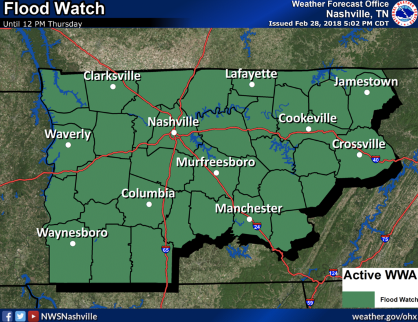
Flood Watch until Noon Thursday

Hi everyone, my name is Caroline Sleeper and I am a freshman at Mississippi State University. I am a Professional Meteorology major with an emphasis in Broadcasting!
Flood Watch until Noon Thursday
Flood Watch in Effect
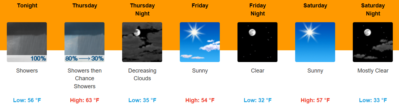
A flood watch has been issued for all of Middle TN from this afternoon until noon Thursday. 2 to 6 inches will be possible causing localized flash flooding and further rise on area rivers, stream and creeks. Please remain weather aware today and tomorrow.
One last day of that full on sunshine as things will change tomorrow. Highs will reach into the 70s with a light breeze through the day.
https://giphy.com/gifs/shortyawards-shorty-awards-2017-3oKIPEh5Lk3RGSIFEI
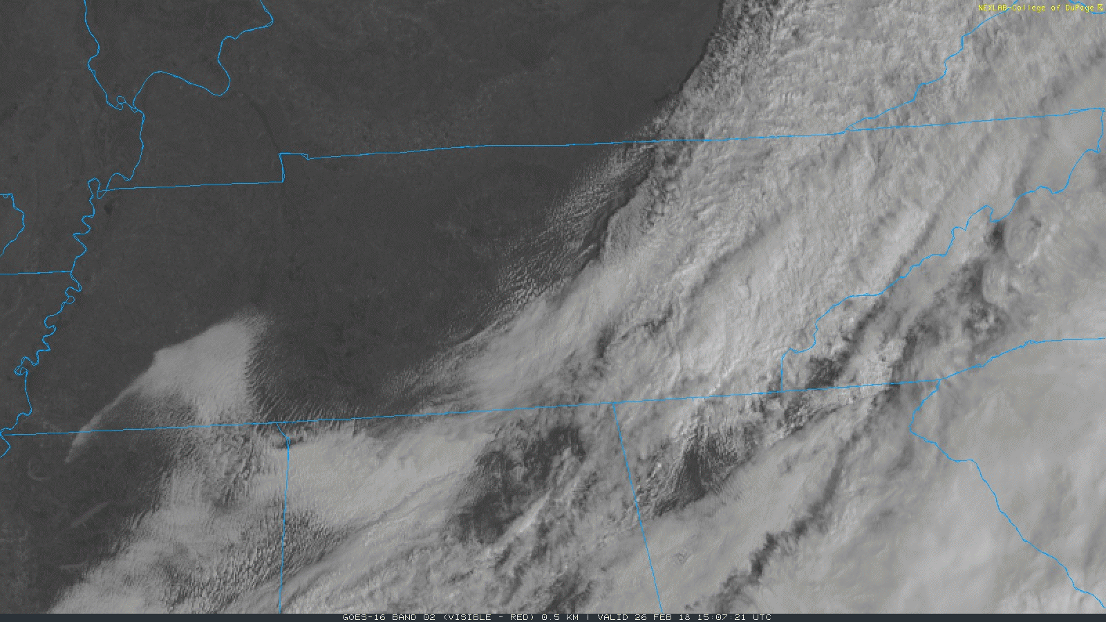
GOES East, Morning Loop
Mostly sunny skies are expected this afternoon, which will bump temperatures into the lower 60s for much of Middle Tennessee. High pressure will stick around with us today and for part of tomorrow, before quickly being shunted to the east coast. Temperatures again on Tuesday are expected to be in the 60s, but pushing 70 degrees with ample surface heating.
Two tornadoes struck Clarksville last night. One was rated EF-2 with winds of 125 MPH. The other was EF-1, winds of 105 MPH. There were injuries, but no fatalities from these tornadoes.
Tornadoes took three people yesterday, two in Logan County, KY, near the TN state line. Another person was killed in Clay County, AR, when trailer was blown into a nearby pond.
Tornado fatalities were reported yesterday in Logan County, Kentucky, which is on the other side of the Tennessee border with Robertson County. Another was reported in northeast Arkansas, where someone lost their life in a mobile home.
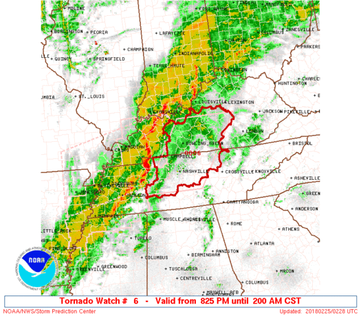
A tornado watch has been issued for both Davidson and Williamson Counties until 2 AM.
![]()
Tornado Watch means conditions are favorable for tornadoes. We are currently under one of these.
A Warning means take cover! No warnings for us yet.
In the Watch area: 40% probability of 2 or more tornadoes. Probability of a strong tornado (EF2 or worse) is 20%. pic.twitter.com/zVP0LLF3cY
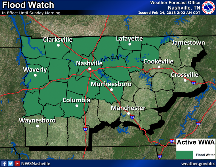
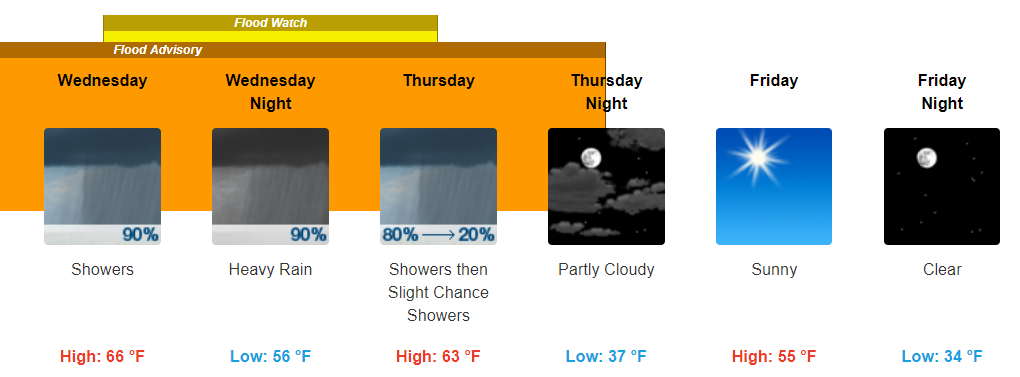
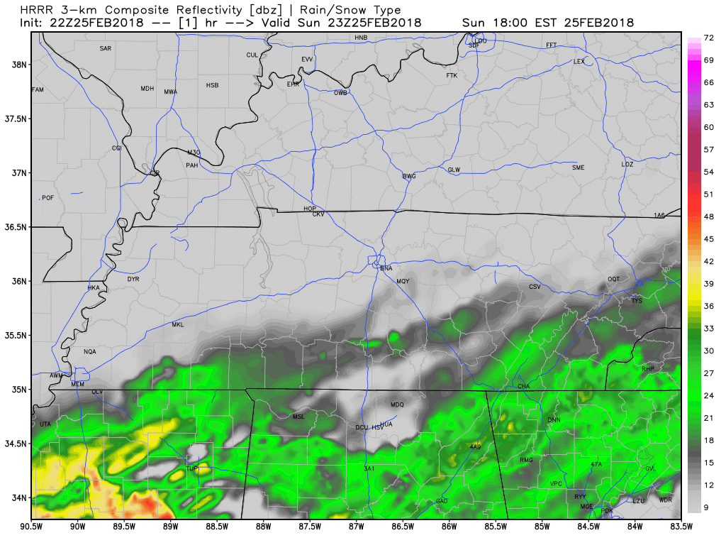
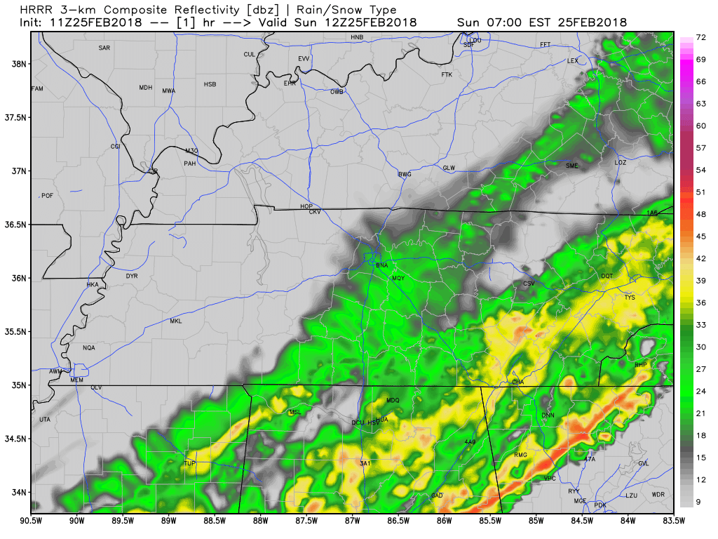
NWS Nashville: A strong low pressure system will sweep through the mid state Saturday night, with additional heavy rainfall expected. Additional rainfall amounts of 1 to 2 inches are forecast during the next 24 hours. This will fall on ground that is largely saturated, and will drain into streams and rivers that are already running high from previous heavy rainfall. Therefore, localized flash flooding and river flooding are possible during and after this next heavy rain event.
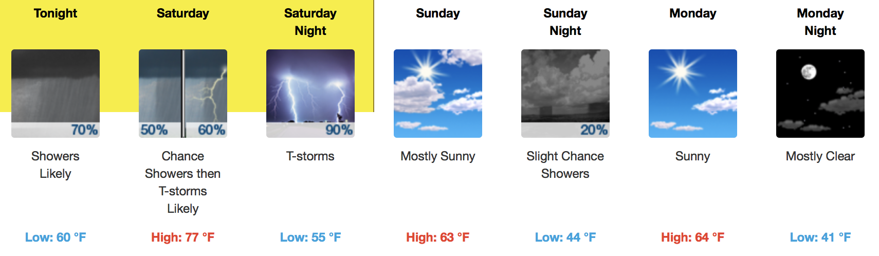
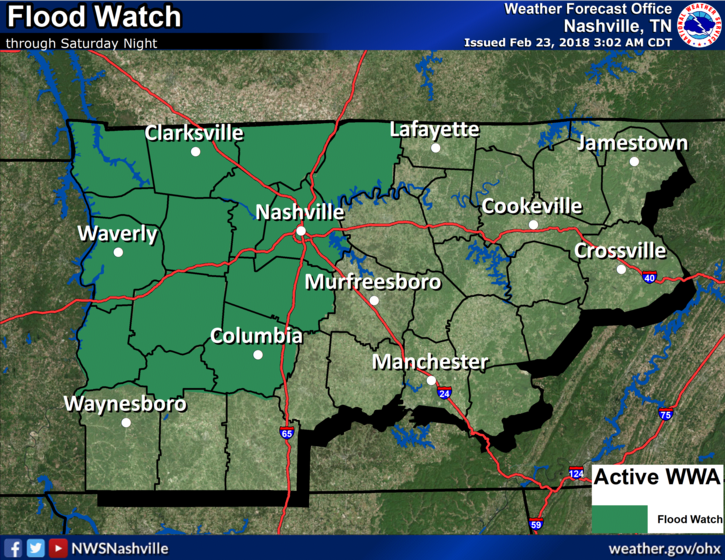
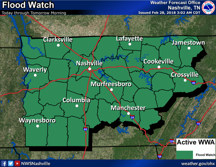
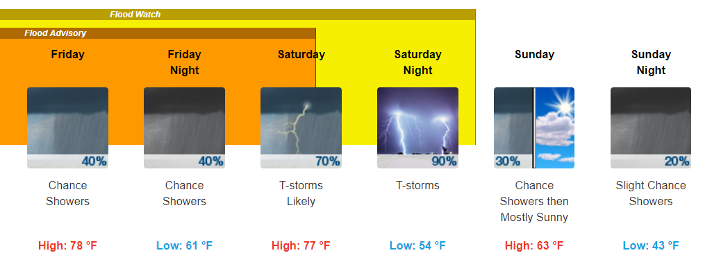
NWS Nashville: A Flood Watch continues to be in effect for portions of Middle TN through Saturday night. While most will see a lull in the rain Friday, those in the watch will not. Additional rainfall is expected Saturday, as well. Both localized Flash Flooding and river flooding will be possible by Saturday night. Those who experienced flooding this past week and are in this Flood Watch need to pay special attention to rainfall accumulations as flooding is expected to return to those locations.
Showers currently drift along to our southeast. Those in the southern portions of Williamson Counties may see a few of these showers this morning. Those in Davidson County may get a slight break through the AM.
You must be logged in to post a comment.