
Flood Watch In Effect through Saturday Night
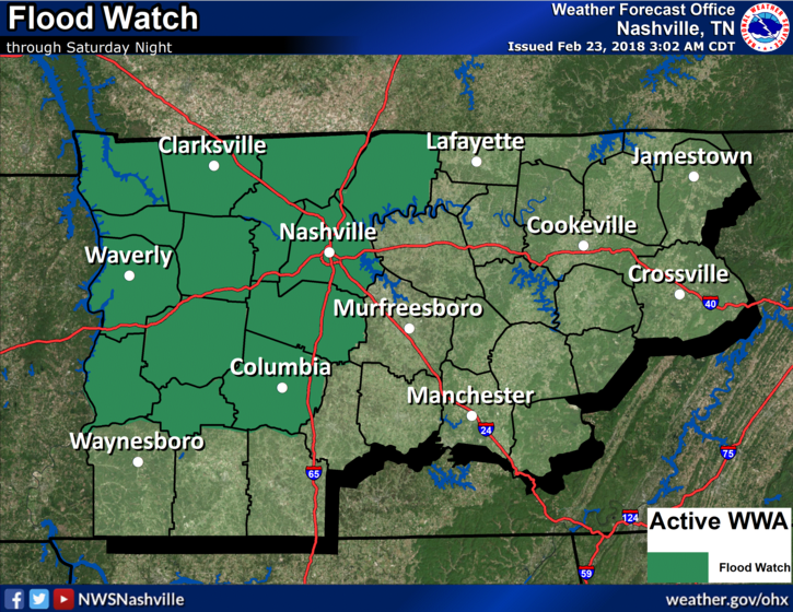
NWS Nashville: A Flood Watch continues to be in effect for portions of Middle TN through Saturday night. While most will see a lull in the rain Friday, those in the watch will not. Additional rainfall is expected Saturday, as well. Both localized Flash Flooding and river flooding will be possible by Saturday night. Those who experienced flooding this past week and are in this Flood Watch need to pay special attention to rainfall accumulations as flooding is expected to return to those locations.
Focus is On Saturday’s Storms and Severe Potential
A warm front is expected to develop, attached to a strengthening low pressure system over the Plains. This low pressure will continue to strengthen and move northeast across the mid and upper Mississippi Valley, dragging a cold front along with it, further south. That’s where we will be, waiting on a cold front Saturday evening/night.
In agreement with NWS Nashville, this system very much resembles a springtime setup and latest model data shows that storm ingredients (instability and wind shear) will be somewhat impressive as storms move into Middle Tennessee Saturday night. The latest SPC outlook keeps Nashville in a “Slight Risk” (2 out of 5 risk), while areas to our west were upgraded this morning to an enhanced risk of severe weather.
SPC Day 2 Outlook
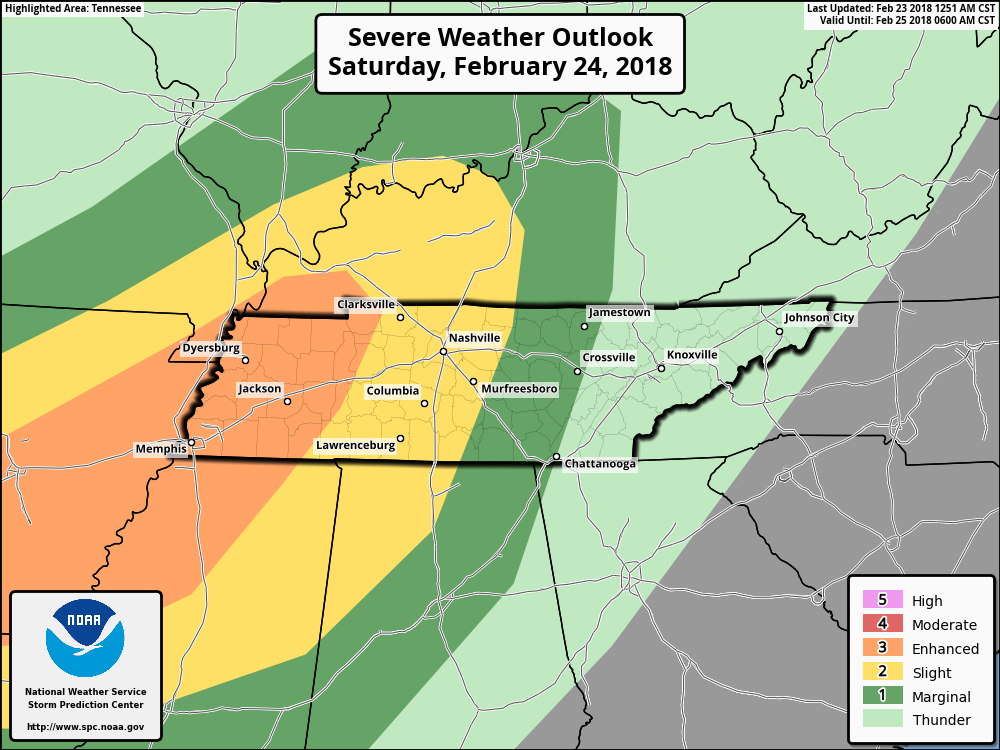
All hazards, including large hail, damaging winds, and a few tornadoes. Damaging straight-line winds are the main concern with these storms.
Details on the isolated tornado threat…
NAM – most aggressive model. Has the lowest level winds of the atmosphere generously conducive for the development of tornadoes.
GFS – a bit less aggressive. Low level winds a bit less “intense” in terms of the development of tornadoes.
Grounds are already saturated, so any type of wind (thunderstorm gust or isolated tornado) will have a greater potential to bring down trees.
When does this all start?
Timing appears to be Saturday night evening into early Sunday morning. Models seem to be a bit slow right now with this event, meaning the approach of severe weather may be earlier in the evening than they currently depict. Stay tuned on timing adjustments.
Time to check those batteries and the status of your NOAA Weather Radio. If you have a weather radio app, make sure notifications are turned on. Statistically, storms inherently become more dangerous under the cloak of darkness. Have multiple reliable sources to get information from Saturday night! We all plan to have a late night, keeping you informed of the latest weather headlines, so stick with us here and @NashSevereWx on Twitter.
Next Week – Dry Days With Another Heavy Rainmaker Midweek
GFS Model Loop Next Week
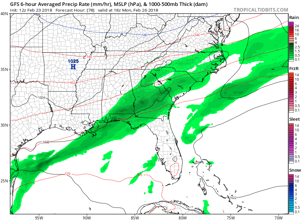
Temperatures will remain mild each afternoon, generally in the lower to middle 60s. A heavy rainmaker (2-3″ possible) is expected to move into the area on Wednesday, ending Thursday. Flash flooding may be more of an issue then, as compared to Saturday’s system.
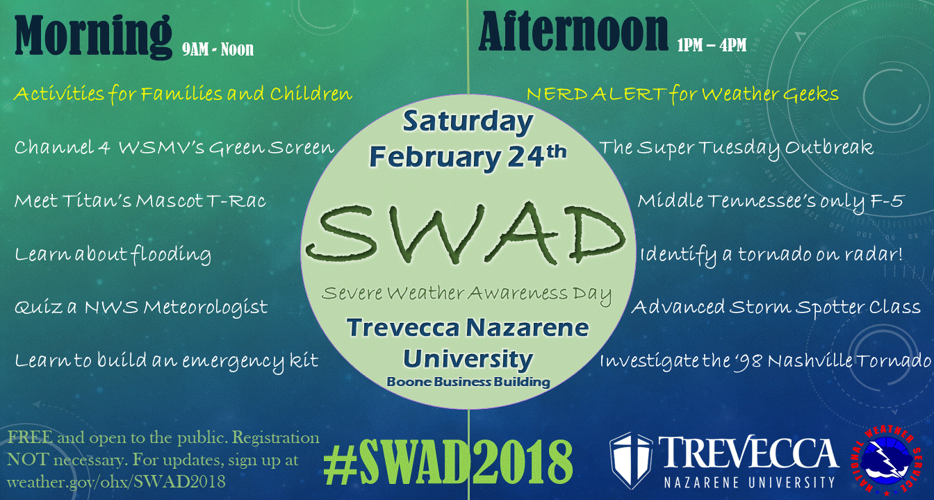
Reminder: Saturday is Severe Weather Awareness Day
Be sure to join us for SWAD 2018! Lots of fun activities for families and your inner weather nerd.

Categories: Forecast Blogs (Legacy)
You must be logged in to post a comment.