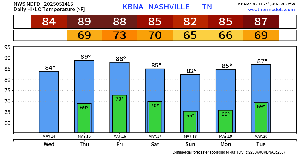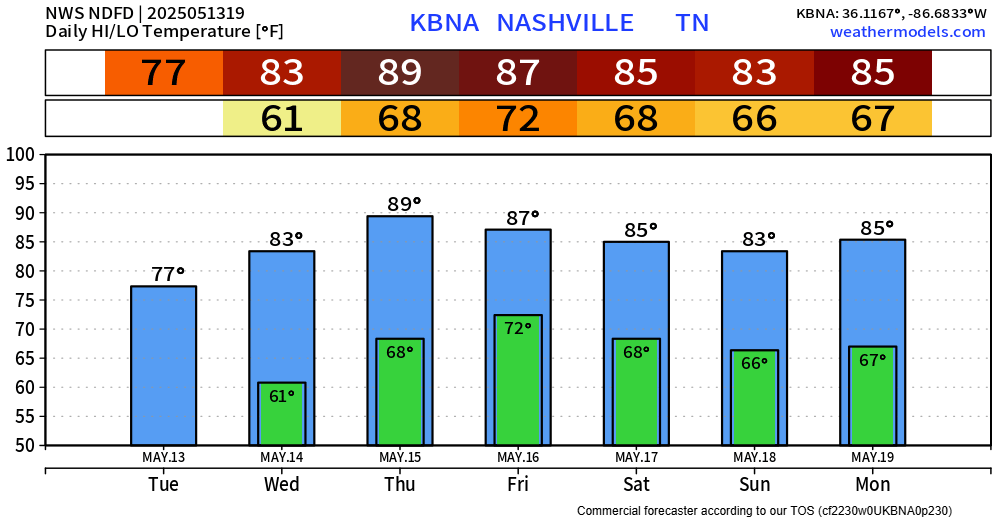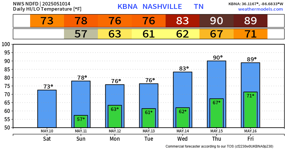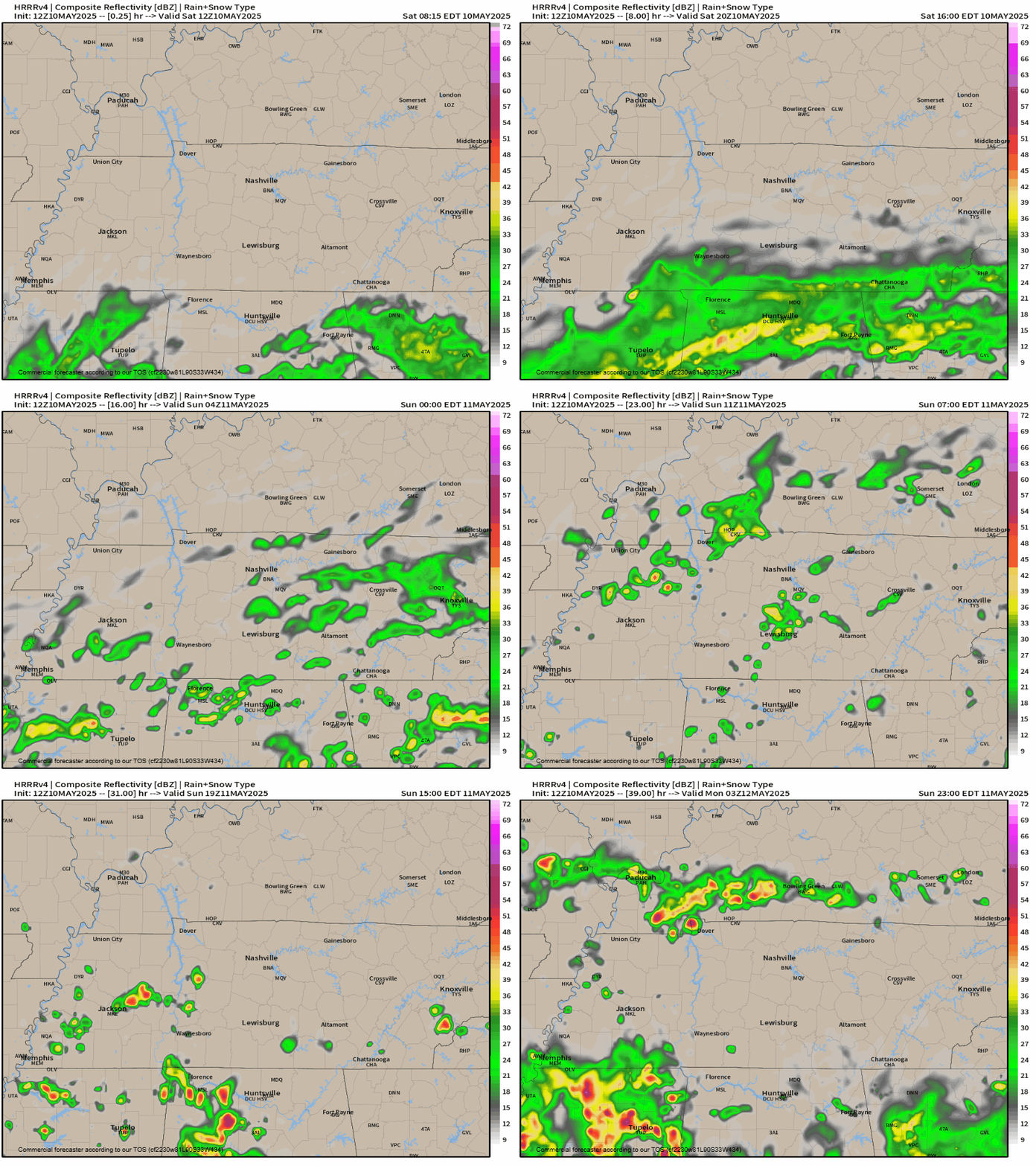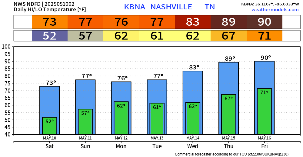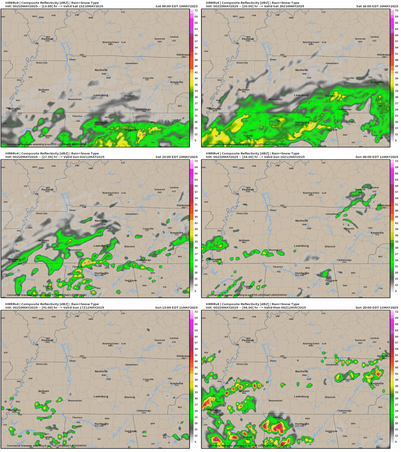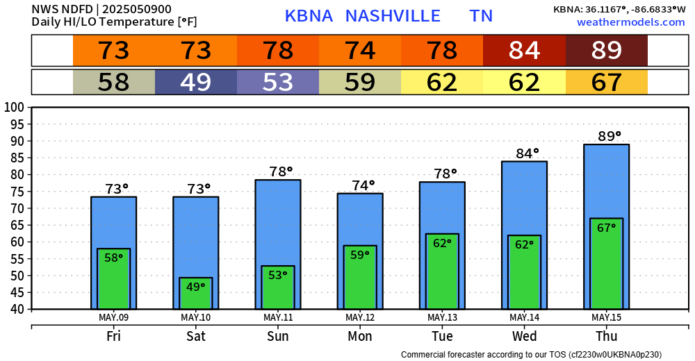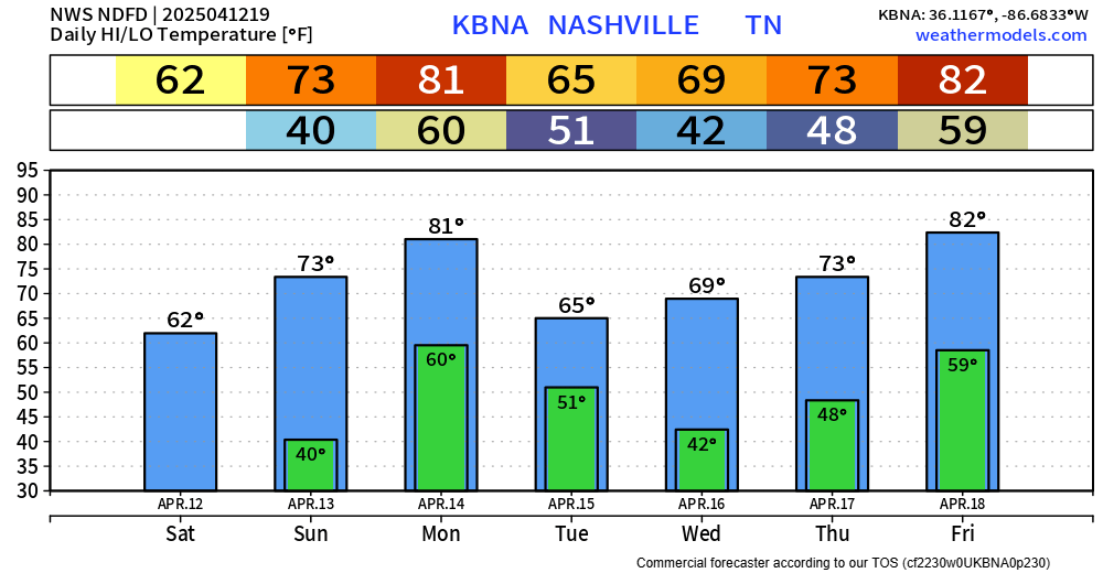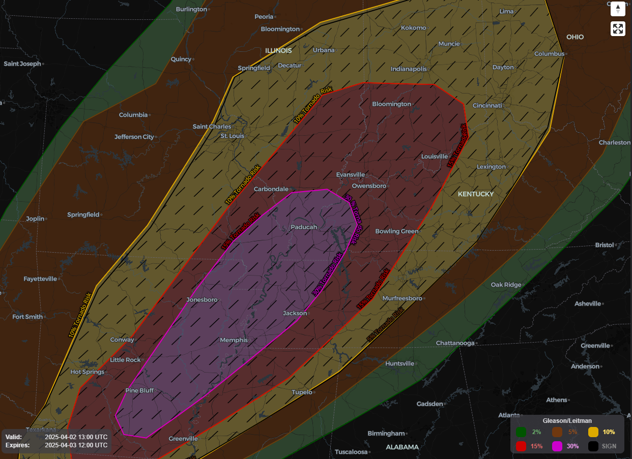
Green Thumbers and Burners, heads up. OTW your need to read: low.

Very little overnight rain, meh.

Do No Burning Monday, Tuesday. “There is an initial concern that most of mid state region will experience marginal fire danger thresholds at least on Monday and Tuesday due to dry conditions, low afternoon humidity levels, and favorable 20 foot winds. Too early to issue any specific fire weather related products, but something certainly to keep an eye out for.” NWS-Nashville.

Frost overnight Monday into Tuesday morning. “[P]otential of widespread frost Monday night as lows will bottom out generally in mid 20s.” NWS-Nashville. 28° here, likely colder in local spots.

Friday the Euro model is dry but the GFS shows about a half inch of rain. 🤷🏽.

Next week looks active with strong cold fronts coming thru; however, not all models agree. Frankly, models 7+ days away are pretty bad.

Next Event Thu/Fri. Deets here. Must read? Nah.

Last Night Review. Rain last night avg around 1″+, more for those south of 840.

One family in my hood got lightning through the roof. No fire, somehow, and thankfully. No one hurt.

19 tornadoes stretched from TX to OH. Middle TN – south of us – saw mostly wind and hail. Local CAPEs fell off as the line came through. Good job, everyone.

Meanwhile, this aged poorly:

State blew the Vols out. Oof. Goodbye, 1 seed.


A Little Rain Sunday Morning. Brief and no big deal.

Temps Drop Monday. Then rebound.

Next Event Thu 21st – Fri 22nd. Looks like rain right now BUT data is too far away to diagnose it further.

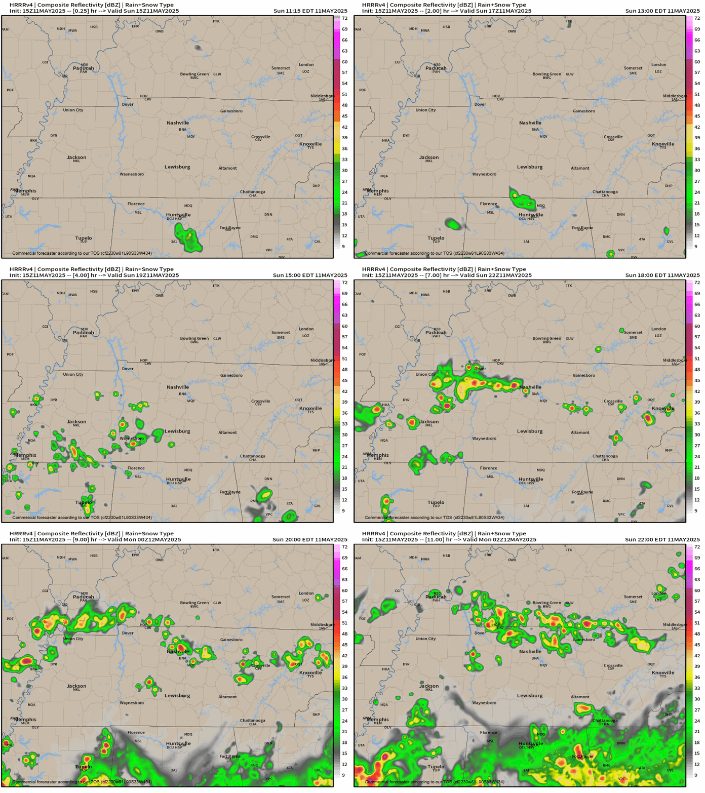
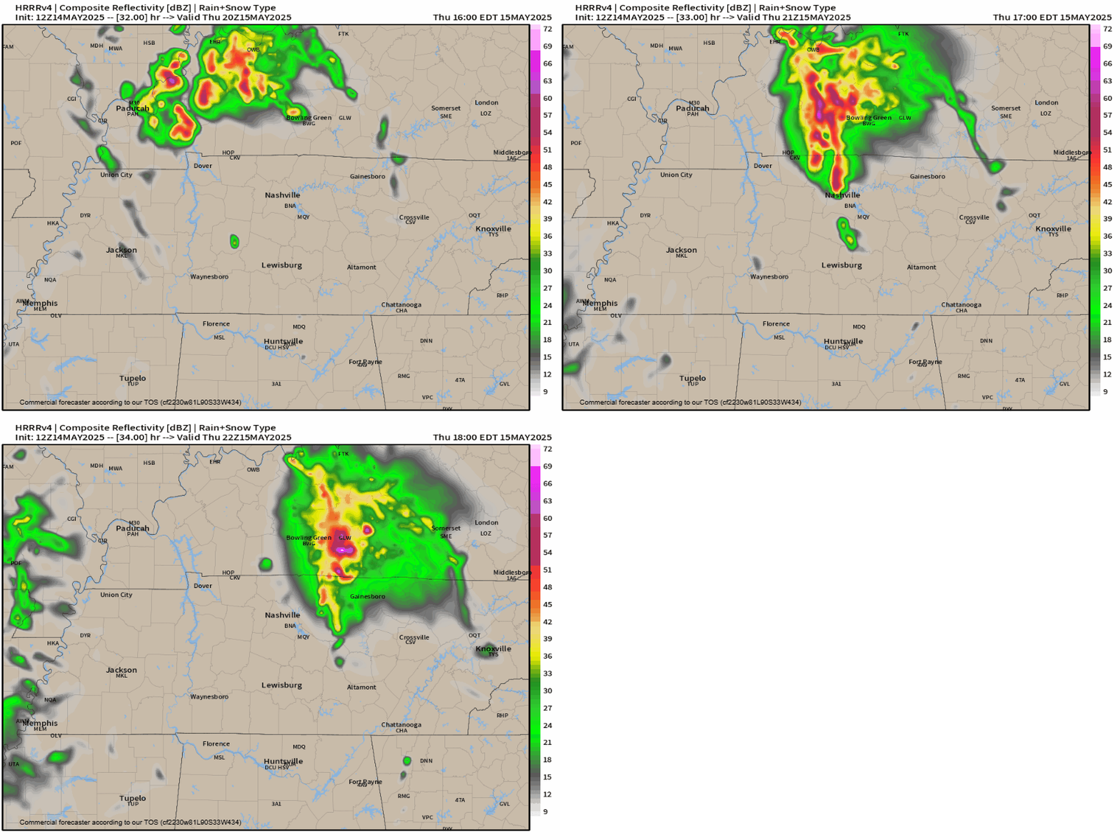
My anxiety level rising for Thursday night. What looked like a meh line incoming is now in range of convective allowing models like the HRRR. Those models show strong/severe storms arriving late night Thursday or the wee hours Friday AM.

That’s the 12z HRRR model above: line arriving around midnight (timing may change) late Thursday night into Friday morning. Data shows storm-making ingredients aplenty:

✅ Lift.

✅ Sufficient moisture, dewpoints low/mid 60s.

✅ CAPE over 1000 j/kg.

✅ curved hodographs with severe-sufficient shear.

Previous model runs showed way less SBCAPE (that’s good!) and a surface inversion (also good!). But now that’s changing. SBCAPEs in other models are running 400+ (enough to make bad storms). Add HRRR as the high-end outlier with SBCAPE 1,200 j/kg, and this has my full attention now. Especially since the HRRR removes the surface inversion right as the line arrives. And the HRRR is often the first to catch on to the truth, fast.

Hazards include heavy rain, lightning, straight line winds, hail, and tornado.

This recent model data shift toward worse storms is not itself cause for alarm. But it has raised my anxiety a little. If the shift becomes a trend, we could be in for a long night Thursday night into Friday morning. Expect another long form blog tonight.

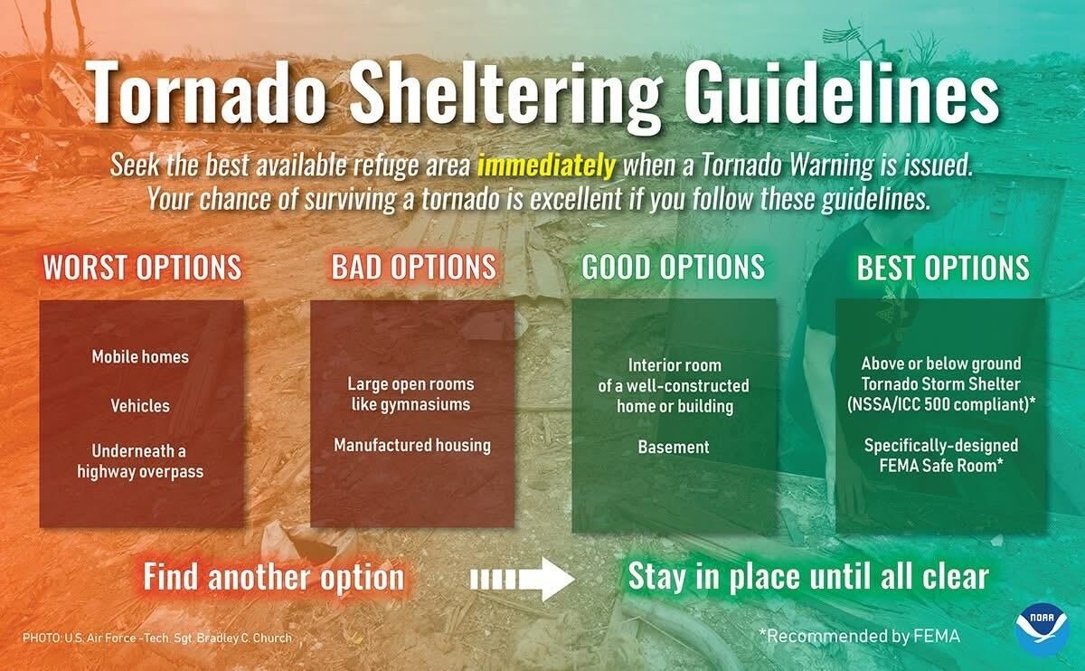
👉🏽 To Do: review your tornado safety terms and have shelter plans. Prepare. Plan to be near shelter tomorrow night. If this event doesn’t materialize (knock on wood), there will likely be another one this spring. Prep time won’t be wasted.

More tonight.

Inconsequential isolated daytime showers found in HRRR model for today:

HRRR model with rain near small areas in Nashville today.

📅 Friday Rain, Storms. 🥶 Next Week. Blog deets ….

Temps ahead well above normal, but record highs safe.

Colder next week. Technically, still Winter. Spring never arrives on a gentle warm slope.


Scattered showers possible but unlikely Thursday. Think those stay away, to the west.

Rain shows up early Friday and washes most of us out. Timing remains a mess, think off and on showers most of the daylight hours. Downpours, few strong breezes, lightning most likely hazards.

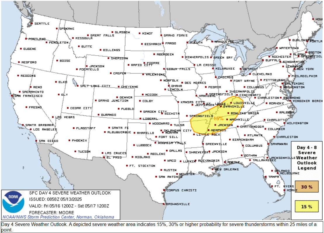
Severe threat is Thursday and west of us, so far we are excluded from a severe storm outlook:

Some severe ingredients will be here for Friday storms.

  • A brief strip of storm fuel (200-400 j/kg for you nerds) may come ahead of the storm.
  • Shear/rotation will be strong.

However, working against storms:

  • The storm fuel isn’t hitting the right spots (surface inversion, elevated CAPE).
  • Storm mode, timing, and displacement from parent low should disrupt severe formation.

We still don’t really know, tho. Convection-allowing-models aren’t yet in range. Until they are (later tonight and tomorrow), forecast accuracy is (as usual at this range) sus.

Does not look alarming, but worth watching.

Middle TN rainfall range 0.5″ to 2″. Higher south, lower north. WPC thinks we’ll get 1″+ Friday into Saturday.


Shortwave Saturday and cold front Sunday supply rain chances but right now each looks light and kinda meh.


Temps below normal for mid-March in both the 6-10 day outlook:

and the 8-14 day outlook:

In this blog: Freezing 🧊 Fire 🔥 Rain/Storms ⛈. Deets….

Near freezing around sunrise Tue. Warming up this week.

These temps 15-17 degrees above normal. Not hot enough to break records.

Fire Weather. Meh. Worth mentioning I suppose.

The only thing to note in the short term portion of the forecast is today`s relative humidity values, which will be running in the 20s this afternoon. While these are low, the recent rains and light winds should mitigate any fire weather concerns today.

NWS-Nashville Forecast Discussion 3/11/24

Rain/Storms Friday. ETA fuzzy, best guess most of it falls Friday morning (Euro model below).

Rain could stretch into Friday afternoon. Still meh.

Severe unlikely. Storm Prediction Center: “predictability too low” suggesting data is inconclusive but the sense is cloud cover, timing, instability will conspire to keep storms behaving.

Experts below, followed by a translation:

This cold front is expected to continue eastward/southeastward across the TN Valley and Southeast on D5/Friday. Showers and thunderstorms are possible, but limited heating and scant buoyancy should keep the severe potential low.

Storm Prediction Center 3/11/24

[F]orecast soundings are mostly benign. However, I would argue that they`re worth watching, even first thing Friday morning. They`re not great (if I could put great in italics, I would [We can, and did, italicize!]), but a few hundred J/Kg left over from Thursday`s warm temperatures, dew points in the low 60s and some hodograph curvature (at least in our southwest counties) is worth keeping an eye on over the next couple of days. At a minimum, showers and thunderstorms will be abundant during the day Friday. Current QPF values are coming in between 1 and 2 inches.

NWS-Nashville Forecast Discussion 3/11/24

Translation:

  • If the models are right, no severe weather Friday.
  • This may change.
  • Check back tomorrow and thru the week.
  • Anxiety level: near zero 👍🏽.

Rain break Saturday, then another rain/thunder event possible Sunday. Some models paint an additional 1″ Sunday bringing cumulative Friday-Sunday rain to 3″ and 4″ somewhere in Middle TN. Minor, usual spot flooding is within the range of possibilities. Looks meh, but it’s March and worth watching.

Rain, storms Friday. Until then we good fam.

Storms Friday probably (?) neither strong nor severe but too soon to be sure.

Still certainly something to watch as things could change, but for now, the thinking is still any severe potential would be to our south.

NWS-Nashville Forecast Disco

HRRR model update thinks most of the rain tonight/overnight will be gone by sunrise Sat. Few passing lunchtime showers possible.

Heaviest rain scoots just east of us. If the model is off by just 30-40 miles, we could be really soggy in the AM.

Temps should steadily fall after noon Saturday as a weak cold front passes through.

Today’s blog feat. sunshine south of I-40 that won’t last.

More light, off and on rain incoming tonight and Sat morning. Latest HRRR below, time stamp upper left:

Downpours Sat AM may ruin dry-required activities. 0.75″ average rainfall, enough to waterlog most fields. However, variance will be high so your results may vary.

Severe weather threat today remains safely south of us:


We are not outlooked for severe weather for the next 8 days.

Cooler weekend temps, near freezing Sun & Mon AM, then wewarmup.

“Wewarmup” is a great word.

Next precip potential next Thu-Fri-Sat.

00Z [weather model] guidance differs considerably on how the upper pattern will evolve late next week, but in general appears our next rain chances will arrive Thursday into Friday as an upper low sets up over the Four Corners and shortwaves eject out across the southern US.

NWS-Nashville, AM Forecast Disco

Storm/Severe potential is unknown one week out because models disagree, but precip is a decent bet.


The intern is mowing lawns for free and antiquing up and down the Atlantic seaboard over Spring Break. So you get us OGs for a while.

Light rain this morning. Break this afternoon and early evening. More off and on heavier rain overnight and Sat AM. Totals about 0.75” on average.