
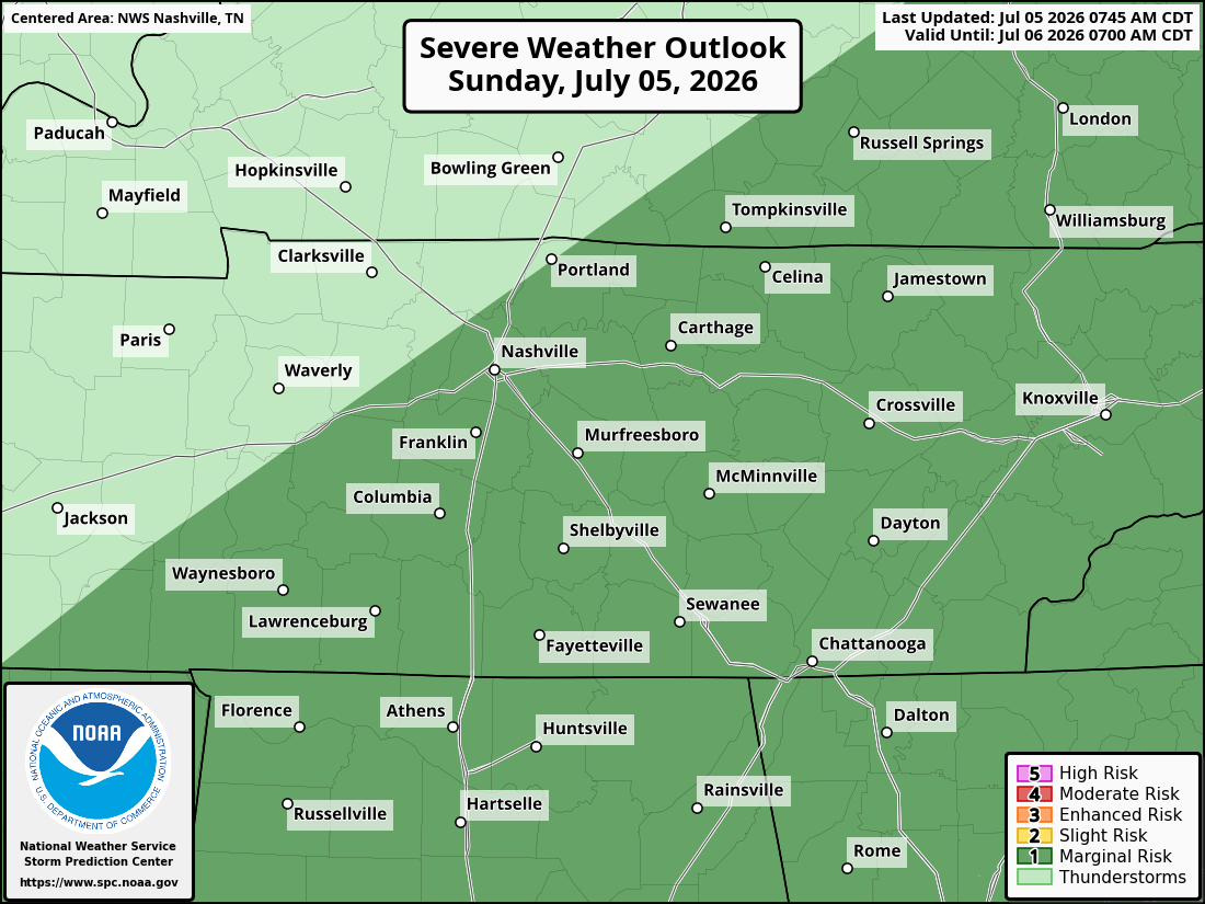
We are outlooked at a Marginal (1 of 5) risk today across Davidson and Williamson County.
Today and Tonight
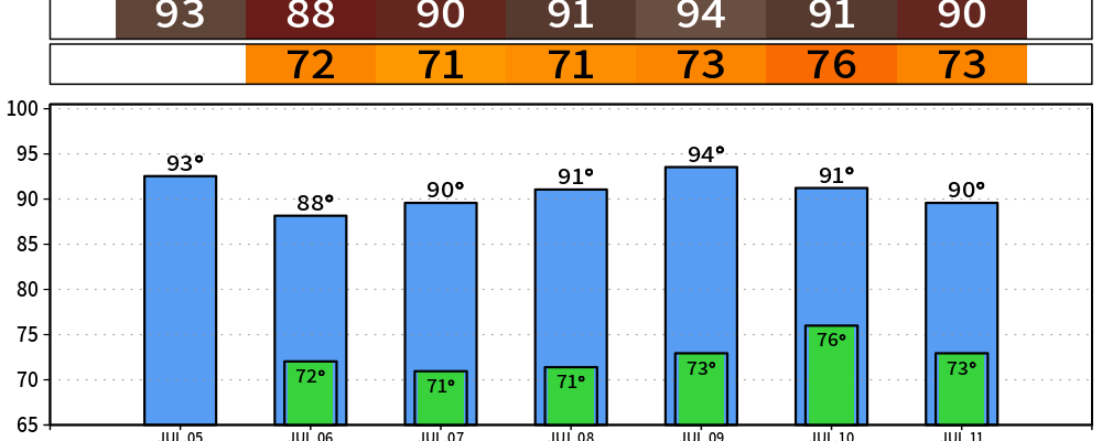
Mostly sunny to start, then storms fire up through the afternoon and evening. High will top out near 92 with a heat index around 98, so hydrate if you’re outside. Rain and storm chances run about 50% through the evening, tapering off overnight with a low near 71.
Here’s NWS-Nashville’s read, straight from this morning’s key messages:
There is a marginal risk (level 1 out of 5) for severe storms on Sunday and Sunday evening. The primary threats are strong to severe wind gusts, torrential downpours, small hail and frequent lightning which might impact outdoor events.
Translation for the cookout: keep an eye on the sky this afternoon and evening. If you hear thunder, head inside. A stray storm could drop a gusty downburst or some pea-sized hail, but this is not a widespread severe setup — it’s the summertime pop-up kind, just a little juicier than usual.
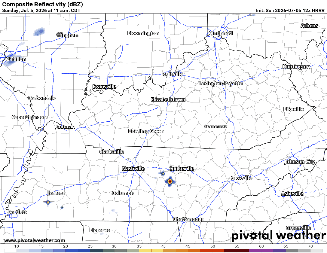
Here is the HRRR through early Monday am.
Monday — One More Round, Then the Door Shuts
Monday looks like the wettest day of the stretch. Patchy morning fog, then showers and storms become likely through the afternoon and evening. High near 87, PoP up to 70%.
NWS-Nashville expects a weak surface boundary to slide through Monday into Monday night, which is what finally kicks the unsettled pattern east of us. The severe risk drops off after today — Monday’s storms should mostly be the loud-and-wet variety, not the damaging variety.
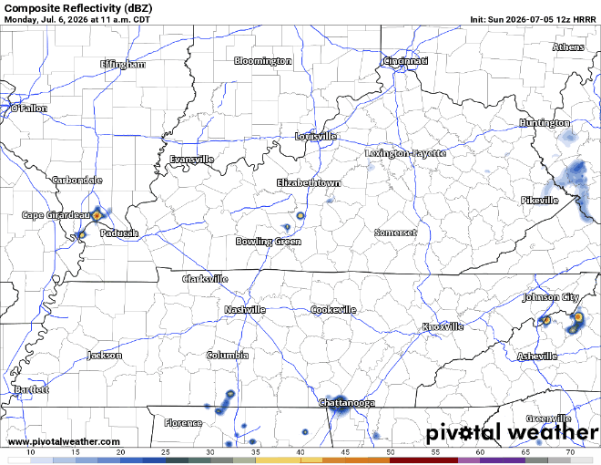
The 12z HRRR also has a prediction for Monday’s wattery. Monday should be more scattered and random than today but stay tuned.
Tuesday Through Thursday — the Break
This is the good part. Drier air moves in behind that boundary.
Rain chances fall to 20–40%, mostly afternoon pop-ups that may or may not find you. Highs bounce between 89 and 92, lows in the low 70s. Seasonal, not oppressive.

Late Week — Storms Return
Another surface boundary is on the way for the end of the week. Friday and Saturday both look wet, with PoP back up around 60–70% and showers and storms likely on and off. Highs near 90. Too far out for specifics on timing or any severe angle — as usual, could change.
Categories: Featured Blog