
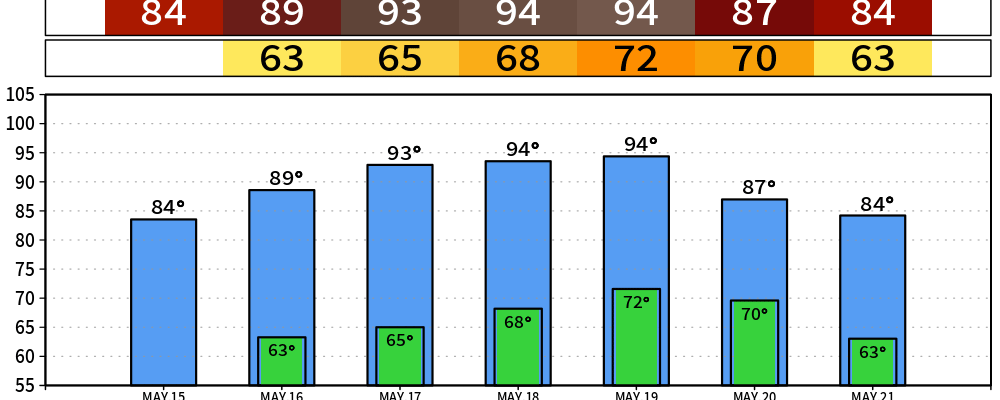
Easy Friday, warm Saturday, and the first 90° day of the year is probably Sunday in Davidson and Williamson. No severe weather on the table.
Today
Sunny and pleasant. Got that Friday feeling. High near 82, south wind 5 to 10 mph. Tonight goes mostly cloudy with a low around 63.

Saturday — a Touch Warmer, with an Asterisk
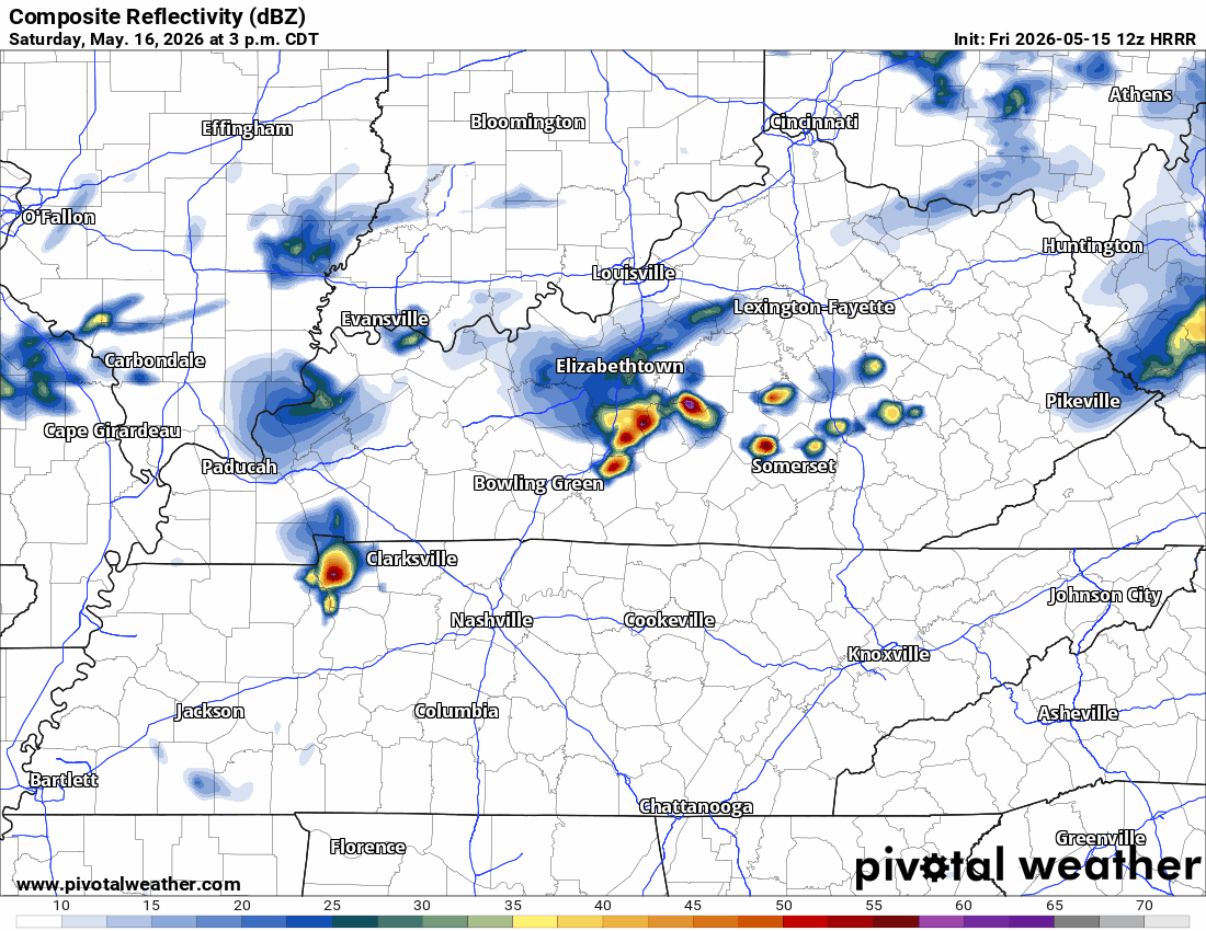
Partly sunny, high near 87, breezy out of the south-southwest with gusts to 25 mph. A weak wave clips far northern Middle Tennessee Saturday into Saturday night, so there’s a very low chance of a stray shower Saturday. The 12Z HRRR run shows a wattery (water lottery) event late afternoon and evening.
Sunday — Likely the First 90°
Sunny and 92. NWS-Nashville puts the odds of officially hitting 90 at Nashville on Sunday in the 80–90% range. South wind 5 to 15 mph with gusts to 25. Low around 68. Summer is peeking out. A great day to head outdoors.
Monday and Into Next Week
Monday looks like the warmest day — sunny, high near 93 west of the Plateau, same south breeze. Low Monday night near 71. By Tuesday a trough and a front start working in from the west, and rain chances climb. The best chance for appreciable rain right now is Wednesday, with the higher totals favored northwest of us. Could change, as usual.
We are not severe outlooked. Day 2 carries general (non-severe) thunder mention, and even that’s a stretch given how dry the column is.
What to Do
- Sunscreen, water, and a hat if you’ll be outside Sunday and Monday.
- Check on your AC — first real heat of the year bites hardest.
- Don’t leave kids or pets in the car. Not even for a minute. Interior temps spike fast at 90°+.
Stay connected as we get closer to the midweek rain chances.
Categories: Featured Blog