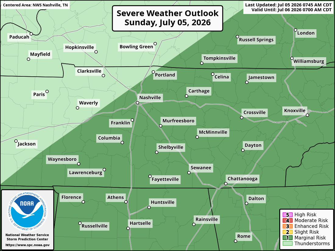
rain spinning in to S wilco might put the nail in the rolly ball practice/game coffin to tonight. radar at 425pm.

The HRRR expects rain to move up into our two counties by the afternoon. May slide east or west so local results may vary. If you have plans tonight, keep an eye on the radar.

Rain moving out. Mist and drizzle for the morning commute. Radar at 5:54am.

High at BNA got to 76º today. The record is 79º for this date.

Test -W

For many of us the wind is picking up and the change over to some kind of freezing precip is occurring. Temps dropping. Careful on bridges and overpasses tonight.

Rain and Snow(ish) moving in. Currently 45°. Not much hope for sticking south of I 40. Radar as of 702pm.

Rain moves in this afternoon. It might change to snow this evening. Some of us may even pick up a trace of accumulation. Models agree that a light dusting of snow is possible. However, our temp will barely be at freezing so don’t expect any frozen precip to last. Here is predicted snowfall amount from the NWS National Blend of Models, or NBM. Not encouraging for snow fans. read more

Radar at 440pm shows a little rain entering Middle TN. No big deal.

Friday and Saturday are Tops

Today and Tomorrow will be fantastic. Bright sun in the morning. A little cloud cover in the afternoon.

In the satellite image above you can see most of the high clouds have moved out. Temps will rise to nearly 60 both days. Some gusty winds are possible late Friday afternoon and into the evening, but nothing notable expected. read more