
Rain Keeps Falling, Rivers Keep Rising
Flood Watch in Effect
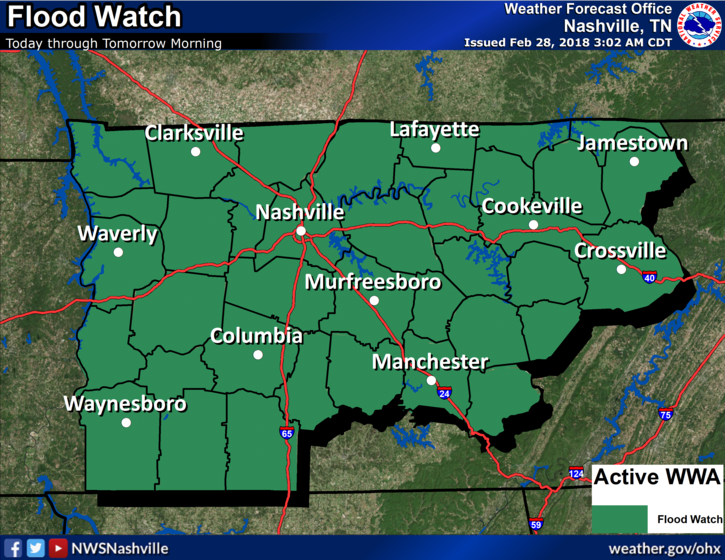
A flood watch has been issued for all of Middle TN from this afternoon until noon Thursday. 2 to 6 inches will be possible causing localized flash flooding and further rise on area rivers, stream and creeks. Please remain weather aware today and tomorrow.
Latest HRRR Loop
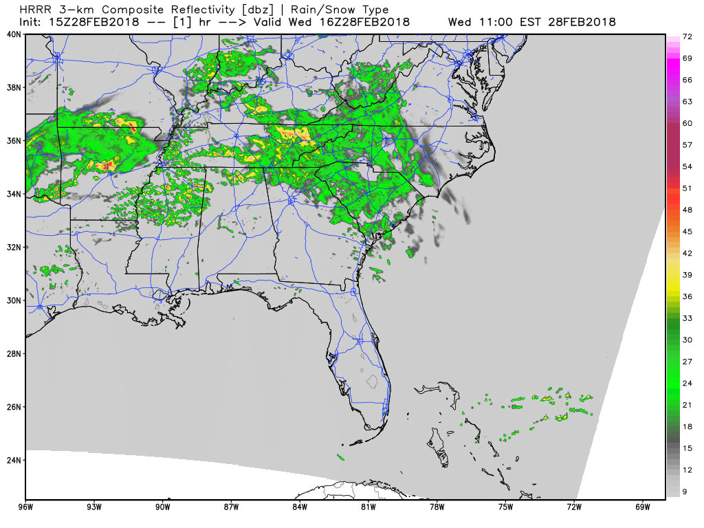
Showers are beginning to fill in from west to east across Middle TN, especially south of the Nashville metro. The trend today will be increasing moisture and low-level convergence setting the stage for a moderate to heavy rainfall event this afternoon through Thursday morning.
NWS Rainfall Forecast
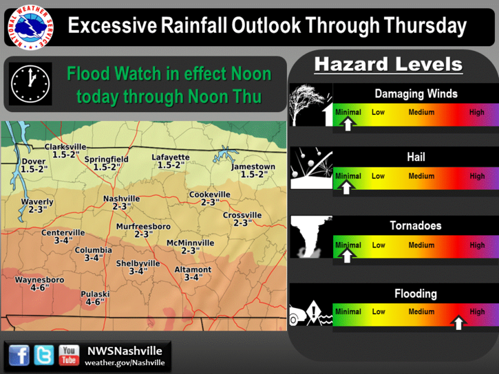
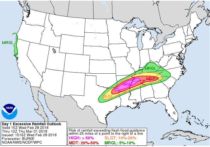
2-3″ are a good bet for most of us…while lesser amounts are expected in northern Davidson County. Even national centers, like the Weather Prediction Center, are highlighting us for a risk of life-threatening flooding. Don’t drive through flooded roadways!
WPC Excessive Rainfall Forecast
A few rumbles of thunder are possible overnight, too, but severe weather is not expected.
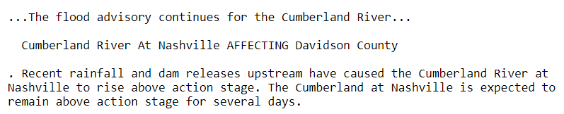
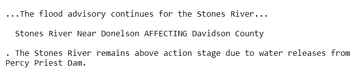
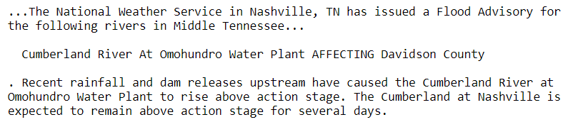
Several flood advisories remain in effect for portions of the Stones River and Cumberland River.
Cumberland River
Stones River
Cumberland River
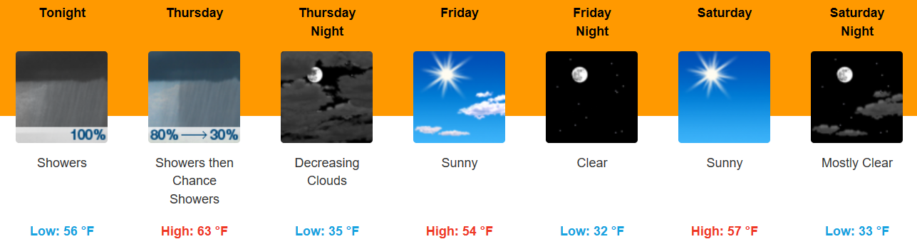
Week’s End Dries Out, Looking Nice for Outdoor Plans
Once the rain comes to an end on Thursday, temperatures will be in the 50s (cooler) for Friday. Saturday will be sunny like Friday, but we’ll still struggle to reach 60 degrees. Sunday is the pick day of the weekend…temperatures in the lower 60s with an abundance of sunshine. Enjoy it while you can, because more rain is in the forecast for early next week!

Categories: Forecast Blogs (Legacy)
You must be logged in to post a comment.