
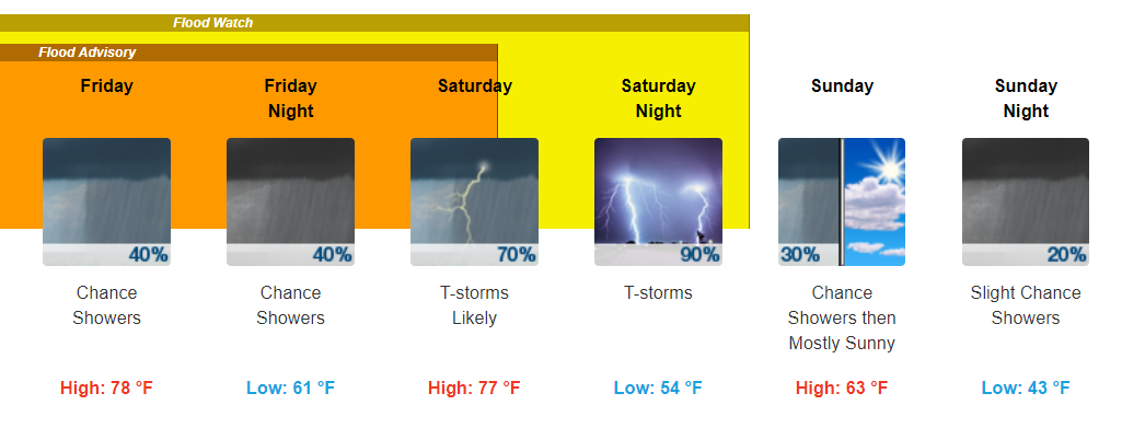
A Soggy and Dreary Couple of Days
Showers currently drift along to our southeast. Those in the southern portions of Williamson Counties may see a few of these showers this morning. Those in Davidson County may get a slight break through the AM.
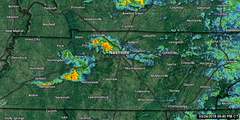
Nonetheless, more showers are expected to move our way through the day. Continue to keep the umbrella handy!
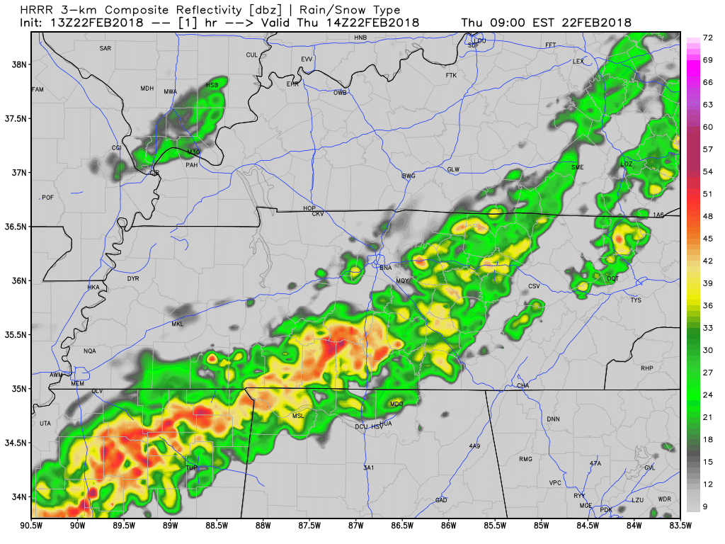
HRRR Loop Through 1 AM
This off and on shower pattern looks to continue over the next few days. Friday night into Saturday morning looks to be the best possible “break” from these showers.
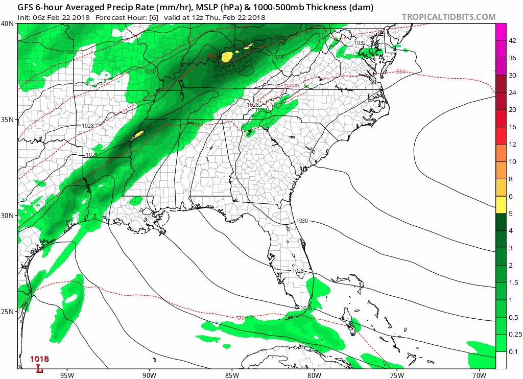
GFS Loop Now Through Noon Sunday
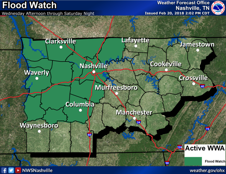
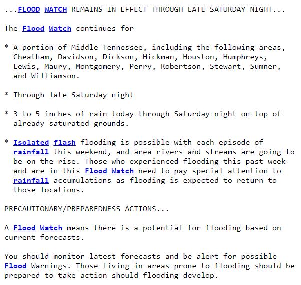
With all of these rain chances over the next few days, our Flood Watch continues.
If you happen to come across a flooded road over the next few days, remember turn around don’t drown!
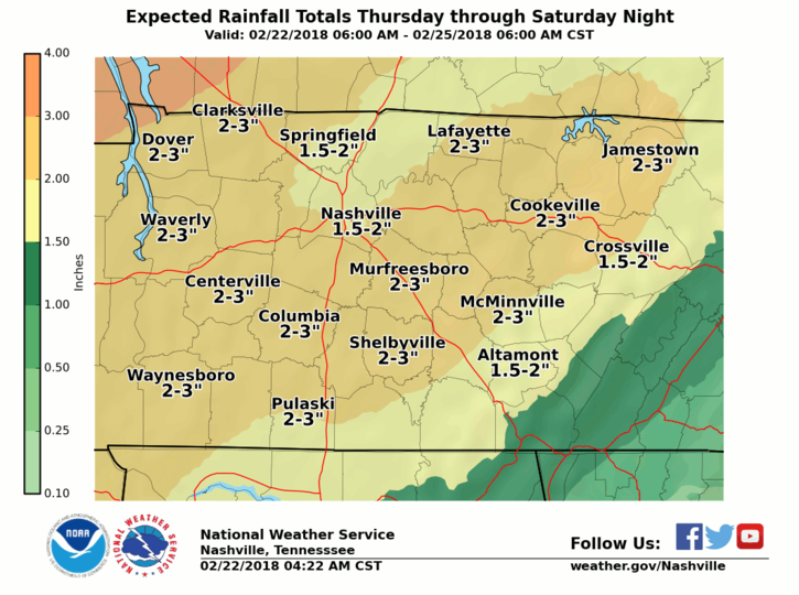
Through Sunday, expect anywhere from 1.5″ to 3″ of additional rainfall across our area.
About Saturday’s Severe Weather Potential
For Saturday, the AM and early afternoon hours primarily look okay. We may see a few scattered showers, but the heaviest showers do not look to arrive until the late afternoon to evening.
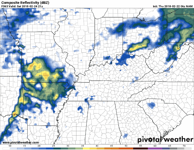
GFS and the NAM want to bring the heaviest showers late Saturday night into early Sunday morning.
NAM Loop 6 PM Saturday Through Noon Sunday
Flooding will continue to be a risk with these showers, which is why the Flood Watch extends through Saturday night. Again, if you come across a flooded road over the next few days, turn around! Don’t pass through flood waters.
In addition to these flooding concerns, the Storm Prediction Center has highlighted our area for a Day 3 Slight Risk.
For Saturday: very heavy rain with a risk of flooding. Strong/severe thunderstorms possible in a squall line with a chance of a few embedded supercells capable of damaging wind & a few tornadoes. Storm ETA fuzzy, best guess late Saturday night. Storm Prediction Center outlook: pic.twitter.com/Cq1d80F0nM
— NashSevereWx (@NashSevereWx) February 22, 2018
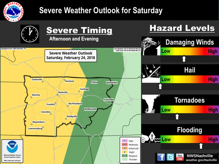
There are still a lot of variables at play here that could determine how severe storms become, or if we even see severe weather at all. Strong wind gusts will be present throughout the day before this expected line of storms even arrive.
Overall, the main threats from this system appear to be damaging winds with the possibility of a brief tornado. This potential has our attention, and will needed to be monitored over the next few days.
A lot can change, and likely will change, before Saturday, so continue to check back here through Saturday.
Sunday and Beyond
Things look to dry out by Sunday afternoon into the beginning of next week. Temps will coast around in the 60s through the majority of next week as well.
Reminder: Saturday is Severe Weather Awareness Day
Be sure to join us for SWAD 2018! Lots of fun activities for families and your inner weather nerd.


Categories: Forecast Blogs (Legacy)
You must be logged in to post a comment.