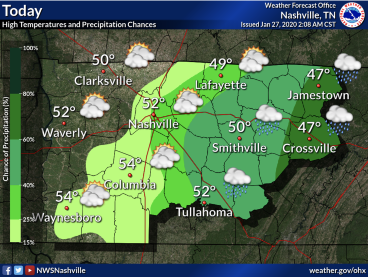
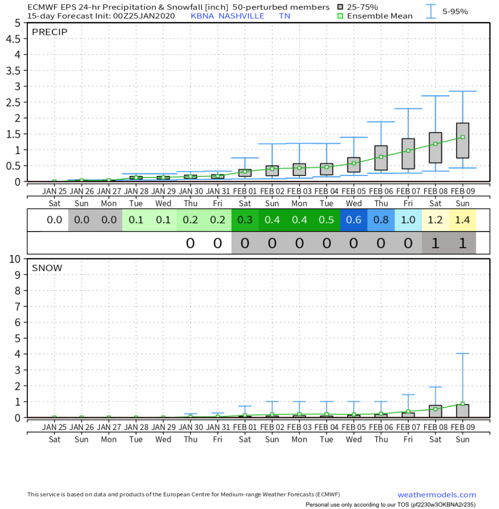
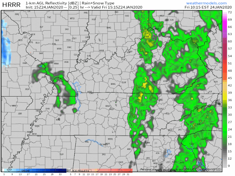
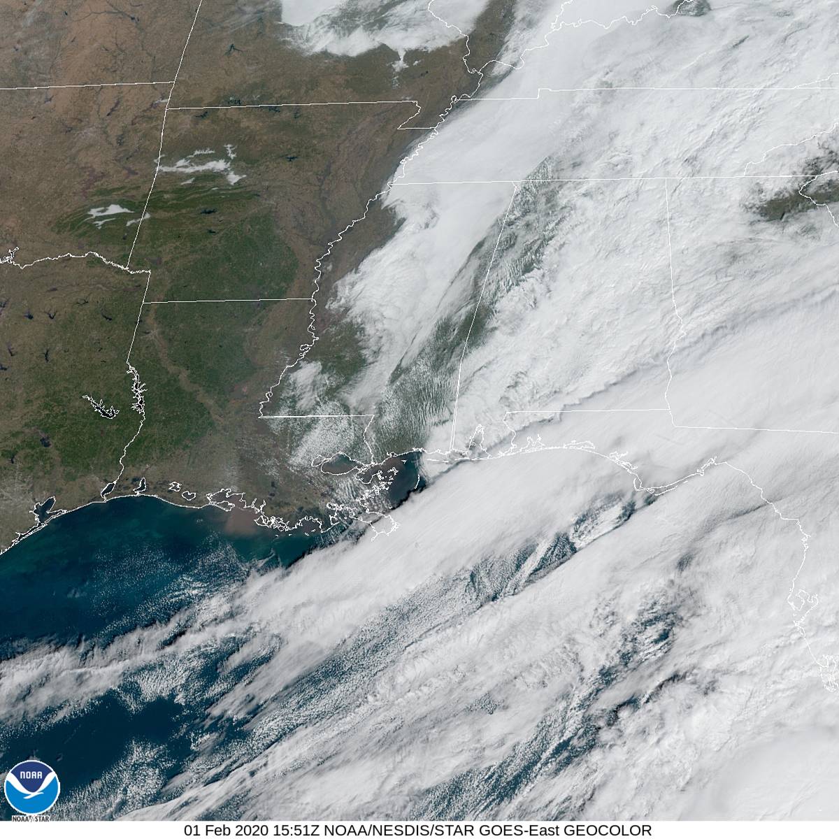
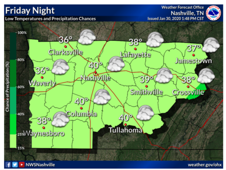
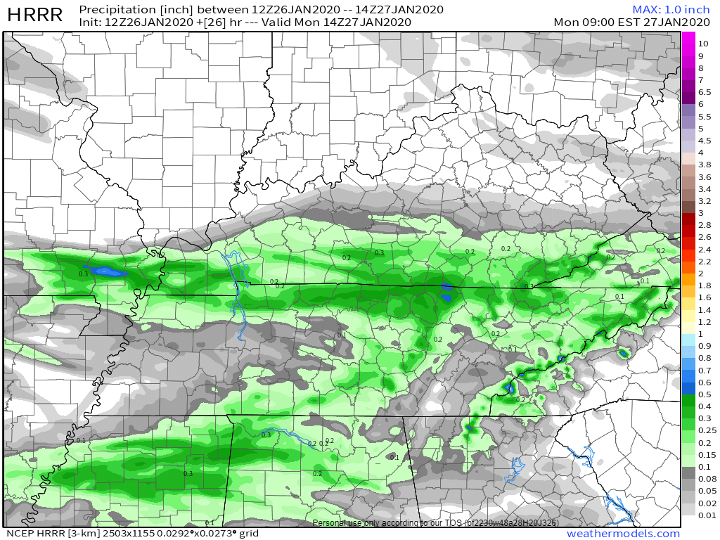
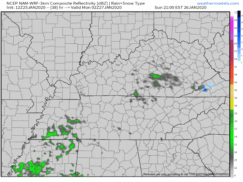
Graupel, a sleetlike winter Sonic ice haily thing, fell today.
Precip/graupel was heavier NE of us, but it’s all moving out. Splat:Melt.
Cold tonight/overnight into Sunday morning. Low near freezing, will feel colder than that.

Graupel, a sleetlike winter Sonic ice haily thing, fell today.
Precip/graupel was heavier NE of us, but it’s all moving out. Splat:Melt.
Cold tonight/overnight into Sunday morning. Low near freezing, will feel colder than that.
Periods of heavy rain will continue throughout much of the day. Urban and river flooding is still very much a risk. Middle Tennessee is under a Flood Watch through this afternoon, as the rain begins to become less widespread.
Rain is already moving into the area this Thursday morning. It will last through Friday.
The HRRR model shows rain all of Thursday, before dispersing on Friday:

The NAM3 model agrees:

Heavier rain should move out by Friday afternoon (as of right now), and the rest should leave by Friday night, though we could see some lighter lingering showers into Saturday.
Cold morning temps will rebound nicely into the mid-50°s this afternoon.

Rain approaches overnight tonight into Thursday morning.

Rain starts Thursday morning.

Rain heaviest Thursday afternoon and evening.
Most of the clouds have finally cleared out.
Current temperature at 2:35 PM: 48°.
Overall, a cool but nice day to close out 2019.

Going out tonight to celebrate?
Temperatures will drop to a low of 32° just before sunrise Wednesday, so be sure to bring an extra layer of warmth.
Now that all the excessive rainfall has moved on out of Middle Tennessee, cooler temperatures are going to stick around with us over the next couple of days. Due to all of that rain, some rivers and creeks are still pretty high, so rivers such as the Cumberland and Harpeth currently have flood advisories attached to them for elevated levels, although neither river is forecast to reach flood stage. Careful on the greenway near Percy Priest Dam, however. Portions of it will be impacted.
1″ to 2″ of rain today. Widespread flash flooding not expected. But area creeks, streams usually prone to flooding may be up tonight and Monday morning. *Looks at Mill Creek in Nolensville*
Today began with a good misting of rain for many of us.

That rain has pulled out and taken some of the cloud cover with it, but it won’t last long.
Here is a wide angle view of the radar at 12:35pm showing more light showers similar to this morning on our SW doorstep.

This won’t ruin any plans, but it will make the roads wet again, and usher in some cooler temps while it’s overhead. Bring a rain jacket to the honkey tonks tonight.

An upper low will deepen as it swings off the Rockies and through the central part of the country. Southerly surface flow will pick up ahead of this system encouraging temperatures to warm into the mid to upper 60s again on Sunday. PWATS are still running very high for the time of the year. Values of 1.5 inches or higher could be possible through the early morning hours on Sunday to Sunday night. Models have shifted the axis of heaviest precip to the west, over portions of west Tennessee and western Kentucky. However, this axis could easily wobble east or west over the next 24 hours as we see how the system evolves. For now, expect anywhere from 1 to 2 and a half inches of rain in Middle Tennessee.
A few showers are showing up on radar this morning and on the HRRR model for this afternoon:

Most of us will stay dry throughout the afternoon, just a little trace of precipitation by the end of the day. Temperatures will be a lot like yesterday’s, high around 64°.
Nice overall with some clouds hanging out:

Friday generally looks the same as Thursday with a high of 64°.
Some sprinkles are possible. Most won’t feel any and if you do, they will be very light and brief.
You must be logged in to post a comment.