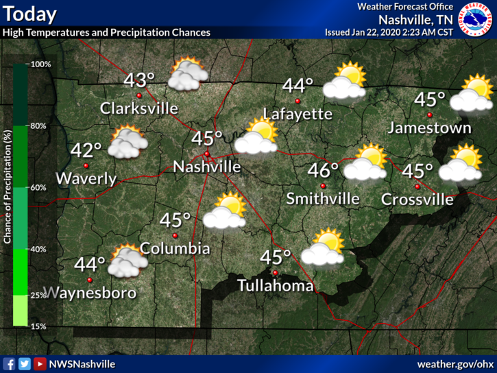
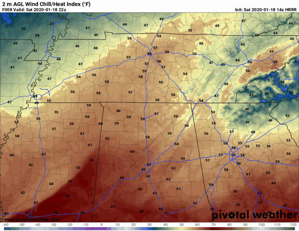
Warmer Air Returns
The past few days have been… well cold, to say the least. Our average high for January is right around 48°F and our highs have been falling short of that recently. This will be changing as we move through the end of the work week.

The past few days have been… well cold, to say the least. Our average high for January is right around 48°F and our highs have been falling short of that recently. This will be changing as we move through the end of the work week.
As the clouds begin to thin out this morning and into the afternoon, the sun will peek out and “warm” us to 38°. Don’t be fooled by the word “warm”, it’ll still be cold. Some of us may be a bit cooler than that this afternoon, depending on how quickly the clouds move out. Keep that heavy coat in hand if you’re going out tonight as well, lows will be back in the teens and lower 20s as we head into Wednesday.

We woke up to some no-worry-flurries today as some energy from an upper level system pushes through. We may even see a few more flurries overnight as an upper level low moves overhead. We’re not anticipating any problems.

At 10:00 AM it was 34°, the wind chill was making it feel like the mid-20°s.
High temperatures today will reach 36°, but northwest winds will keep bringing in cold air, making it feel like the 20°s all day.
2. Winds gusting to 30-35 MPH this morning should relax this afternoon.
3. Cold front tonight. You need a jacket. Wind chills will drop below freezing around 9 PM.
4. It’s going to stay cold. Wake up wind chill 19° Sunday morning. Wind chills in the 20°s all day Sunday. Monday will be worse, wake up to 10° wind chill, with wind chills again only the 20°s all day Monday.
An abundance of some clouds will keep our temperatures around 48° for the high this afternoon. No rain in the forecast for the rest of today, so Friday evening plans are all clear, but you’ll probably need a jacket as temperatures drop once the sun sets.

High temperatures today (Thursday) will reach 49°. Winds will be 10-15 MPH with gusts as high as 20 MPH.
Friday will reach 48°. Showers in the afternoon/evening are possible, but we aren’t really counting on them. If we see any, they will be light and brief.
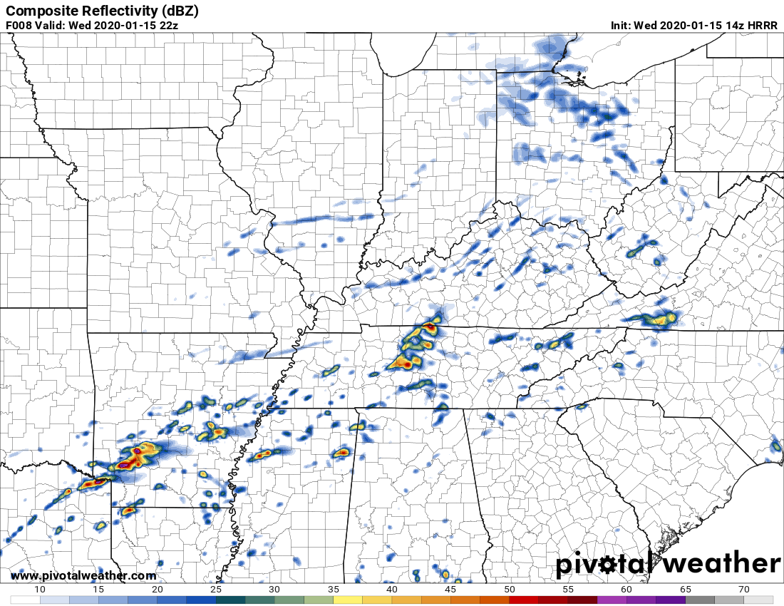
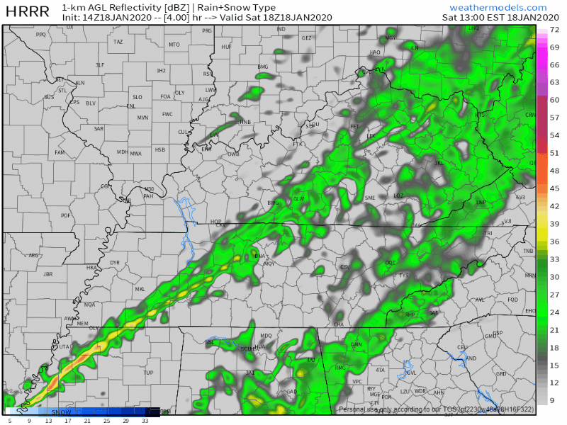
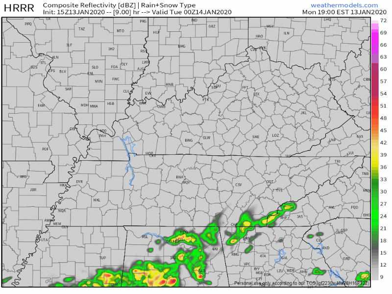
One weather model, the HRRR, thinks heavy rain and thunderstorms will arrive around 4 PM (give or take a few hours).
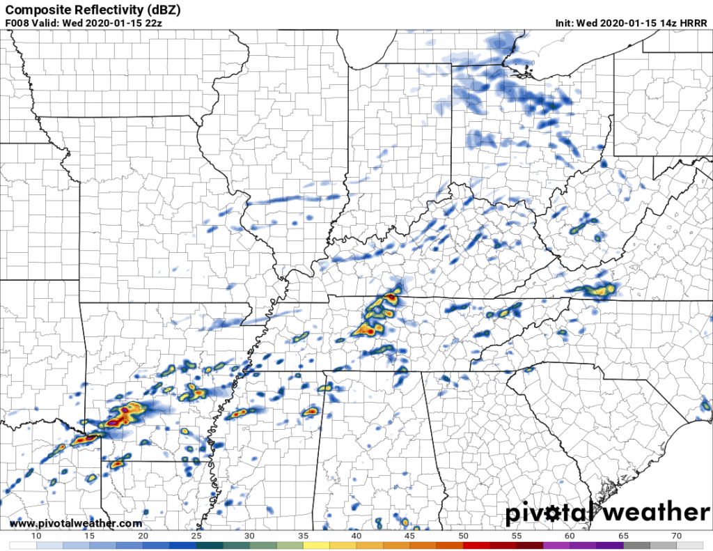
The HRRR model thinks these storms may be strong or severe, however, this model may be overstating the severity of the storms (below see HRRR model which expects 1,161 j/kg of surface based CAPE to fuel a pretty big storm or two; this high amount of storm fuel seems unrealistic given the cloud cover, so HRRR may be predicting the storms to be worse than they’ll actually be).
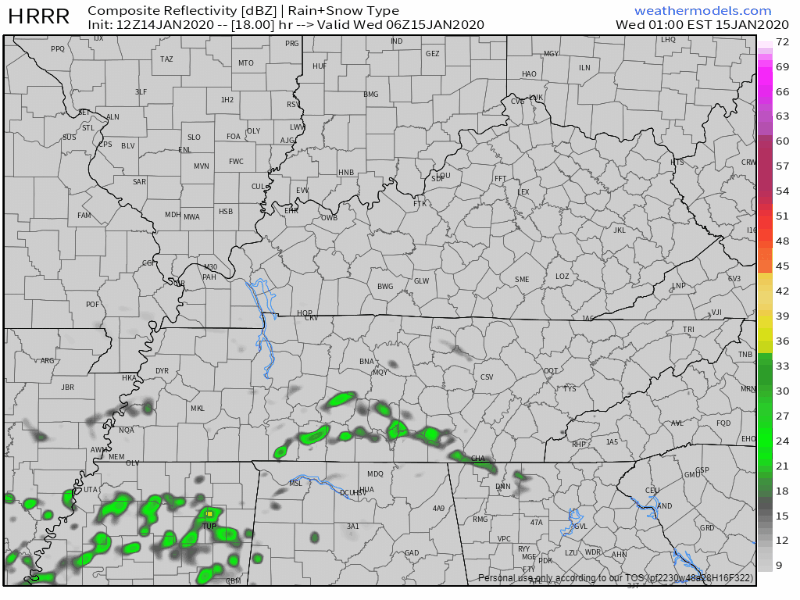
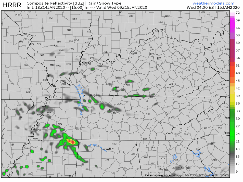
The HRRR model predicts storms Wednesday morning around the AM commute, around 5-7 AM:
Other models think morning rain and storms are possible, but prefer to keep them south and east of us. ETAs may vary.
No rain today, high 60°.
Rain comes tonight, after midnight. A few rumbles of thunder and/or a downpour might wake you up tonight; hail the main concern. No tornado or strong wind concerns.

Hail up to 1″ in diameter is remotely possible, mainly south of I-40 in the dark green shaded area. The probability of a big ole hailstone falling within 25 miles of those in the green shaded area is 5%.
You must be logged in to post a comment.