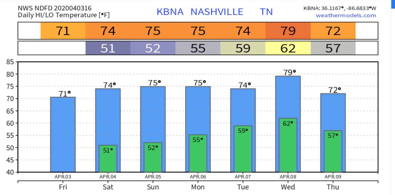
We’ve had a beautiful day with plenty of sun so far today, but clouds will begin to push their way into Middle Tennessee, especially into the evening hours as a weak front approaches. Along with this front comes not only some rain, but also gusty winds for us into the afternoon.
Winds 15-20mph gusting to nearly 40mph are possible for all of Middle Tennessee as this front approaches. Rain wise, we’re not going to be getting a whole lot, up to 0.5″ for some areas. The HRRR has these showers moving in around 9PM-11PM.
Cooler Saturday, More Rain Sunday
You’ll notice a little difference in the high temperature on Saturday. 63°. Clouds will be on the increase, but nonetheless there will still be some rays of sun to brighten up our cooler afternoon.
Sunday on the other-hand will likely be a washout. More showers and possibly a thunderstorm or two begin moving in from the West before noon, and continuing throughout the day. Here’s what the NAM has in store for us:
A few rumbles of thunder aren’t out of the question, but no severe weather is expected. Rain totals not very impressive, still only up to an inch.
Nice And Clear Through Midweek
Once the rain pushes its way out on Sunday night, the sun returns and leaves us with a beautiful first half of the week. High temperatures start off near 66° on Monday and make their way back into the 70s.
More rain comes into the forecast for Wednesday night and Thursday. Stay tuned for more updates!
A few clouds and a stiff north wind will keep our high temperature at 50° for the high. Even if the sun is shining today, don’t be fooled, it’s still chilly. The wind won’t be giving us much of a break either, gusting up to 20 mph throughout the day. A slight chance of one or two light showers are possible, but the HRRR thinks we’ll steer clear of those:
Wednesday
Freeze Watch
As sub-freezing temperatures are possible across the region early Wednesday morning, we’re included in a freeze watch from 3AM-7AM. Frost and freeze conditions can kill crops and possibly damage unprotected outdoor plumbing, so take steps now to protect your crops and pipes.
Once the sun rises on Wednesday however it will stick around with little cloud cover for the remainder of the day. It’ll be warmer, but still in the 50s, high of 58°.
Warmer Into Start Of The Weekend
We’ll gradually get warmer through the end of the week. Thursday we’ll be back in the 60s again with a high of 66°. The sun will hang around into Friday as well and warm us into the low 70s to set up a beautiful end to the week.
When Is The Rain Returning?
A weak cold front will bring some spotty showers Friday night and into the early hours of Saturday. What I like to call “splash and dash” showers will be possible this weekend, but no washouts nor severe weather is in the forecast. Have a great afternoon!
We’ve got a few spotty showers making their way across Middle Tennessee this morning and into the afternoon. Some of us may see some wet pavement in a few spots, but barely registering in any rain buckets.
We’ve lost our 5% severe risk from the Storm Prediction Center since yesterday because of a strong inversion or “cap” preventing any storm formation this afternoon. High of 80°.
Higher Severe Threat Overnight Wednesday
After a mostly dry afternoon Wednesday, a front will makes it’s way across Middle Tennessee, bringing in our next severe threat into the overnight hours.
Ingredients will be there for severe storm formation. There will be plenty of dry air aloft, making our hail threat larger, along with a higher wind threat as well.
The NWS-Nashville points that out this morning:
“This would spell a large hail threat (bigger than quarters) and an accompanying severe wind threat. I will say, wind fields aren’t impressive in regards to tornado development, but shear vectors perpendicular to frontal motion would also suggest a greater severe wind threat.”
NWS-Nashville Forecast Discussion 4/7/20
The Storm Prediction Center currently has us in a 15% chance of damaging winds within 25 miles of you,
and for hail, there is a 15% chance of seeing hail the size of quarters within 25 miles of you. We are also just outside of the dashed area which indicates a 10% or greater chance for 2 inch diameter or larger hail. For comparison, that’s about as big as a chicken egg. Ouch.
Tornadoes still have a chance of forming in this type of environment (2% chance within 25 miles of you), but the threat is lower than the damaging winds and large hail.
Timing
The NAM model has this front moving through between 3AM-5AM, so have a plan now.
[Editor’s Note: That plan Bryce is referring to should include having multiple ways to get warnings while you are asleep. Don’t pick one way to get warnings and trust that one device to wake you up. Have at least two devices that will wake you up (weather radio, wake-me-up app, etc).
Cooler, But Seasonal Into The Weekend
Thanks to the front moving through overnight Wednesday into Thursday we’ll drop out of the 80s for highs. We’ll stay dry on Thursday and Friday. Temperatures will be in the lower 60s on Thursday and windy, then the upper 50s for Friday.
We’ll warm up as we push into the weekend, with our next chance of some rain on Saturday.
Check back for more information as we approach the front moving through on Wednesday night/Thursday morning!
Plenty of sun today, 71° the afternoon high. If you look at radar you’ll see showers in west Tennessee moving east, but models do not think they’ll get here.
Saturday is almost the exact same, a little warmer at 74°.
A stray shower or two is possible on Sunday, but the NAM model isn’t really buying into it much. If we do see any rain on Sunday, it’s not going to be anything close to a washout. Outdoor plans still should be a go for this weekend, just keep an eye on our twitter for a couple stray showers or two.
Although we have a chance of some showers and storms on Monday, the models aren’t sold on it raining here until Tuesday.
“Both the GFS and Euro really don’t show anything organized until Tuesday, as a warm front sets up to our north and an 850 mb trough approaches from the west. This puts is squarely in a maritime tropical airmass, with temperatures approaching 80 degrees by Wednesday. Some surface-based instability means that a few thunderstorms are possible, although dynamics with this system are going to be weak and [rainfall] throughout the next 7 days suggest below normal rainfall totals.”
NWS-Nashville Forecast Discussion 4/3/20
No storms are expected to be severe, but the little amount of instability in the atmosphere will allow for a few thunderstorms to form. We won’t really get a whole lot of rain from this either.
It’s going to be hard to complain about high temperatures in the mid 70s all week though for the first week of April. Have a great week!
Rain begins to push in from the West and South early Tuesday morning hours. The NAM3 model thinks rain will last all day. Nothing severe, just gloomy and soggy.
The rain will cool us off big time as well. Only 55° for the high. Less than an inch total expected, so we stay clear of any flood threat as well. However, it’ll still be a bit windy with winds gusting up to 20 MPH.
Sun Sticks Around Rest of the Work Week
We’ll gradually warm up from the upper 50s on Wednesday, to the low 70s by Friday.
The weekend looks unclear. It may rain, but the pattern is unsettled and unclear.
Clouds today could limit our sunshine, but you’ll still get your fair share of it this afternoon. 84° for the high. That’s nearly 20 degrees above average for us for this time of year.
Humidity is way up, dewpoints in the low 60s. For the first time this year we have to drag out the dewpoint/humidity translator:
Saturday Night Severe Weather: Threats, Risks, ETAs
We’ll be dry throughout the majority of Saturday until the late evening hours, when our next chance of some severe weather rolls through.
Let’s start with how the NWS-Nashville breaks this down this morning:
“A tightening pressure gradient over the Ohio and Tennessee Valleys will help winds to gust 20+ mph Saturday afternoon and evening. In addition, a low-level 850mb wind max develops over west TN and slides east into Middle TN Saturday night. Diurnal surface heating will boost instability during the afternoon and evening hours. Thus, a line of rain and thunderstorms are expected to fire along the MS River Saturday afternoon, reaching the TN River by 00z-03z Sunday”
NWS-Nashville Forecast Discussion 3/27/20
Instability is like fuel to a storm. Diurnal surface heating increases instability as a line of thunderstorms pushes through Middle Tennessee. The Storm Prediction Center currently has Nashville and Williamson County at a 15% chance of seeing severe weather (damaging winds, hail, and/or tornado — keep reading) within 25 miles of you.
Threats: The main concern is damaging winds of 60+mph. Large hail isn’t much of a concern, but we still could see some small hail. A few tornadoes are possible somewhere in Middle Tennessee, and the Storm Prediction Center points that out by including us in an area with a 5% chance of seeing a tornado within 25 miles of you:
ETA: Models have come into a better agreement on timing, although minor adjustments might happen as we approach Saturday night. The current expected timing for this line of storms is around/after midnight.
As usual the NAM3 model loves this event, but the GFS and the Euro models suggest a low level inversion that would reduce our tornado risk.
Plan ahead and have multiple ways to get warnings now. Since this event is expected to happen later at night, possibly after midnight, have a plan in store ahead of time in case severe weather strikes.
Check back here and especially on Twitter @NashSevereWx for updated information. Forecast threats, risks, and timing improve the closer we get to an event. Replace older, generalized information with newer, more specific information.
Severe Storms Risks, Threats, And Timing For Today
Our first round of storms has already pushed off to the Northeast, but what we’re really going to watch is the greater threat with the second round of storms ahead of a cold front moving through this afternoon and evening. The Storm Prediction Center is currently monitoring these storms moving in from the West. We are listed in a mesoscale discussion. You can find it here….
Threats: Like the forecast yesterday stated, the primary threat is going to damaging winds 60+ mph, but now we add an increased chance of flooding in low-lying areas. Large hail, up to half dollar size, and a few tornadoes are possible as well. .
Risks: The Storm Prediction Center still quantifies our probability for both damaging winds and hail at 15% within 25 miles of anyone in the yellow region of the map above. Our tornado threat for Davidson county has moved further South slightly, but still has a probability of 2% of seeing a tornado within 25 miles of you. This doesn’t mean tornadoes still aren’t on the table. Williamson County on the other hand, is still 5% chance of seeing a tornado within 25 miles of you.
Timing: The NWS-Nashville has this graphic to help explain and illustrate the timing of these storms moving through Middle Tennessee. Late afternoon and into the evening hours are when we need to keep our eyes peeled.
A warm front between the 4PM-6PM time-frame will lift near Nashville.
“Warm front is still off to the south, and the question will be how far north the front will move this afternoon. Surface low will be moving east with the quick moving upper shortwave, and will ride along the front. This will provide greater lift for the unstable airmass this afternoon, and with the deep layer shear remaining strong and low level shear/helicity increasing, along and south of the front will remain the area for greatest risk of severe thunderstorms.”
NWS-Nashville Forecast Discussion 3/24/20
As the quote states, this warm front will bring with it a lot of storm-making instability and shear that can produce supercells. Currently, the warm front is looking to set up South of Nashville, hence why the tornado risk is now lower. The further South you go down I-65 into Williamson County, the greater the tornado threat.
Here’s the HRRR, showing that the warm front is setting up South of Nashville, providing the greatest threat for all forms of severe weather further South along with it.
Stay connected and weather aware as these storms begin to make their way through into the region this afternoon. Some things may change, so make sure to have a way to get your warnings and know where to take shelter in the event severe weather strikes.
EDITOR’S NOTE: SUBSCRIBE TO OUR YOUTUBE CHANNEL AT THE BOTTOM OF THIS POST. ENABLE NOTIFICATIONS FOR OUR TWEETS IN TWITTER AND SET YOUR TIMELINE FOR CHRONOLOGY.
Rain this morning moved out. Dry the rest of the day, clouds maybe breaking up a bit and providing a few rays of sunshine this afternoon. Temps a little below average, afternoon high 60°.
Severe Weather ThreatTuesday
Threats: The primary threat will be damaging winds and large hail. Tornadoesare less likely than damaging winds or hail, but still possible. Below, NWS-Nashville breaks down threats on a 0-5 threat scale:
Risks: The Storm Prediction Center quantifies our probability for both damaging winds and hail at 15% within 25 miles of anywhere inside the yellow region on this map, us included:
We’re also included us in the brown region on this next map, signifying a 5% chance of a tornado within 25 miles of anyone inside it.
Some more from the NWS-Nashville on this:
“Summarizing some key points of SPC`s Day Two Discussion along with local analysis, low level atmospheric [winds] will strengthen as day progresses, with dewpoints reaching lower 60s especially across locations south of I-40 and west of I-65 during late afternoon hours. Expecting MLCAPE values to peak in the 500-1000 J/KG range during these afternoon hours also, as strong deep-layer shear profiles and steep low-level lapse rates also develop. 0-6 KM shear 65 to 75 kt range expected. This would be favorable for supercells and short bowing line segments.”
NWS-Nashville Forecast Discussion 3/23/20
Potential ETAs:
I’ll bring in another quote from the NWS-Nashville:
“In agreement with previous forecast reasoning that there could be potentially two rounds of severe weather across our area, one during late morning hours as a warm front pushes northward and the second late afternoon into early evening hours as a squall line develops and sweeps west to east across mid state region.”
NWS-Nashville Forecast Discussion 3/23/20
Let’s illustrate these two rounds of storms with the NAM model.
Below notice the first round, ETA as early as 8AM-9AM and moving out by 2PM. The main threat with this first round is going to be the damaging winds threat. Tornadoes appear less likely during this round as these storm ride a warm front, so there will be no instability waiting for it. Tornado concerns are more of a Round 2 concern.
Then the stronger round of storms moves in as early as 4PM-6PM and departs sometime before midnight. This round brings the threat of damaging winds, large hail, and a couple tornadoes:
Editor’s Note: Forecast soundings — basically a two dimensional graph breaking down atmosphere details – show large, curved hodographs, no “cap”, low cloud bases, dry air aloft, and rising instability. I think Round 2 storms are the “main event.” But much of that will depend on how Round 1 shapes up and influences our atmosphere. There’s still a lot we don’t know, and won’t know, until Tuesday afternoon.
Summary: Now of course like every forecast, nothing is completely set in stone. However, our confidence is rising by the hour as the threats increase for these strong to severe storms. Stay tuned with us for the latest information on this event. The time is now to have a plan for when severe weather strikes. Be sure to have multiple ways of receiving warnings for when severe weather strikes your area.
Storm Anxiety? Read this, then consider another way to perceive risk:
Think of it this way:
Probabilities of these **NOT** happening within 25 miles of us tomorrow:
Scattered showers and storms this morning will lead into more widespread storms this afternoon, especially along/East of I-65. Here’s the HRRR:
No severe weather is expected, but we still could see a few stronger storms this afternoon that bring heavy downpours and strong wind gusts of 40-50 mph. These showers and storms unfortunately will hang around Middle Tennessee into the evening hours.
It’s going to be pretty warm and muggy as well, 75° for the high and those dew points in the mid 60. So, not the best type of hair day.
Break From Rain Saturday, Rain Comes Back Into Work Week
We’ll get a small dry run from the rain for Saturday. Clouds will still hang around, but we should still see a few peeks of sun here and there. Nearly a 20 degree temperature drop from Friday, 56° for the high. It’ll still be a bit breezy as well, winds gusting up to 25 mph.
Sunday Afternoon Rain
Starting off Sunday we’ll be dry, but we’ll see more rain move in during the afternoon. The NAM model shows these showers moving in around 1-3PM, and remaining scattered throughout the afternoon into the evening. ETA’s are likely to change a little bit as we approach Sunday.
High of 57°
Rain Chances Hang On
More “splash and dash” type rain showers are expected through the work week, a chance every day. Temperatures continue to rise again through the week as well, reaching the upper 70s by later in the week.
As always, check back for updates to the forecast and be sure to follow @NashSevereWx on Twitter!
Scattered to widespread showers hang around Middle Tennessee all morning. We expect to begin to dry out between 5PM-7PM, so today isn’t a complete washout, but if you’re heading out before then, take the umbrella. Here’s what the HRRR model thinks might happen:
57° for the high.
Wednesday And Thursday
Yes more rain, but not a complete washout.
Wednesday does bring with it another rain chance, but it’s not going to be an all day, or really even widespread. The NAM thinks most of the showers will stick off to our north and we’ll see a few “splash and dash” rain chances through the afternoon:
It’ll be warmer, 74° for the high.
Thursday brings much of the same, but more widespread rain than Wednesday, warm again at 77°.
Storm Potential Late Thursday And Friday
A cold front pushing its way through Middle Tennessee will come through late on Thursday and into early Friday. Most of the moisture ahead of the cold front will be where we get most of our impacts of this system from.
The NWS-Nashville goes further in depth to explain what is going into this system:
“Overall, shear ramps up from time to time but instability remains very low end. While the main front passes largely Fri afternoon, there is a window overnight Thu into early Fri were instability does become a little more favorable, while shear elevates as well. At this point however, it is still wait and see if models trend instability higher for severe potential because even a bit more favorable it is still quite low.”
NWS-Nashville Forecast Discussion 3/17
The severe potential is there, but still too far out to be certain of anything. If a decent amount of instability and shear are available overnight, we could get stronger storms out of this system. The storm prediction center has our two counties highlighted in its general thunderstorm risk area.
This being said, we’re still uncertain on exactly how much energy these storms will have to work with. Regardless, plan now and have a plan in case severe storms do make their way into Middle Tennessee Thursday night into Friday morning. Stay connected. Don’t let this be the last time you check on the forecast for this system.
Weekend
Behind our cold front passing through on Friday, we will begin to see a much needed and wanted drying trend that will last through most of the weekend, as a few showers may return again later on Sunday. The cool front will certainly bring cooler weather. Mid 50s for the highs over the weekend, but the sun makes its glorious return for us.
Have that umbrella handy this week and happy St. Patricks Day!