
Calm, Dry End of the Week
We can expect mostly sunny skies Thursday and Friday. Thursday’s highs reach 65°, while Friday’s highs reach 76°.
Secure any hats Friday as winds will blow at 10-15 MPH, with gusts as high as 20 MPH.

We can expect mostly sunny skies Thursday and Friday. Thursday’s highs reach 65°, while Friday’s highs reach 76°.
Secure any hats Friday as winds will blow at 10-15 MPH, with gusts as high as 20 MPH.

Thursday: Sunny, high of 65°, breezy.
Friday: Down to 38° early AM. Then copy and paste the rest of Thursday, but a high of 59°.
Saturday: Cold start to the morning with highs in the mid to upper-30s. Some could possibly wake up to some patchy frost if it gets cold enough. Sunny, high of 68°.
Mostly sunny, highs Sunday (today) 77°, and 79° Monday.

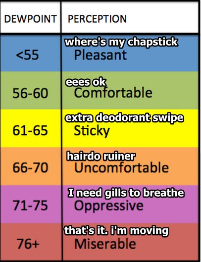
Humidity will rise each day this week. Dewpoints in the low 60s Tuesday and Wednesday.
Models believe it’ll rain Tuesday.
A specific ETA is unknown because although models agree it’ll rain, they aren’t sure when. Rain could begin as early as Tuesday morning or as late as Tuesday afternoon, and should clear out by Wednesday morning. The rain should come in short waves with no expected rainouts, but, on Tuesday night . . .

Thursday’s high reaches 66° with mostly sunny skies. Copy and paste this for Friday, but with a high temp of 77°.
This was me reading this forecast.
Saturday starts partly sunny, then a light rain system moves close by Saturday night and Sunday. It may or may not produce local rain. Models think the system is weak, lacking rainmaking and storm-making ingredients. Some of us may get a little rain, no washout.

Sunday (today): Dry, sunny, high of 71°, 15 MPH winds with gusts as high as 25 MPH.
Monday: Copy and paste Sunday, but with a high of 69° and a light breeze.
This is perfect weather if you ask me.
Both the EURO and GFS models agree it’ll rain on Tuesday. While rain is expected to begin Tuesday morning, the good news it that it will move out by Tuesday evening/night.
Thursday: Sunny, high of 81°, southerly winds of 5-15 MPH with gusts as high as 20 MPH.
Friday: Some clouds move in, dry, high of 83°.
Overall, a great end to the week.
Saturday starts off dry, but the chance of rain increases later into the afternoon and evening.
Showers moved through the area this morning.
Weaker showers are forming to our southwest and may or may not make it here today. They’re scattered and light and will probably miss us. For most of the day, we should stay dry until late tonight.
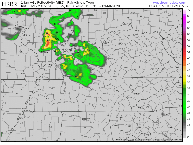
As of 4 PM, Davidson County (Nashville) remain in the Tornado Watch issued earlier today, set to expire at 5 PM. Williamson County is currently not included. It’s expected this Tornado Watch will expire without anything bad happening. We were on the southern edge of the Watched area, storms prompting the Watch passed to the north earlier this afternoon.
This morning, Will tweeted “Do not seek definitive answers. Seek info.” Wish definitive answers existed about what will happen today. They don’t. Instead we have probabilities about what might happen. This forecast is not a prediction, it’s a threat/risk assessment, expressed as probabilities and updated throughout the day. Later today information will be more precise, timing more certain, passed quickly to you via Twitter. Be flexible, stay alert. Have a way to get warnings, and consult multiple reliable severe weather information sources (local TV meteorologists are great!).
… and off and on rain will carry on throughout the week.
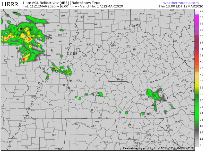
The HRRR model thinks scattered showers will begin Monday night (tonight) around 9 or 10pm:
The GFS model also thinks rain begins later this evening with a break after Tuesday morning, heavier rain Wednesday afternoon, and then more off and on showers through Friday:
You must be logged in to post a comment.