
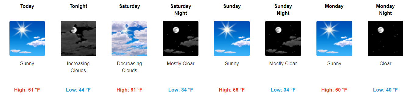
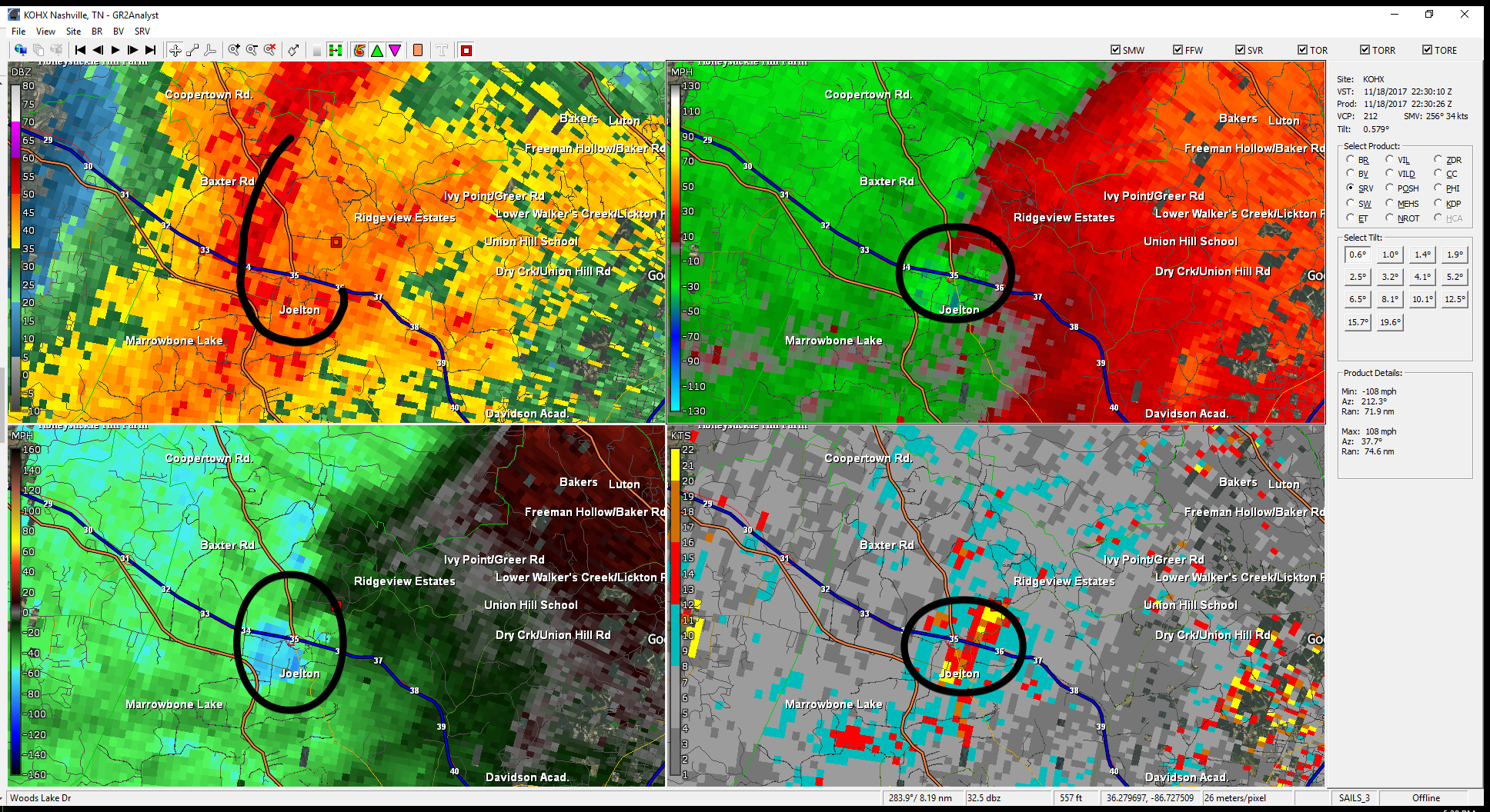
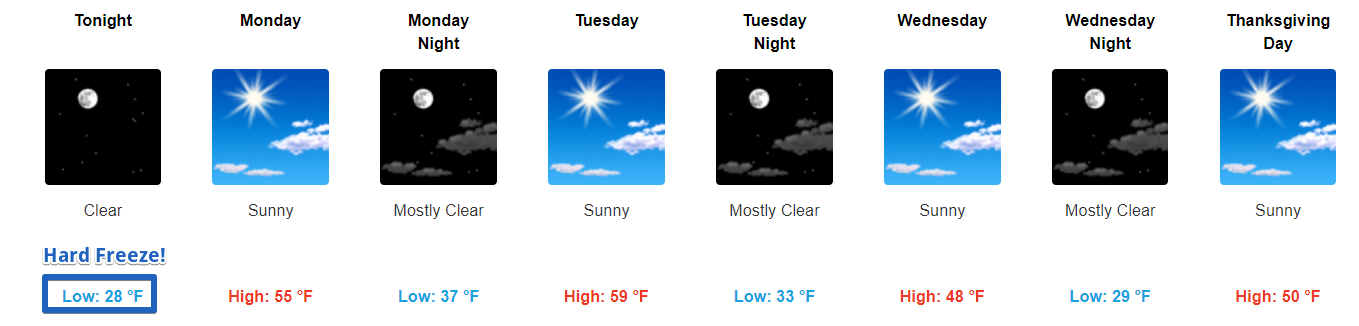
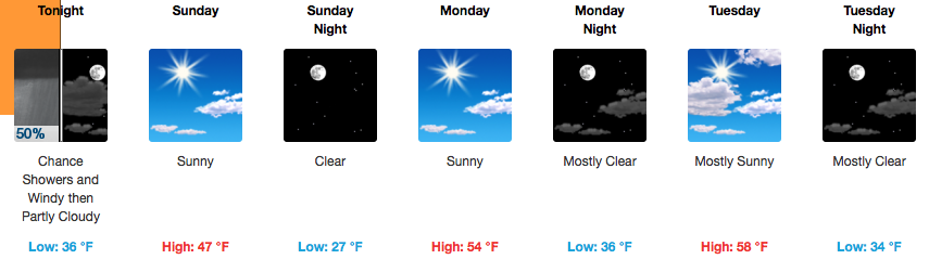
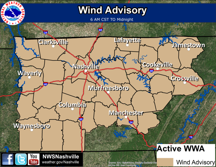
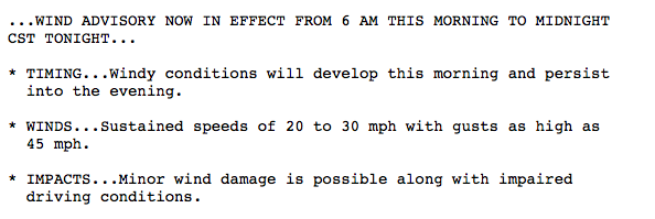
Somewhat Warmer Temps Continue, Dry Cold Front Passing Through Tomorrow
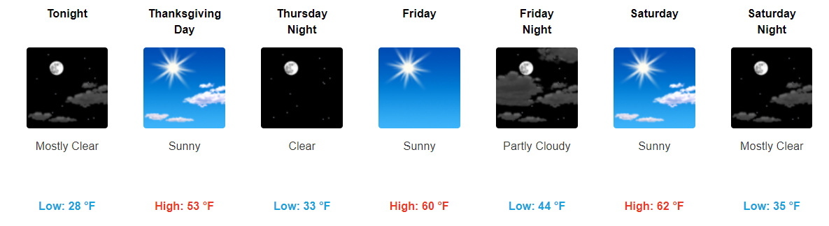
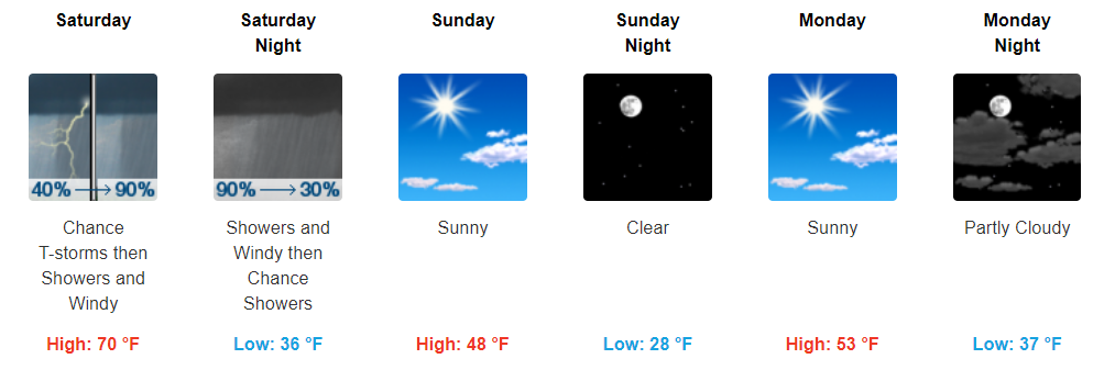
Black Friday shopping conditions look pretty great. Sunny skies with highs reaching into the low 60s.
https://giphy.com/gifs/nbc-thanksgiving-xUOxfgvoZWJo9CvTm8
Tonight into tomorrow, expect for a few more clouds than we’ve seen recently. A dry cold front will move through the area tomorrow, bringing somewhat cooler temps for Sunday. Full on sunshine will return then.


You must be logged in to post a comment.