
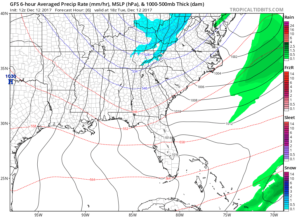
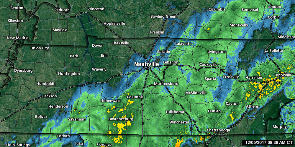
Dry Spell, Not Much Moisture To Work With
GFS Model Loop Through Sunday
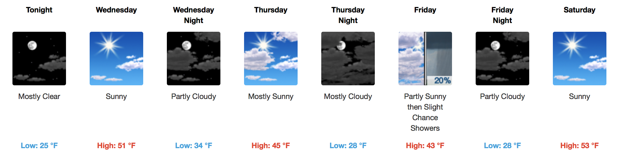
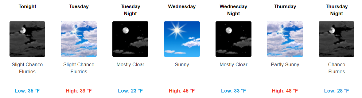
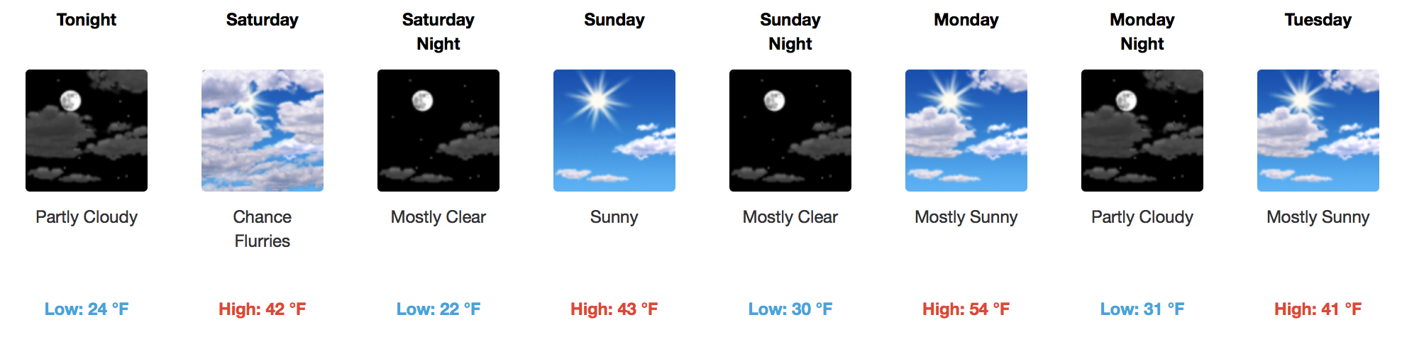
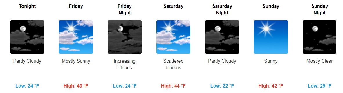
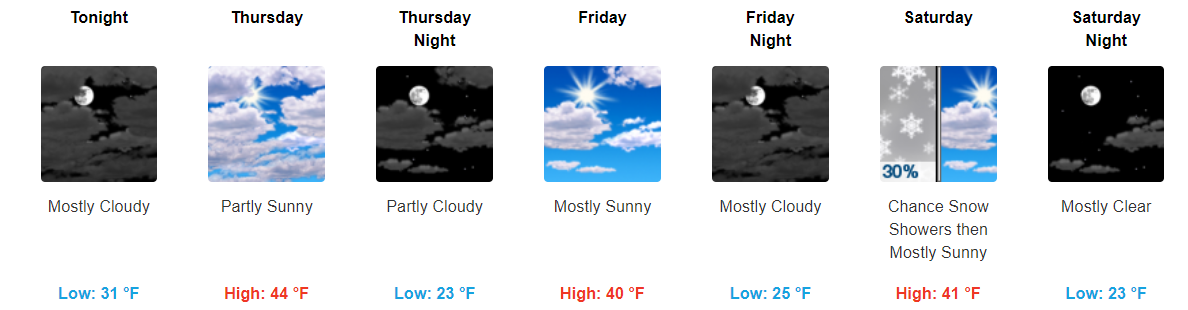
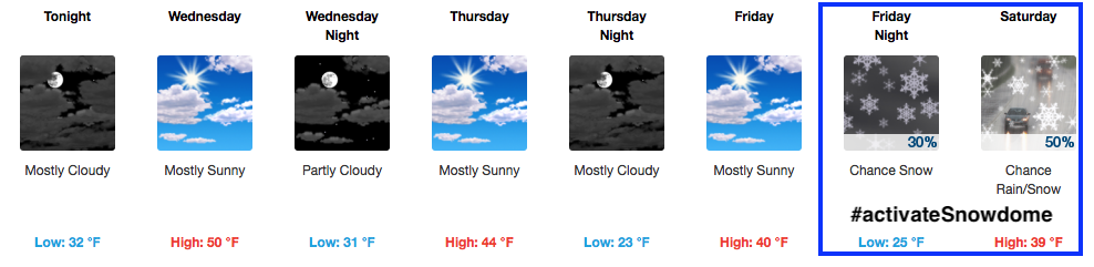
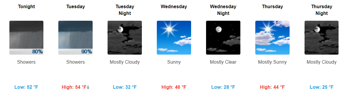
Temperatures will fall after a high in the 50s on Wednesday back into the 40s on Thursday and Friday afternoons. Winds will pick up on Wednesday afternoon with the passage of a dry cold front, gusting to 25 mph. Expect variable cloudiness and a decent amount of sunshine.

You must be logged in to post a comment.