
One more nice day, y’all.
Winds Picking Up
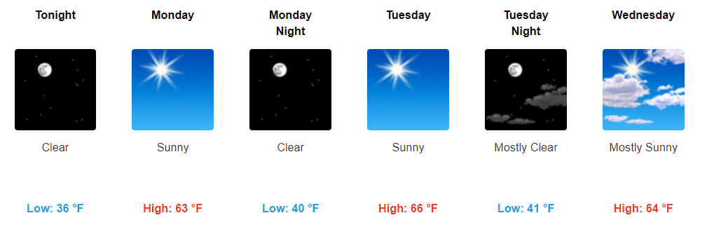
Winds will gradually increase Monday. Secure your outdoor Christmas stuff. Winds will gust near 30 MPH Monday night.
That’s right, it’s another @WendyMonday! Get it?!

One more nice day, y’all.
Winds will gradually increase Monday. Secure your outdoor Christmas stuff. Winds will gust near 30 MPH Monday night.
That’s right, it’s another @WendyMonday! Get it?!

Sunshine today, maybe a few clouds here and there, mid 60s this afternoon, gentle east breeze blowing over the top of Nissan Stadium for the Titans game.
Pretty great for December 3.
It’s all going downhill from here.
Temperatures have already climbed into the lower 50s this morning and will continue to rise with additional sunshine. Today’s official high of 64ºF is several degrees above what was previously forecast, so take the opportunity to get outdoors…maybe to put up some decorations!
It’s finally December, but it sure will not feel like it today through the beginning of next week.
https://giphy.com/gifs/eye-roll-oLHpseET8Y50I
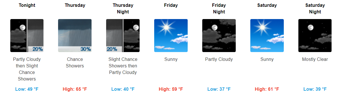
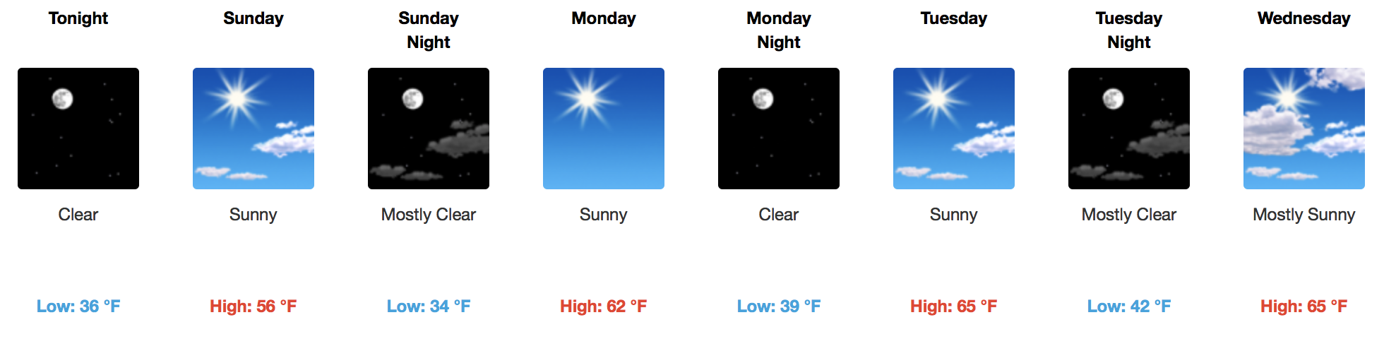
Temps continue to climb a degree or two each day with highs in the low-60s today, mid-60s this weekend, and then into upper-60s by Monday. Sunshine looks to hang around through it all, so all weekend activities look to be in great shape.
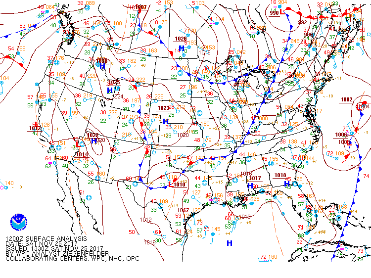
WPC Surface Analysis at 6AM
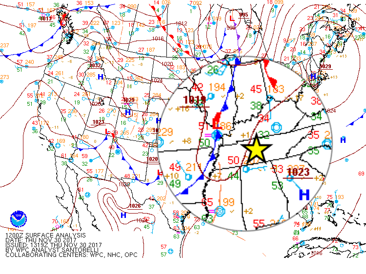
A northerly component to the light breeze will usher in cooler air behind the cold front.
24-Hour Temperature Trend
[av_textblock av_uid=’av-tufcg6′]
[cjtoolbox name=’Treg DONT DELETE’]
[/av_textblock]
More of the same today with the only difference being that our high temps will be even warmer today than yesterday. Besides that, throw some shades on and enjoy the nice weather!
https://giphy.com/gifs/off-showed-mrBEVU9zQIsZa
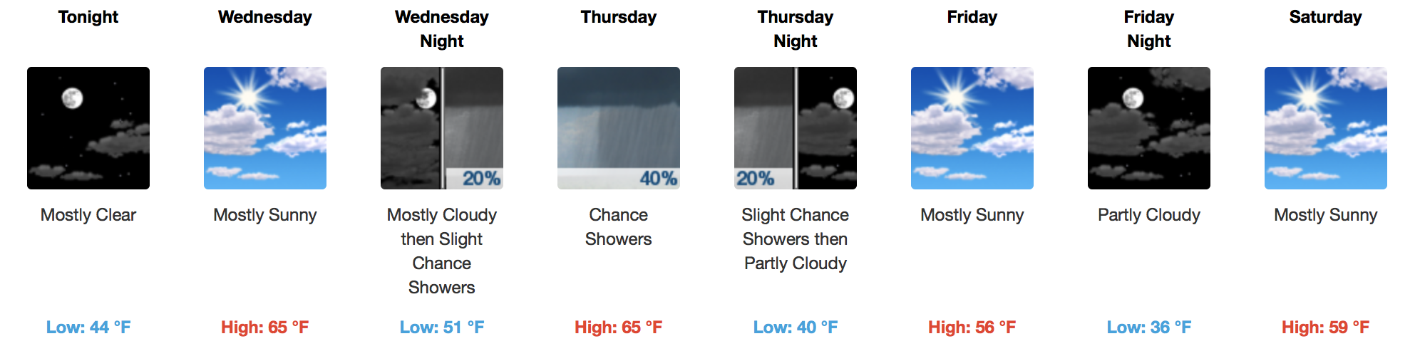
Surface high pressure is moving east towards the Atlantic U.S. Coast this morning, allowing southerly flow to pump in warmer air. This afternoon, temperatures will rise into the middle 60s with winds gusting as high as 20 mph.
Enjoy the sunshine and comfortable daytime temps for the first half of the week.
https://giphy.com/gifs/oscars-academy-awards-oscars-1984-26gskDU3cThn1Eeti
Unfortunately, as it gets closer, this system continues to look less impressive in terms of rainfall. Models agree a bit more on timing now. However, the overall rainfall accumulation from this system continues to be less and less.
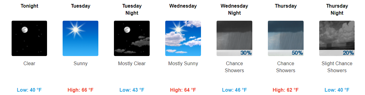
High pressure remains well in control today and to start the beginning of the week. Sunny skies will stick around through Tuesday with only a little more cloud coverage on Wednesday.
Highs will be above average through a good bit of the week. Tuesday looks to be the warmest day, with highs in the mid to upper 60s.
WPC Surface Analysis
No rain with this one! The atmosphere is quite dry this morning over Middle Tennessee. Expect partly cloudy skies into the early afternoon, then clouds quickly clearing by evening. Temperatures will fall into the middle-lower 50s by 6pm, from a high of 63ºF around 3pm.
You must be logged in to post a comment.