
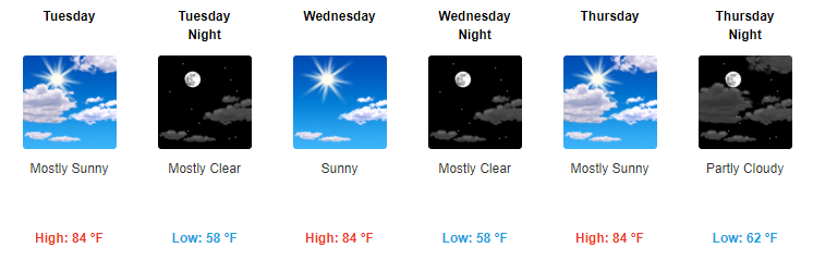
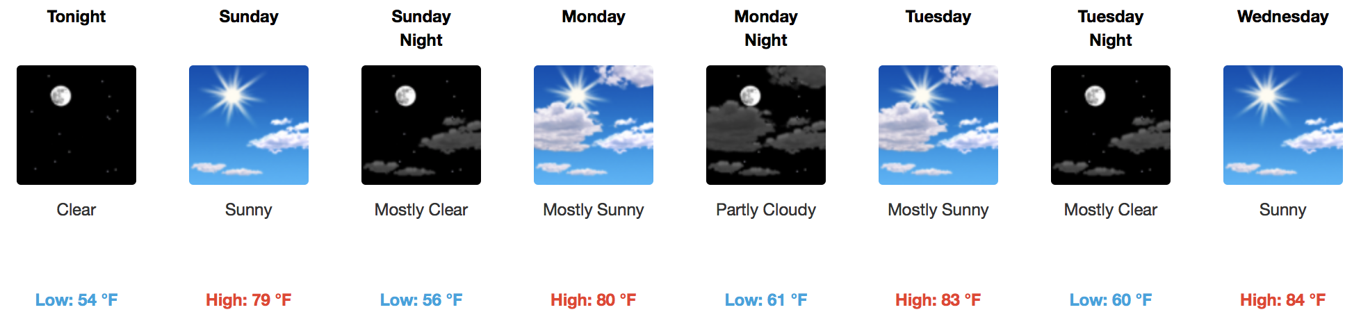
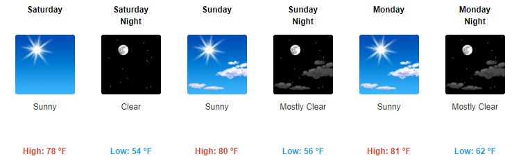
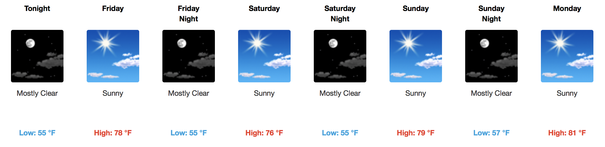
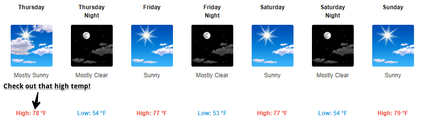
Slightly Above Average Temps & Sunshine for the Entire Week
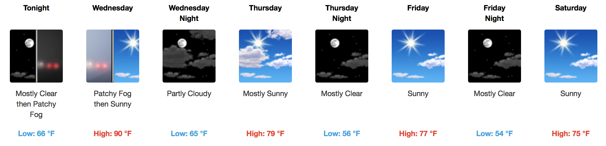
Temperatures Today/Tomorrow
[av_textblock av_uid=’av-tp8utb’]
[cjtoolbox name=’Treg DONT DELETE’]
[/av_textblock]
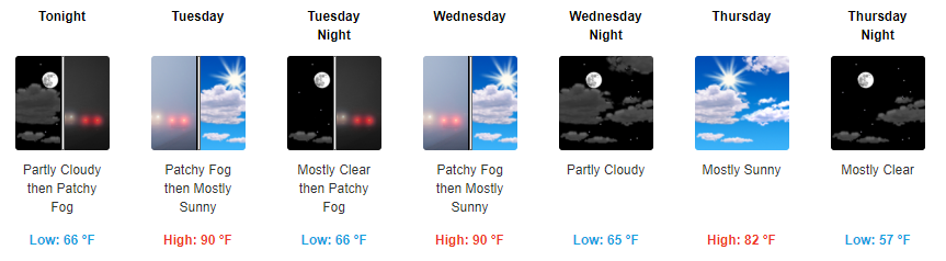
Starting tomorrow, our highs will jump into the low to mid 80s. Overnight temps this week will dip into the upper 50s to low 60s, so you may need a jacket in the evening and for the early AM commute.


You must be logged in to post a comment.