Gloomy and Rain-Filled Tuesday
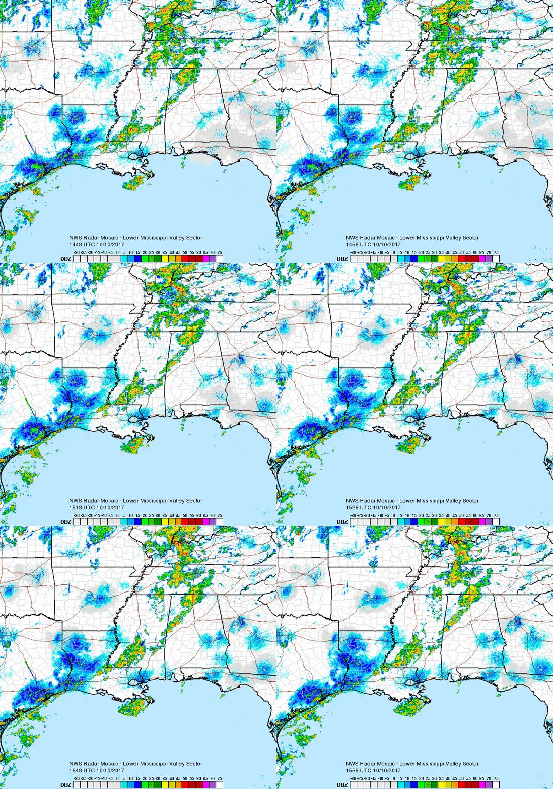
Regional Radar 11:30AM CDT

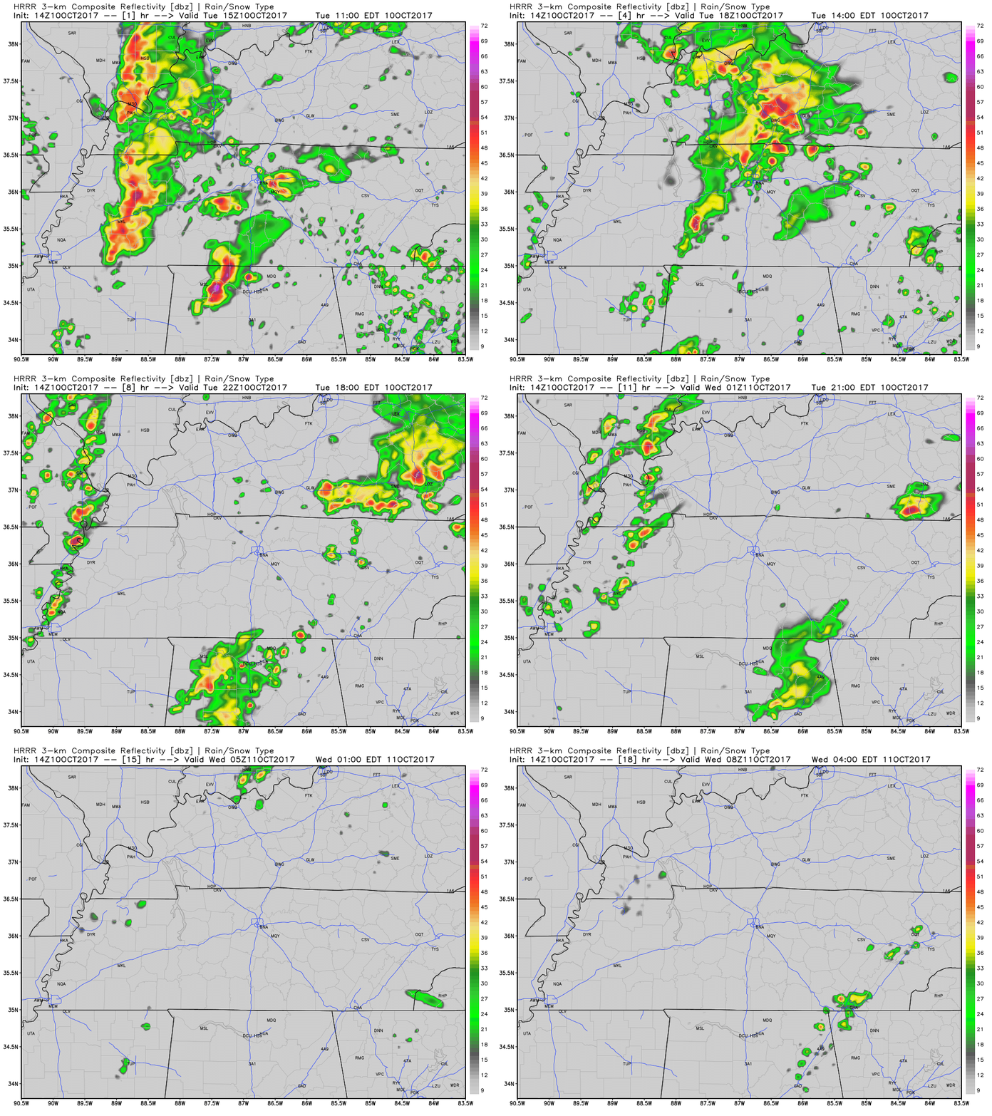
Rain has encompassed much of Middle Tennessee this morning and another heavier batch is moving in from the west for the lunch hour. Plus or minus a few more showers after this next rain swath, we will be largely done with measurable precipitation by late afternoon/evening. The HRRR is in good agreement with this scenario.
Latest HRRR Model Loop

If you have outdoor plans this evening, keep the umbrella handy just in case. For the most part, though, things should remain mostly dry.
Clouds Stay For Wednesday, Clearing For the Rest of the Week/Weekend
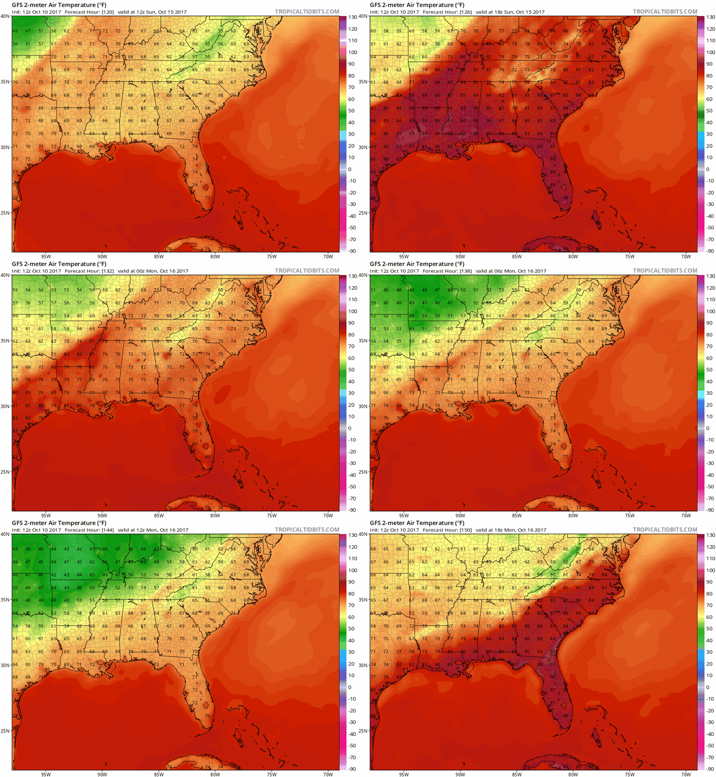
This “cool” front that brought today’s showers will not exactly bring extensive relief in terms of temperatures. We will dip into the 70s tomorrow and Thursday but return to the 80s on Friday. The weekend looks great, too! Highs in the 80s and lows overnight in the 60s will do, but an increase in moisture piles up ahead of our next cold front late Sunday/early Monday morning. After a decent rainfall Monday morning, the atmosphere dries out and we expect more “fall-like” temperatures to overspread the area.

Latest GFS Temperature Model…see the cold front?

Categories: Forecast Blogs (Legacy)


You must be logged in to post a comment.