547 PM Update:
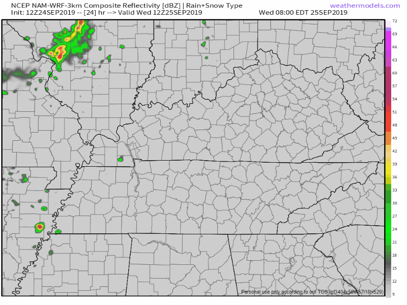
Tonight's rain fizzling, Thursday morning rain amounts vary dramatically by weather model, after that hot the rest of the month. Deeets ⏬ https://t.co/lfehyETKnH
— NashSevereWx (@NashSevereWx) September 25, 2019

Tonight's rain fizzling, Thursday morning rain amounts vary dramatically by weather model, after that hot the rest of the month. Deeets ⏬ https://t.co/lfehyETKnH
— NashSevereWx (@NashSevereWx) September 25, 2019
Humidity left. Dew points in the mid 40°s — fall quality! — but temps remain above normal for late September with mid/upper 80°s.
Wednesday will be nice.
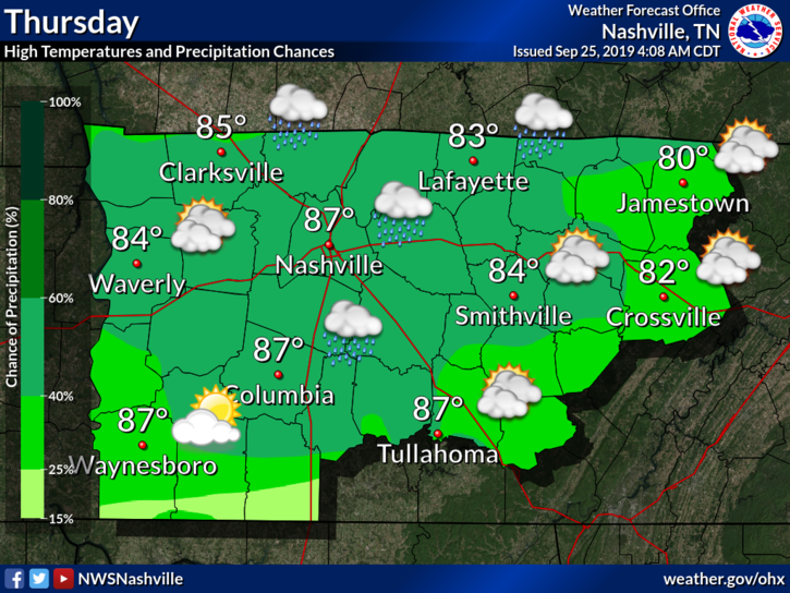
Showers arrive maybe Wednesday night but probably Thursday morning as another cold front moves into the region.
At least it’s something?
These aren’t pop up storms, instead a weak cold front is moving through today, setting off this rain.
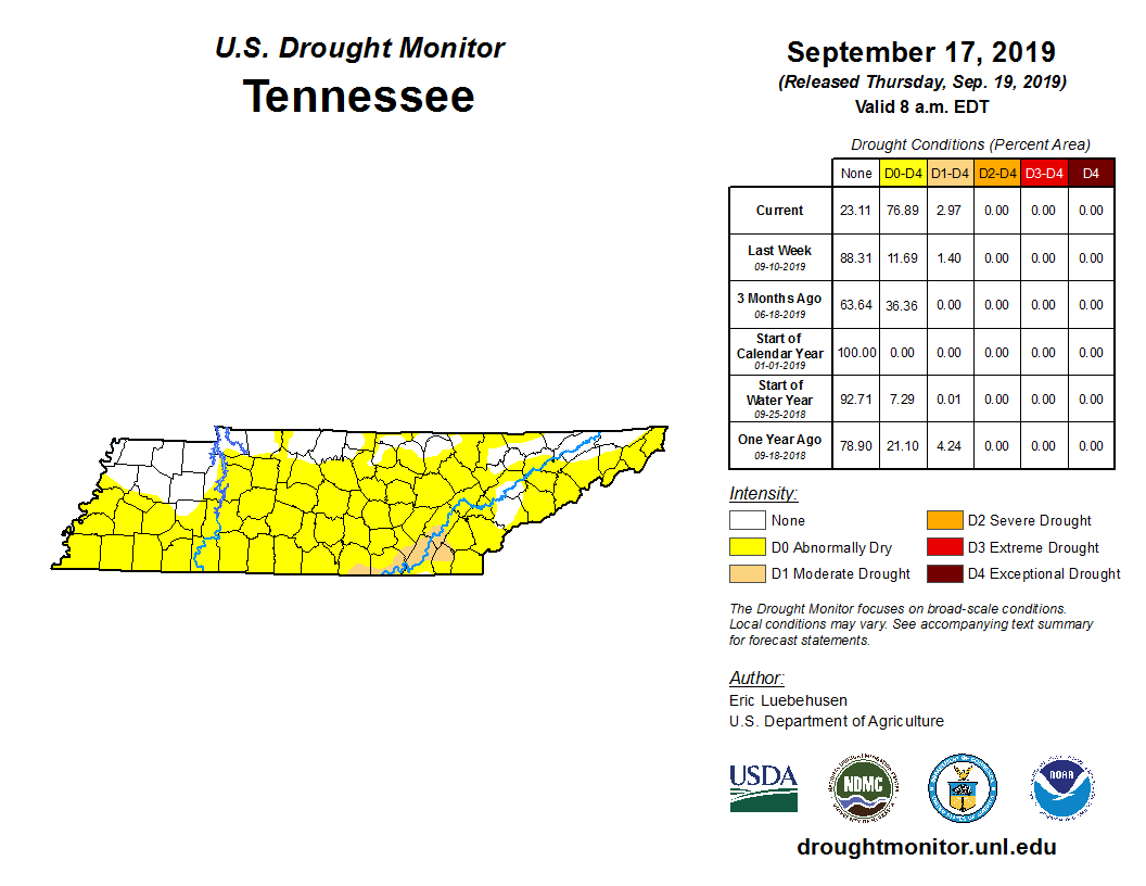
NWS-Nashville predicts less than .25″, with most areas receiving less than .10″. Your backyard could see more, some could see less; either way it’s not a lot. This will do little to cut into our monthly deficit.
Fires can spread quickly this afternoon.
Dewpoints are likely to drop into the mid 50s later today, and with winds speeds picking up and pretty dry ground conditions, marginal fire danger is likely this afternoon. •NWS-Nashville

At the time of writing this the temperature is 89º, but it sure doesn’t feel like with a 52º dew point. A steady 10mph breeze doesn’t hurt anything either. All in all, if you’re tailgating, back yard tailgating, or outside for Pilgrimage, things are pretty comfortable. That being said, take some sunscreen.

We’ve got great weather to end the workweek today for Middle Tennessee.
Cooler than the past few days, but more importantly, lower dewpoints! We’ll be up to 89° today, but the dewpoints are actually going to be our friend today and stay in the 50s!
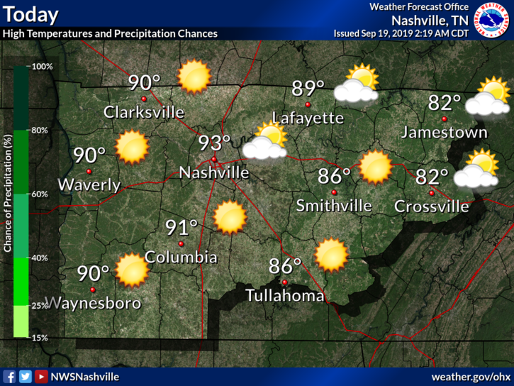
It’s still kinda humid and dry, though we will have a slight drop in high temps.
These above-average high temperatures keep pushing us closer to breaking a record:
“Still looks to reach the 90s for much of the area, with Nashville now at the #2 most 90 degree days ever in a year and inching ever closer to the all time record set in 1954.” @NWS-Nashville
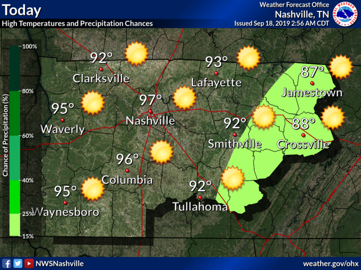
Hot, unfortunately. The heat continues into the middle of the month.
High today expected to be in the upper 90°s. Dewpoints in the mid 60°s. Bleh.
Any relief coming?
NWS-Nashville:
Surface observations this morning show it`s (surprise) another warm and humid one with current readings in the 60s and 70s. Some patchy fog is noted mainly over eastern counties, and cannot rule out a few dense spots. Otherwise, another unusually hot mid September day is on tap, although at least highs look to be a degree or two below yesterday`s levels. Models continue to show a surge of slightly cooler and significantly drier air coming down the east side of the Appalachians then spreading westward into our area later today.
Just barely. We might be dealing with some dry heat instead of our typical muggy heat. Let’s check the dewpoints on the models!

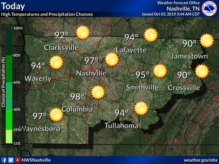
High temperatures Tuesday (today) will reach 97°, but we could see a heat index up to 101°.
Dewpoint temps? Mid-60s. Not bad, but not great.
Due to a weak frontal boundary that came through yesterday evening, a few could see a shower or two, but that’s super unlikely.

https://twitter.com/hfrees/status/1173633322884444160?s=20
Editor’s Note: this is on me. I was perusing other data sets and saw that when I said 17 before I had misread something, I’m not exactly sure what. I messed up. Below is the confirmed data. The streak is 8 days in a row:
You must be logged in to post a comment.