
547 PM Update:
Tonight's rain fizzling, Thursday morning rain amounts vary dramatically by weather model, after that hot the rest of the month. Deeets ⏬ https://t.co/lfehyETKnH
— NashSevereWx (@NashSevereWx) September 25, 2019
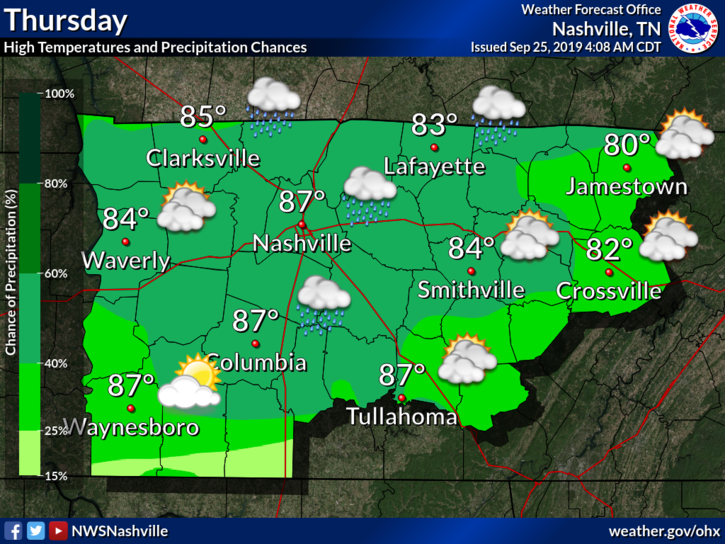
Rain Chances Increase Thursday Morning
ETA early morning until around noon.
Could get some thunder and lightning with some of the stronger stuff.
Techy details:
These showers/storms likely die off in the evening…but redevelopment is expected overnight and well into Thu as the affects of our plains front get into the picture. This front is expected to be near our northwest corner around 12z, then it sinks south to near the TN/AL border by early evening. Instability remains marginal through that period but along with scattered showers, do expected isolated storms as well. Deep moisture return ahead of this boundary will not especially good. We are currently running 2.5+ inches short this month and rainfall with this episode likely less than 0.25 for most. • NWS-Nashville
This might be our best shot of rain so far this month, which isn’t saying much. This front will increase our rain chances throughout the early and late morning hours.
We are also looking at rainfall amounts less than 0.25 inches for most people. Yeesh. September has seriously been dry.
The high temp Thursday won’t make 90° due to cloud cover and rain.
Humidity Cranks Up Friday and Continues Into the Weekend – Summer Continues
Not much to say into the weekend. Summertime air mass reigns supreme once again. Hot and humid wins out.
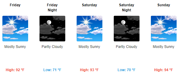
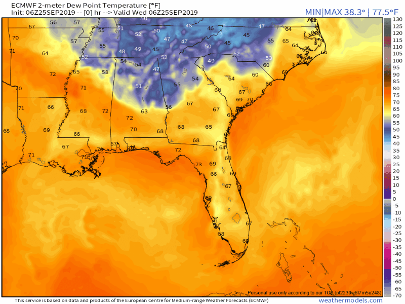
Watch the cool, crisp, fall-like dewpoints in blue slowly erode Friday into Saturday.
Summer will end eventually, I promise. Just not right now.

As always, check back for updates to the forecast and see the latest on our Twitter @NashSevereWx!

Categories: Forecast Blogs (Legacy)
You must be logged in to post a comment.