Today should be the nicest day of the week.
Humidity left. Dew points in the mid 40°s — fall quality! — but temps remain above normal for late September with mid/upper 80°s.
Rain chances return Wednesday night into Thursday morning.
Wednesday will be nice.
Showers arrive maybe Wednesday night but probably Thursday morning as another cold front moves into the region.
ETAs are iffy.
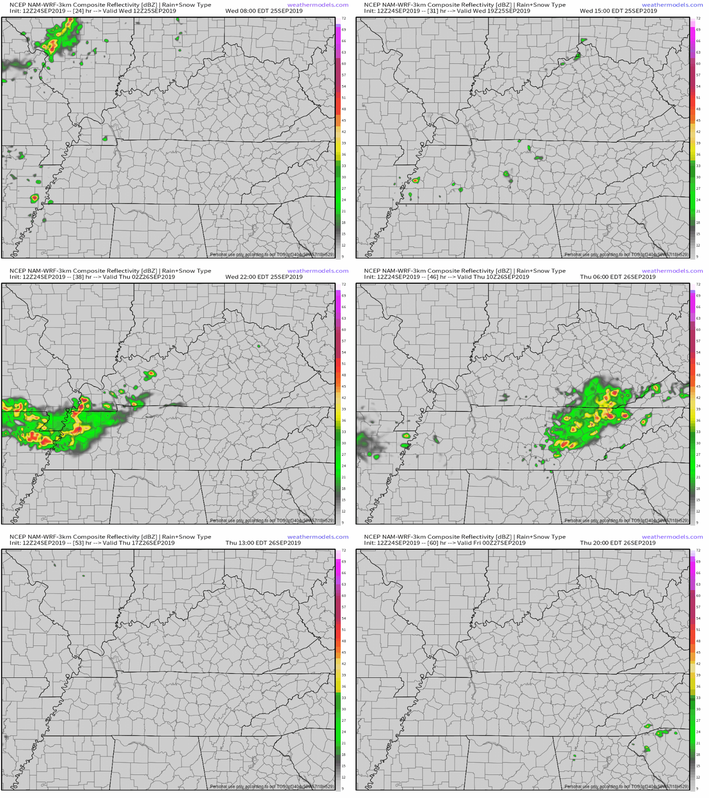
The NAM3 model shows a showers in late Wednesday afternoon and evening with the main rain event arriving overnight into Thursday morning:
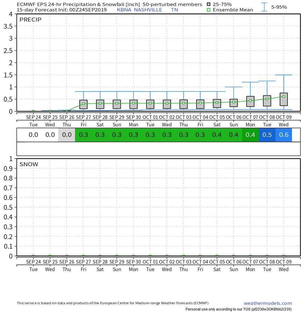
The Euro model thinks this is not a Wednesday thing; instead, it’s a Thursday morning event. Around 0.3.”
If we got 0.3″, we’d avoid the driest September on record. Currently the Official BNA Rain Can has 0.02″ this month. The record is 0.13″ from 1903.
Temperatures will be a few degrees cooler Thursday with a high around 84. Dew points will be on the rise, however, and it will feel a touch stickier out there.
Heat and summersmite humidity return for the weekend as Fall is nowhere to be found.
A Bermuda high-pressure system will build into the Southeast US and switch us on to BROIL. Low/Mid-90°s temps with dew points in the low to mid-60s!

When is Fall coming? Ummmm, well, …..
Above normal temps dominate medium range Euro ensemble model runs, the latest one below:
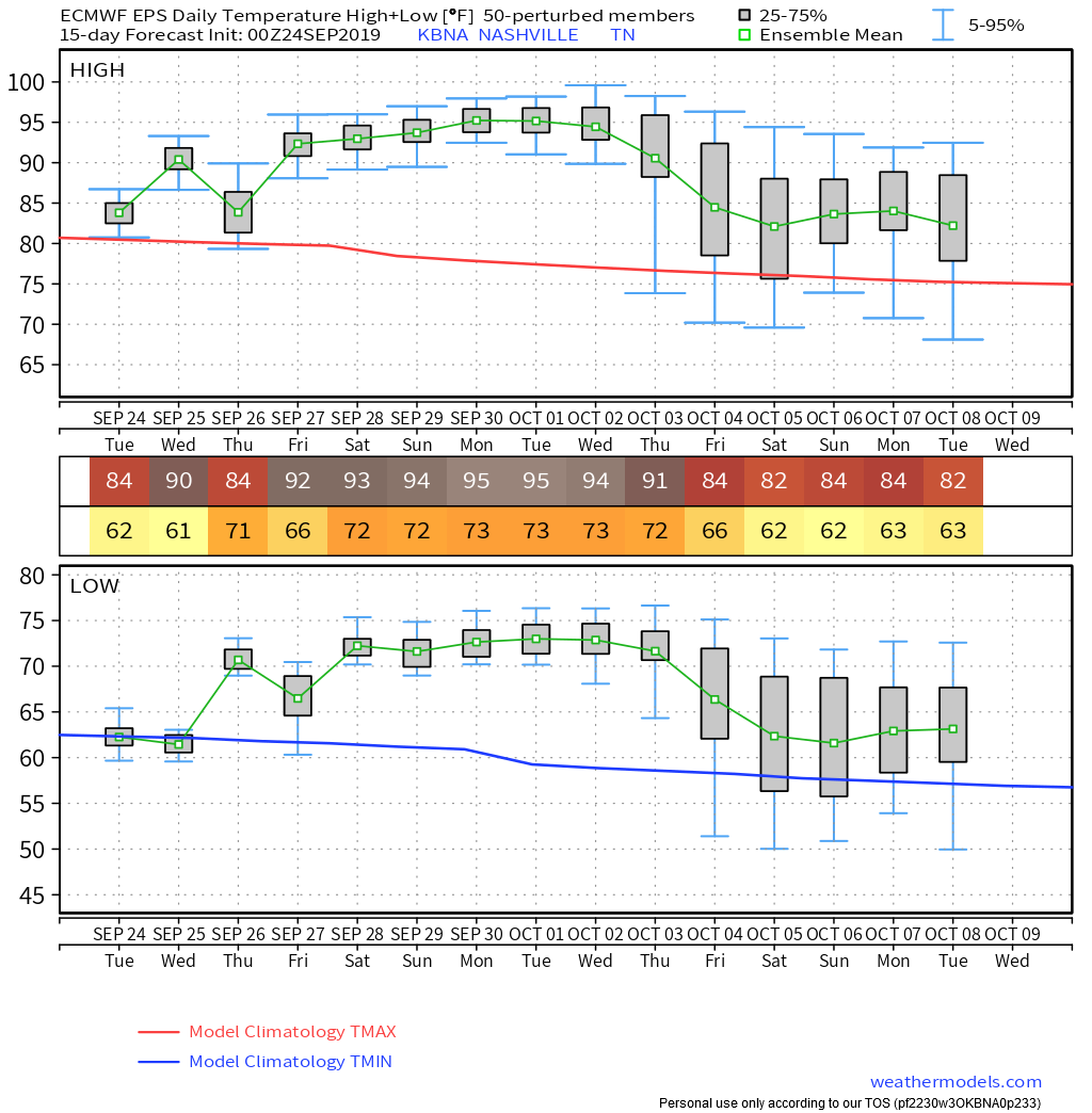
Still think we will challenge the second hottest September on record with those mid 90°s temps to round out September. If not we will easily make the top 5.
Usually when that hot and humid, pop up rain showers bubble up in the heat of the day. Instead, high pressure looks so strong that we may not get any additional appreciable rainfall. Total forecast rain now through October 9 per the Euro ensemble model is 0.6.”
Fall . . .

Categories: Forecast Blogs (Legacy)


You must be logged in to post a comment.