Tuesday
We’ve got a normal summer week ahead of us.
We’ll stay mostly dry today, partly cloudy. High temperature near 91°.
We can’t completely rule out an isolated shower or storm this afternoon. But rain is unlikely.

We’ve got a normal summer week ahead of us.
We’ll stay mostly dry today, partly cloudy. High temperature near 91°.
We can’t completely rule out an isolated shower or storm this afternoon. But rain is unlikely.

The week will start off much drier than what we saw this weekend.
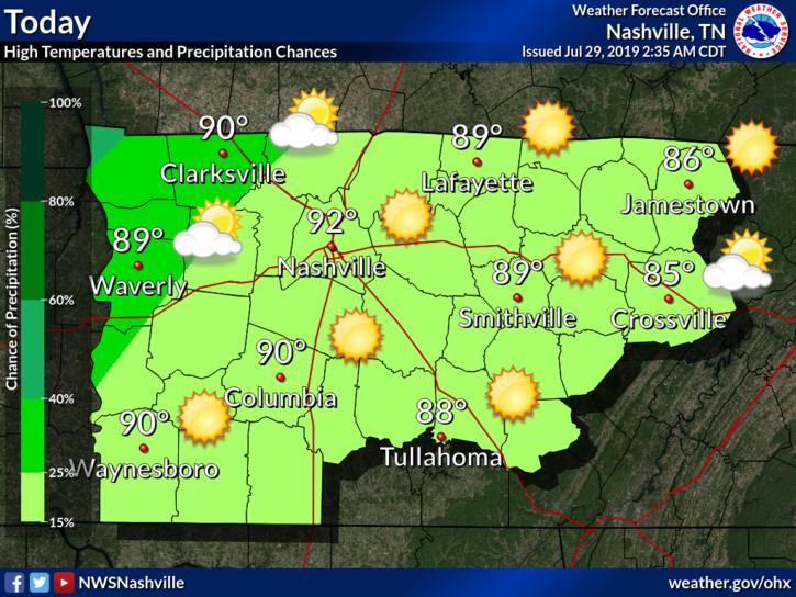
Typical summer-time heat and humidity continues. High temperatures will top out near 90 degrees Monday and 92 on Tuesday. Dew points will be in the mid and upper 60s which will make it feel a bit sticky out there this afternoon.
No specific reliable ETAs due to model uncertainty and storm setup. But we have an idea: around 1 PM to 5 PM.
Flexible plans recommended in case that changes. If you don’t think it may change, welcome to Nashville! You must be new.
Happy weekend everyone!
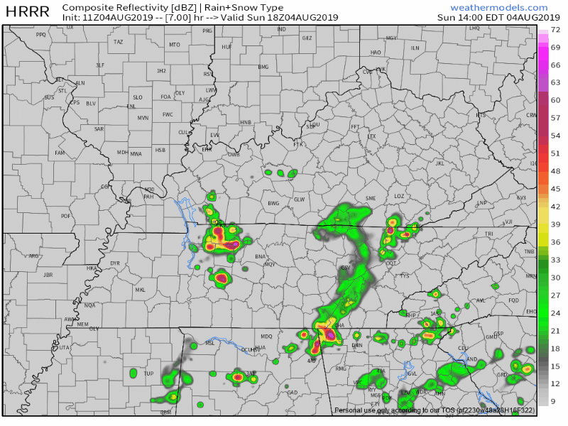
We start off our Saturday mostly sunny through the morning and early afternoon, until storms begin to develop, especially along/west of I-65. The latest HRRR model has these storms popping up sometime after 1PM:

Happy Friday!
Editor’s Note:
The end of our work week is going to be a wet one for some of us. Isolated to scattered pop-up storms will be possible this afternoon, mainly after 3PM. Not all of us will see rain, but a few of us could potentially see a couple downpours by the time the evening rolls around.

A pretty typical summer afternoon ahead for us today in Middle Tennessee. We’ll start off the first day of August with near normal temperatures, capping at 89° for the high, and of course, the humidity will play a factor in how it actually feels outside. Dewpoint values will be upper 60s as we progress into the afternoon.
Most of the rain will push east today, though we could still see some scattered showers.
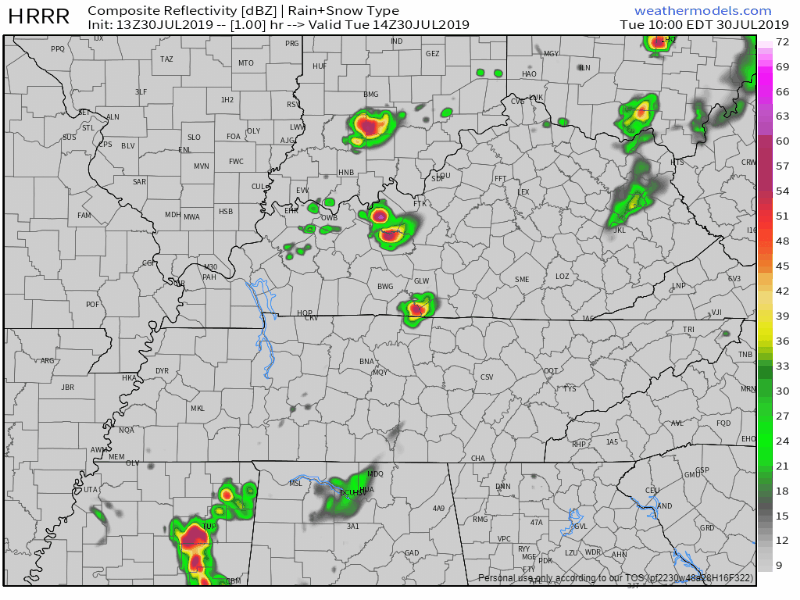
Here’s the HRRR model:
It’s hard to say when and where these will exactly pop up, and not everyone will be caught underneath one. We shouldn’t have any rain-outs, frog stranglers, or severe weather.
A weak cold front is coming in from the west. It may spark a few showers and storms. Rainfall totals won’t be much. It’s possible you won’t get any rain at all.
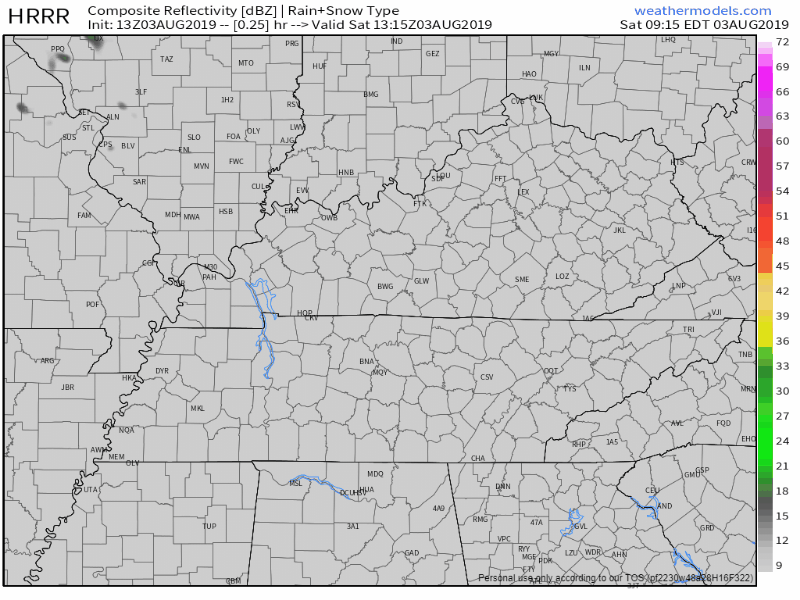
The latest HRRR model has showers developing 2 PM – 4 PM, but not everyone gets one:
Typical late July.
Low 90°s high, with clouds building into the night.
A few late night showers may be included in the clouds moving in.
Why? A weak cold front is heading our way.
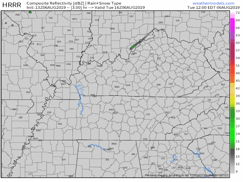
Rain chances will increase as we move into Tuesday.
Scattered showers are possible across the region today.
Here’s the HRRR model:
The best timing for these pop-ups will be the afternoon and early evening hours.
It’s hard to say exactly where these will form, so keep an umbrella on hand just in case.
You must be logged in to post a comment.