Clouds are beginning to move in this morning.
High temps will be near 53° today.
It should be dry throughout much of the afternoon, but can’t rule out some stray showers popping up ahead of the main rain event.

Clouds are beginning to move in this morning.
High temps will be near 53° today.
It should be dry throughout much of the afternoon, but can’t rule out some stray showers popping up ahead of the main rain event.

Clear and cold today, but those temperatures will warm up out of the 20’s fairly well for a high of 49.
The sunshine will help keep you warmer today as well!
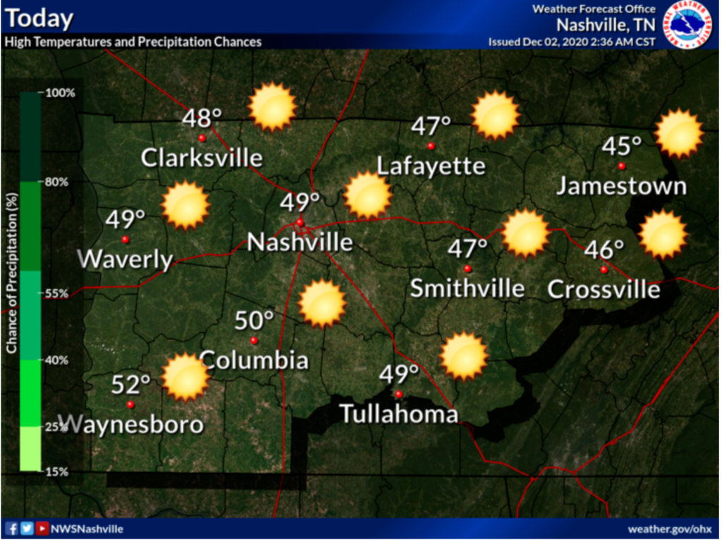
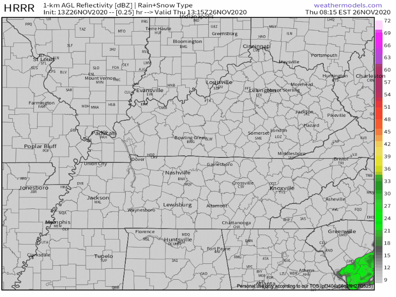
Thursday morning and early afternoon will be rain-free, but mostly cloudy.

Local CoCoRahs observers needed a 1 inch long ruler to log November 30 snow totals:
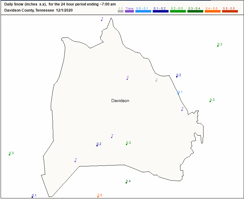
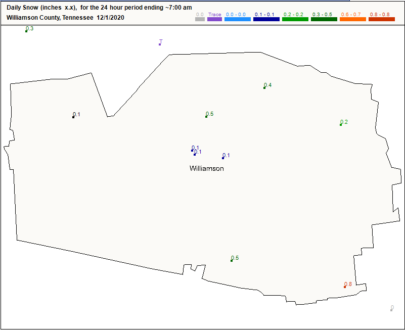
Got flocked.
November 30, 2020
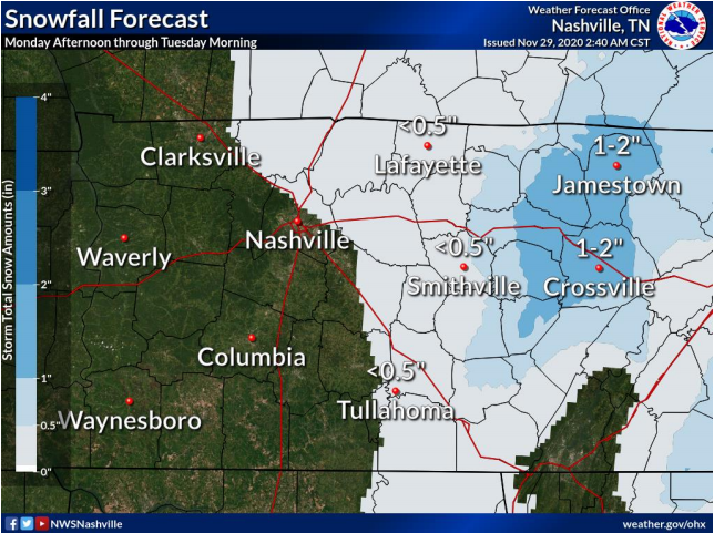
The Middle Tennessee snow winner was:
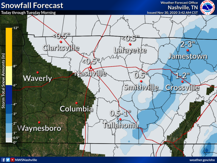
Jamestown and surrounding communities (Fentress Co) were the winners yesterday with 3-4 inches of snow.

Don’t expect this to be you today. Looks like maybe a dusting today. No major travel impacts expected here, but as always this will be watched. A few degrees here or there will make the difference between splat:melt and a dusting.
Rain will continue off and on tonight and overnight.
Forecast rain totals increased slightly from this morning. 1.00″ on average, but local rain gauges will vary. More rain is likely southeast (Nolensville, Antioch, College Grove, Franklin). Less rain is likely northwest (Bellevue, Bordeaux, Joelton, Fairview).
Our quiet November is about to change.
Daylight hours Sunday should be dry. Rain expected around sunset or shortly thereafter.
Euro Model shows a 6PM start time.
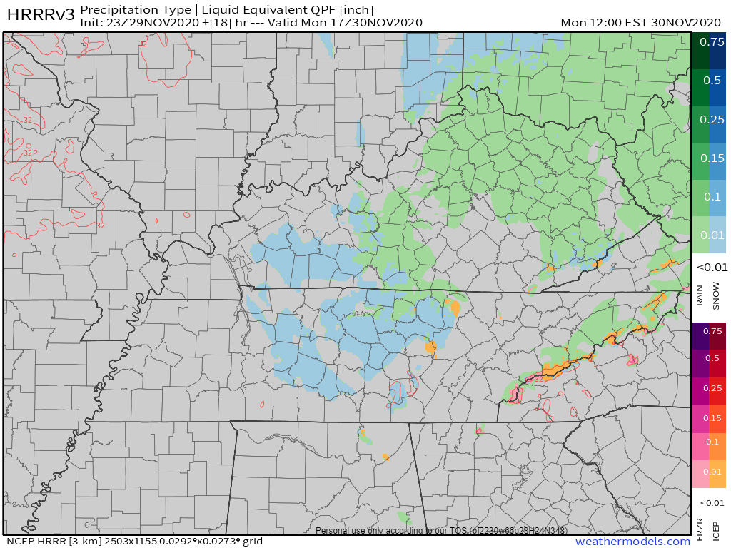
This is a soaker. NWS-Nashville lists 0.75″ but that’s an average. Data suggests more rain southeast (Nolensville, Antioch, College Grove, Franklin) and less rain northwest (Bellevue, Bordeaux, Joelton, Fairview), but that line could shift a bit here or there and give everyone 1.0″ or 0.5″ or less. Some may see more than 1″. We’d rather see less rain to limit the potential for black ice Monday night into Tuesday morning. Here’s the HRRR model total rainfall:

A lot of weather to unpack over the next few days!
Clouds are hanging around this morning, but will be moving out by this afternoon, leaving plenty of sunshine.
High temps will reach around 55°.
We could begin to see some rain by 6 pm Sunday. It will stick around into Monday, a bulk of the rain exiting by noon.
Another beautiful day is in the books for us today! High temperatures will hover in the low 60’s and rain should stay well to our south. Clouds will clear up for plenty of sunshine!

On Sunday, a low pressure system will take shape to our southwest. This will bring us lots of rain Sunday night into Monday.

Enjoy the weather while it lasts this week. Temperatures today expected to top out around 60°. Partly cloudy skies will prevail this afternoon, so any outdoor plans you have today won’t be affected by the weather.

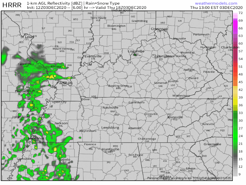
As of 1:00 pm, a cold front is moving east through west TN. The widespread clouds we’ve seen so far today are also moving east, leaving us with what could be a partly sunny afternoon.
In some scenarios, this would destabilize the air above our heads enough to create damage-making severe weather. However, today, the general mood of computer models and forecasters is somewhat chill.
You must be logged in to post a comment.