Tornado probability remains 2% Friday morning. Meaning, two percent chance of a tornado happening within 25 miles of you. That’s from the Storm Prediction Center.
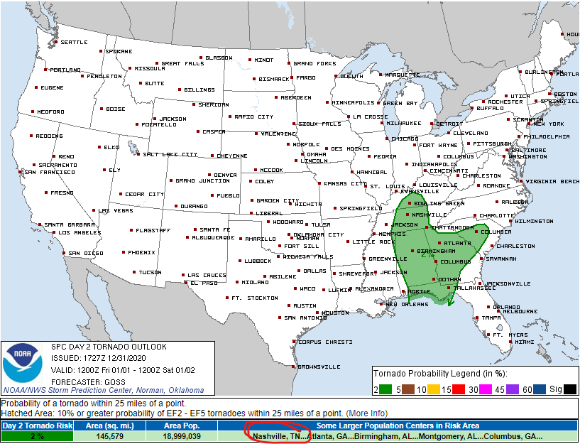
Damaging thunderstorm wind probability remains at 5%.

Tornado probability remains 2% Friday morning. Meaning, two percent chance of a tornado happening within 25 miles of you. That’s from the Storm Prediction Center.
Damaging thunderstorm wind probability remains at 5%.

I know most of us are pretty excited to watch 2020 go and move into the New Year of 2021!
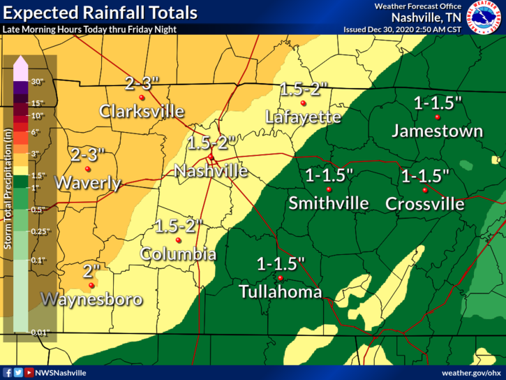
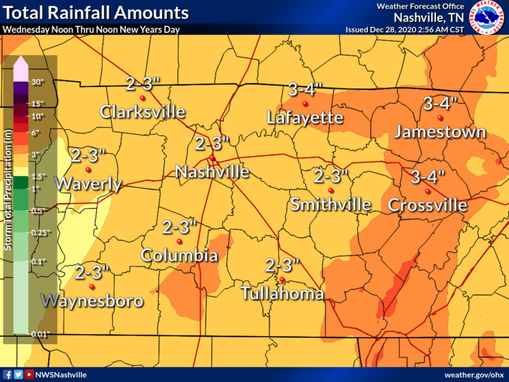
The weather, unfortunately, remains gross – rain, rain, and more rain.
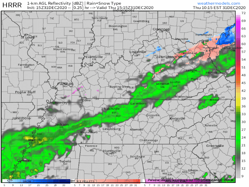
HRRR model indicates some light rain/drizzle on and off until early afternoon hours. We’ll see a break in the rain from mid-afternoon until early this evening.
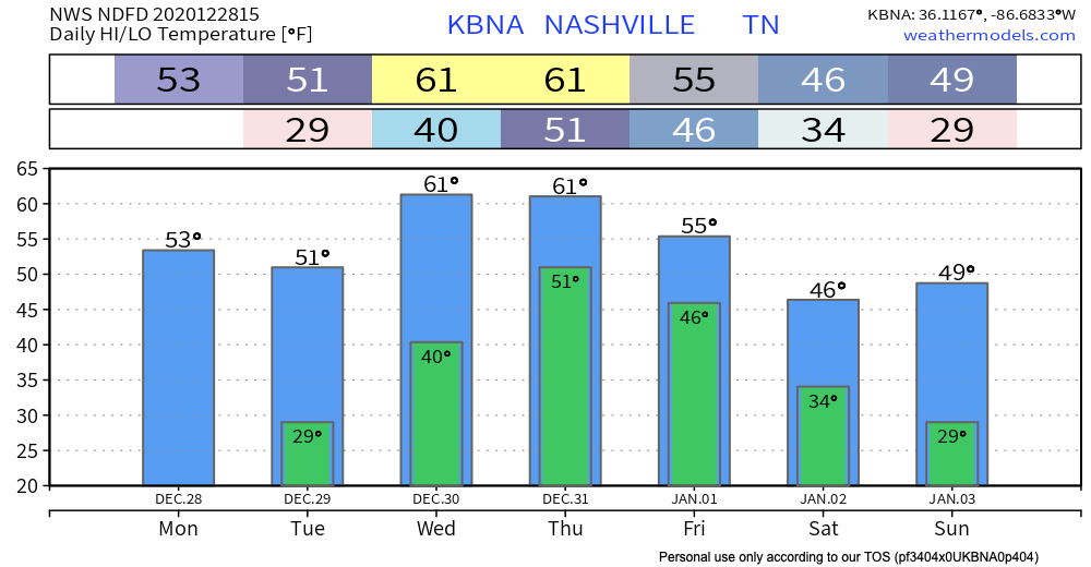
The morning weather balloon showed winds just off the surface at 50 knots. Some of that wind will find its way to the surface by mid day. Expect gusts to 33 MPH around noon, slackening off tonight. Morning temperatures in the 50’s will reach 65° this afternoon. That’s about 20° above climatological normal.
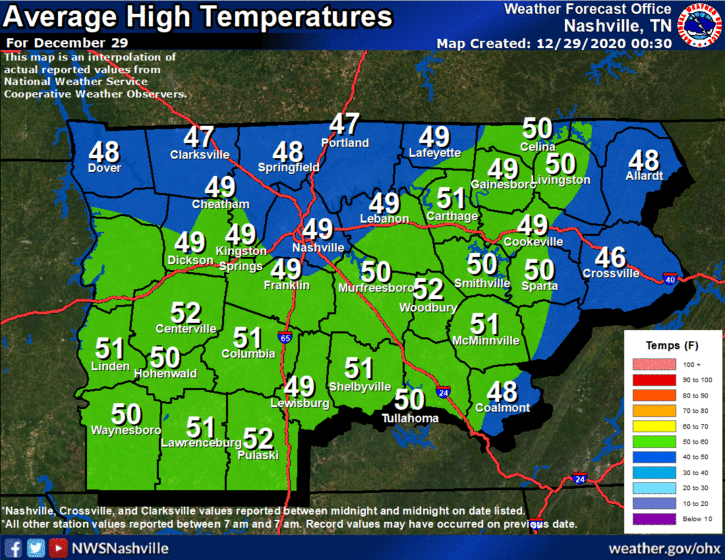
Beautiful today, high reaching 50º. This is near climatological norms:
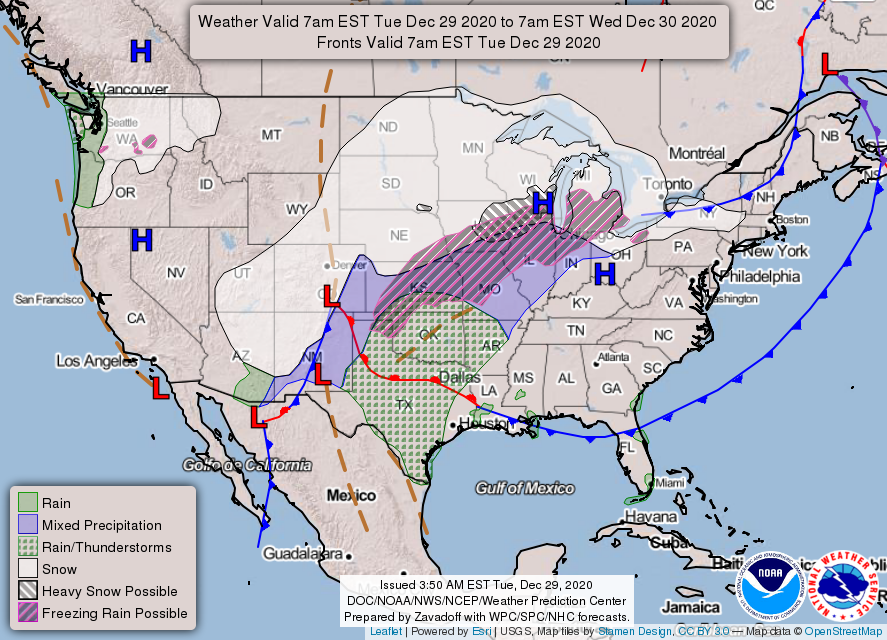
A surface high pressure is just to our north, which will fend off rain for one more day. Tomorrow’s a different story, though. All that “stuff” to our west on the map below will move towards Middle Tennessee.
Clouds and sun next couple of days. Unseasonably warm for winter.
Heavy rain will spill out of a robust weather system that’ll pass to our west Wednesday and Thursday. Northwest of the low (the big red L below), snow. We’ll be southeast of the low, so rain.
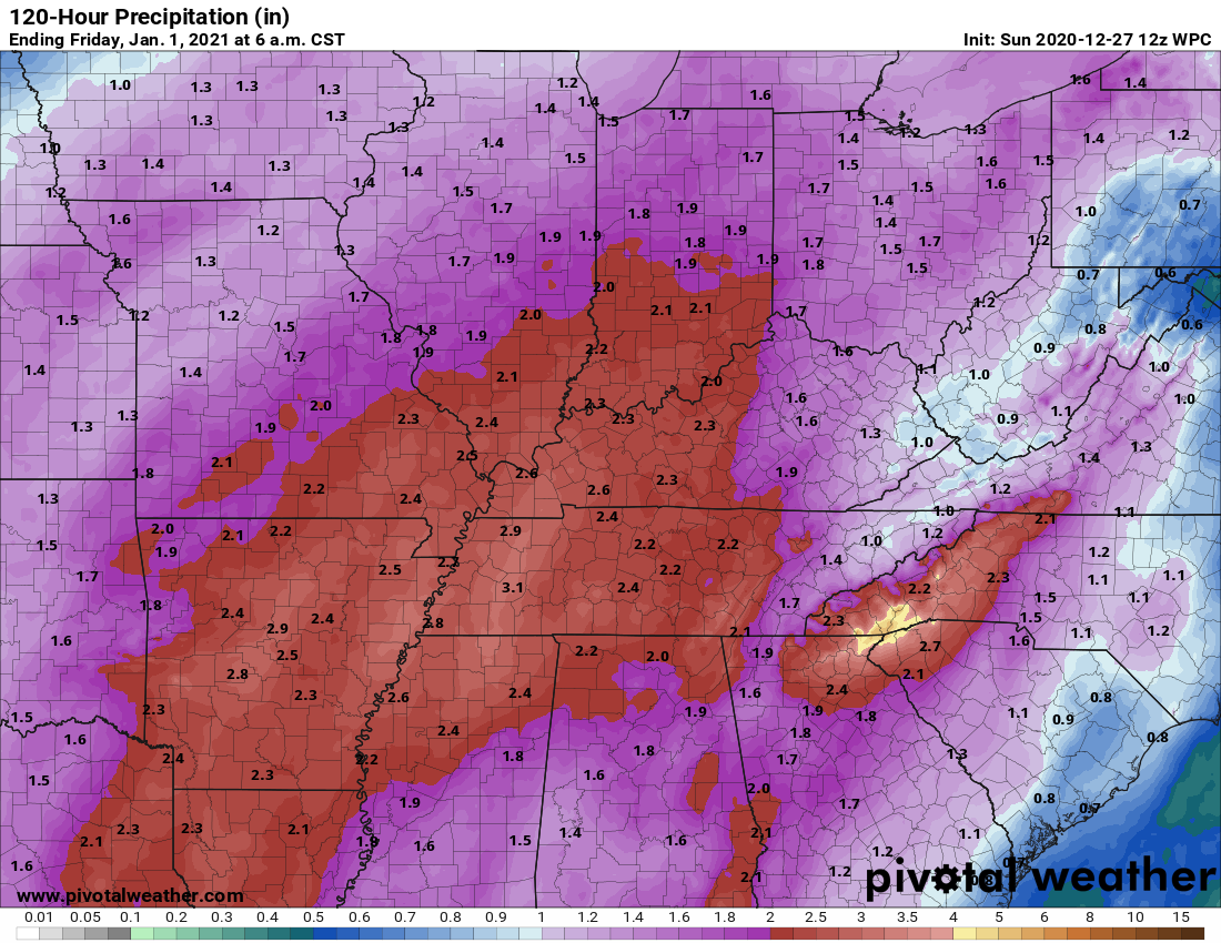
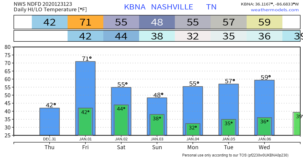
2020 began with heavy rain. 2020 will end with heavy rain.
First, a minor event tonight.
Light rain tonight, ETA a few hours before midnight. Not a heavy event (that’s Thursday). Tonight’s rain will be off and on, scattered, and should end around sunrise Monday. Was hardly worth mentioning but here it is. HRRR model below.
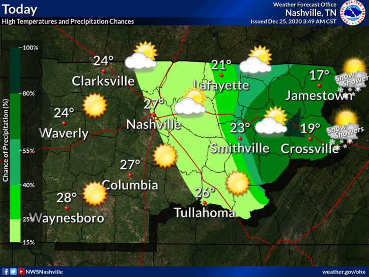
It was definitely a chilly morning when some of you woke up:
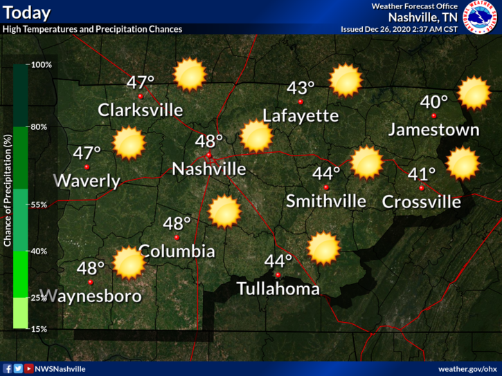
We have sunny skies and temps warming up through the afternoon, highs around 48°.
Clear conditions continue overnight, lows near 31°.
Sunshine will continue to stick around, which helps temperatures to continue to rise.
Christmas Day 2019 we touched 70°.
Christmas Day 2020…
Currently 20° with a wind chill of 7°. Remember to look after those furry friends, check in on the elderly/those without heat, and the pipes.
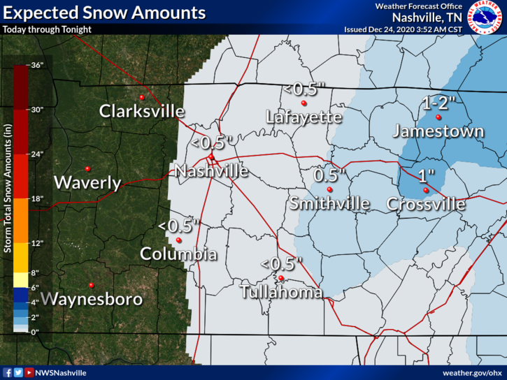
What’s on everybody’s mind, perhaps more than what’s under the Christmas tree.
Model soundings for this afternoon show a very shallow layer of moisture. There is enough lift in the atmosphere to squeeze out a few flakes for us. Our best chances of seeing the white stuff will be after about 3pm.
Oh, no, Sir. Festivus is all too real.
George Costanza
37 MPH was the top reported hourly BNA wind gust as of 6 PM. Gusts 40-45 MPH are possible until midnight. A Wind Advisory remains in effect until then. Winds will blow from the south.
You must be logged in to post a comment.