

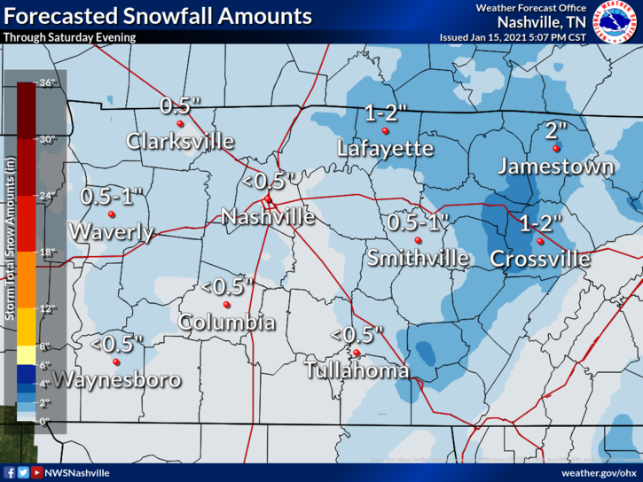
Happy Sunday!
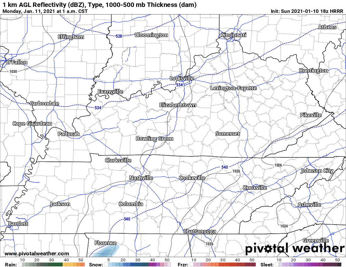
A quick blast of snow is possible around midnight. HRRR model below:
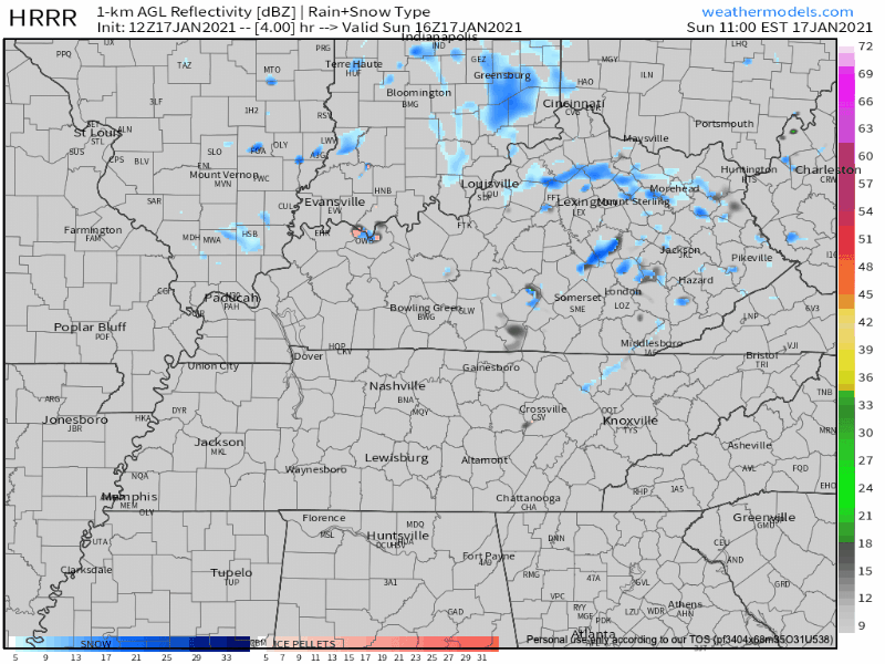
HRRR Model from 11am today-4am Monday This event shouldn’t threaten your Monday morning travels or inconvenience you in any other way.
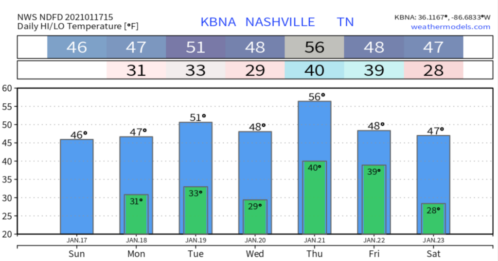
The forecast for the rest of the week is a confusing mess.

Forecast is of low confidence as models continue to be all over the place as they struggle with the upcoming fast, split flow upper level pattern.
You must be logged in to post a comment.