Rain will not ruin the family wiffleball game.
Editor’s Note: family wiffleball games?
Plan on clear skies and dry conditions for the coming days. HRRR is showing little to no cloud coverage for the day.

Rain will not ruin the family wiffleball game.
Editor’s Note: family wiffleball games?
Plan on clear skies and dry conditions for the coming days. HRRR is showing little to no cloud coverage for the day.
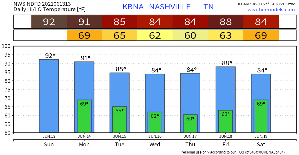
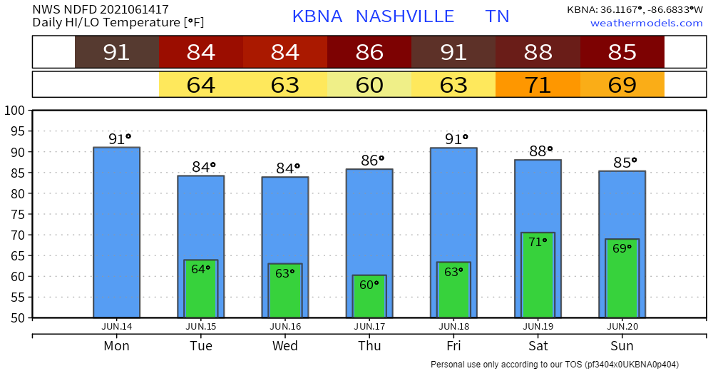
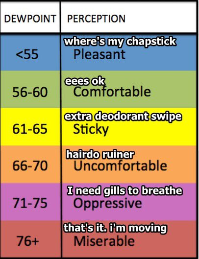
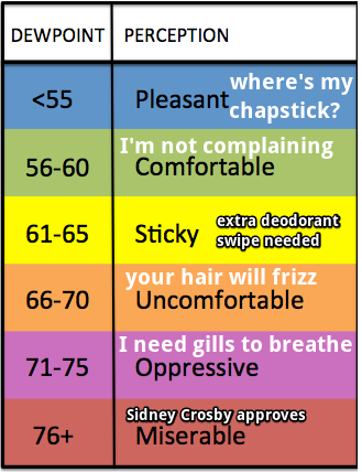
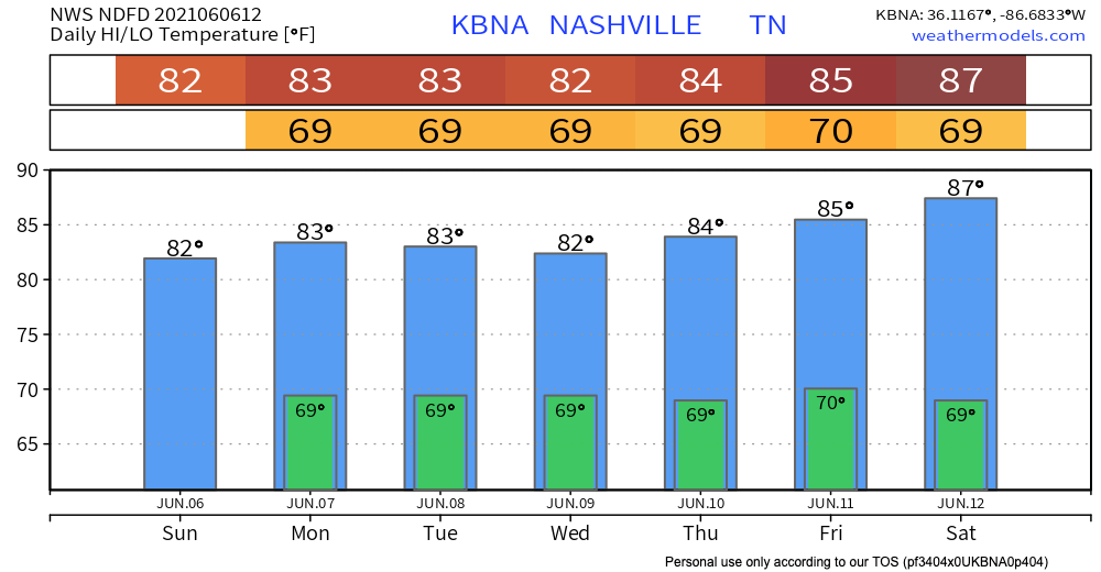
Temps up into the 90s this afternoon. Heat index is expected 99 degrees. Dewps in the low to mid 70s are oppressive according to the scale below.
Most of the morning and afternoon will be free of rain. If you’re thinking it’s about time, don’t get too ahead of yourself. Scattered thunderstorms are STILL a possibility with a cold front passing through the area late this afternoon.
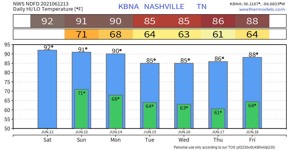
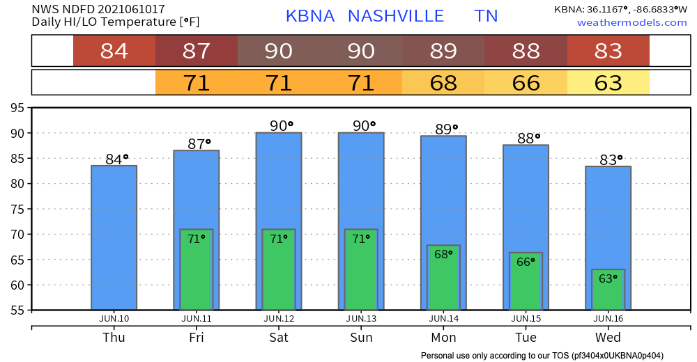
Low 90s temps in the shade this afternoon and Sunday afternoon.
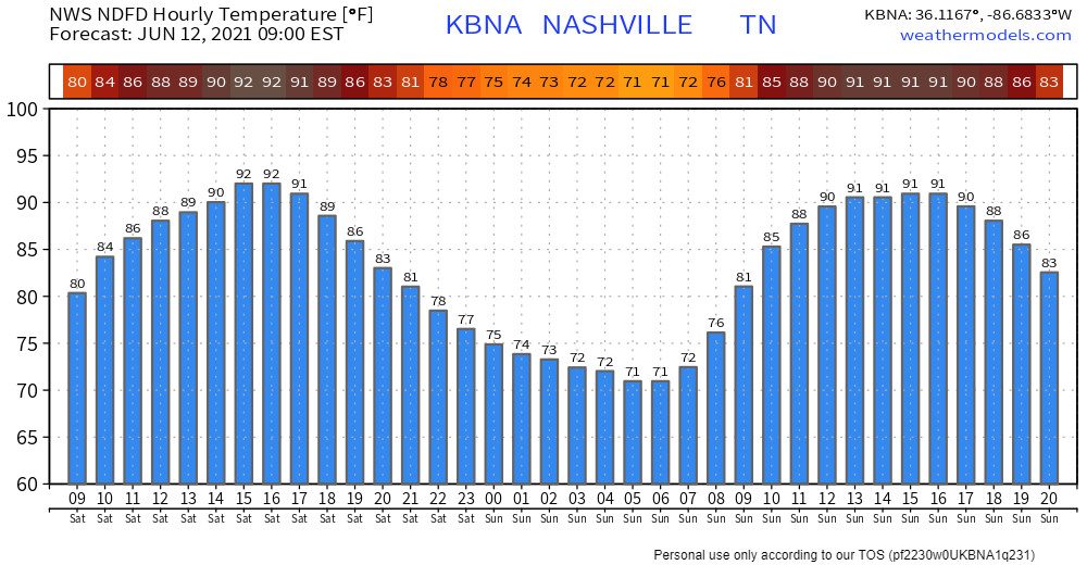
Low 70s dewpoints this weekend. Heat index up to 99.
Remember, temps and that highly suss number called the heat index (anti heat index rant deleted for brevity) are for in the shade. Official high temps are always taken in the shade. If you’re out in direct sunlight, it’ll be worse, obviously.

The low pressure trough is finally leaving our area, and starting to take the rain with it. Key word “starting.”
The HRRR shows scattered storms mostly in the afternoon and evening, but they look significantly more scattered than in previous days. This means there should be some gaps in the rain, if you wanted to run some errands or go for an actual run. You’re probably sick of hearing this by now, but precise timing of when it will and will not be raining is hard to say.
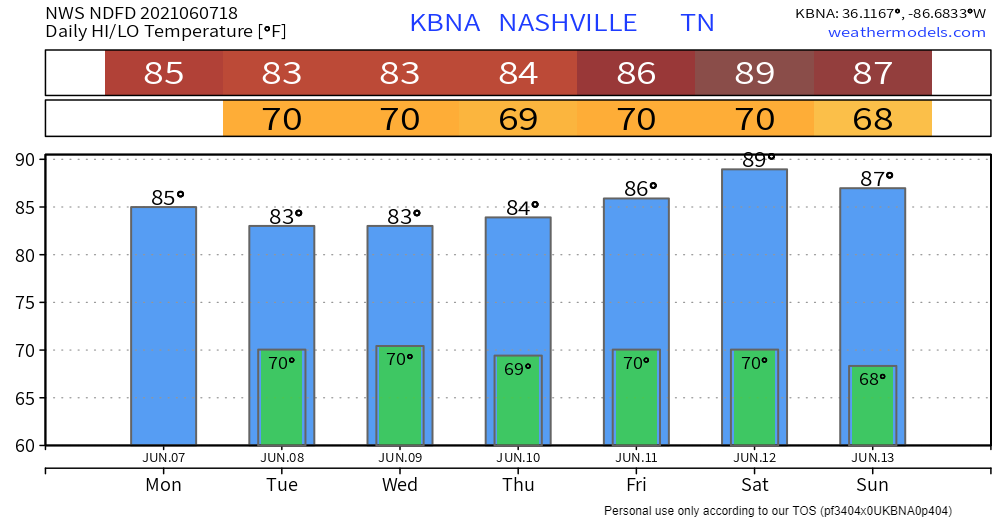
Low pressure will hang around two more days, causing a “will it or won’t it” downpour risk. Today should look like the past few days – scattered showers and storms — some dry, others getting a show. NWS doesn’t expect anything too intense out of these storms, other than some heavy rain and wind, maybe lightning.
You can keep thanking the annoying upper-level low for your recent weather woes. We want it to go away, too.

We also wish there were clearly defined start/stop times. We have things to do, too.
But the weather is trolling schedules and plans
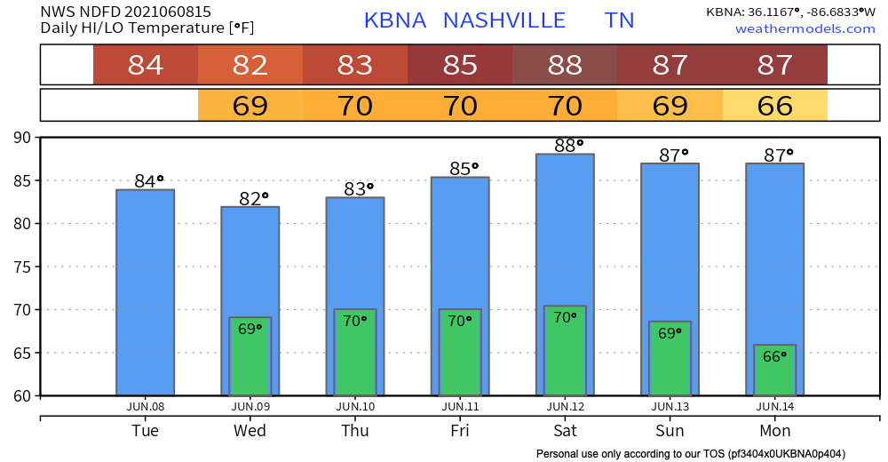
Low pressure over Arkansas is bringing us rain for the next couple days.
HRRR shows a line of showers moving in this afternoon after lunch. As instability builds, the rain blob will break apart into scattered showers and off and on thunderstorms. Lightning possible. Timing is difficult for any one location. These models run hourly, each run has a different idea.
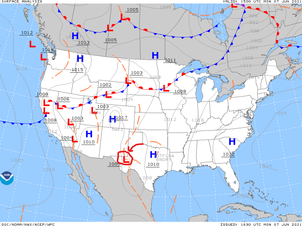
Blame an upper level low spinning over Texas for wretched humidity and “will it, or won’t it, on and off rain and storms” this week. We can’t reliably time out whether or when it’ll rain because no frontal boundaries will be there to initiate storm-o-genesis. The result: difficult outdoor planning. Disorganized “may contain lightning” storms may be streaking by.
There is plenty of moisture in the atmosphere for rain and storms today.
HRRR thinks the rain will slowly make its way up from the south over the course of the day. It also shows some pop-up thunderstorms in the afternoon. No real severe threat.

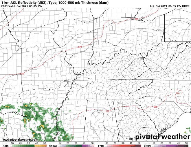
The HRRR (above) shows rain to the southwest moving northeast. It begins to dissipate when headed our way. We can’t trust the model to be 100% actuate so prepare for possible pop-up showers in the afternoon and evening.
You must be logged in to post a comment.