
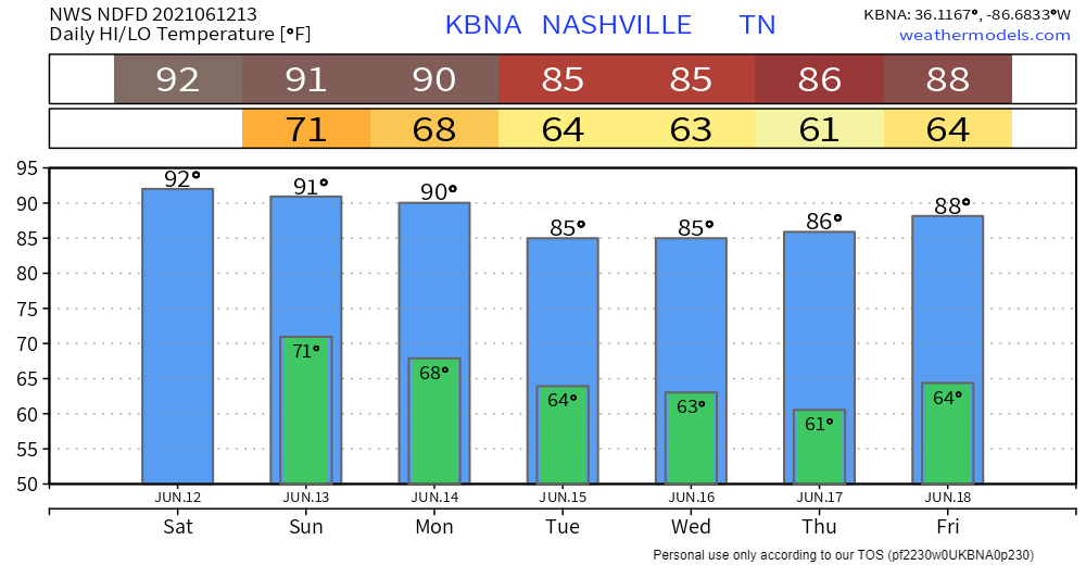
Low 90s temps in the shade this afternoon and Sunday afternoon.
Low 70s dewpoints this weekend. Heat index up to 99.
Remember, temps and that highly suss number called the heat index (anti heat index rant deleted for brevity) are for in the shade. Official high temps are always taken in the shade. If you’re out in direct sunlight, it’ll be worse, obviously.
A cautionary tale:
I once ignored a humid burner like this. Ran around like an idiot. Not enough water, rest, or shade. Ended up vomiting on a friend’s driveway and drinking baby Gatorade after half napping it out the rest of the day. No. Alcohol. Was. Involved. In. The. Making. Of. That. Heat. Exhaustion. Episode.
Fog in the usual spots late tonight into Sunday morning.
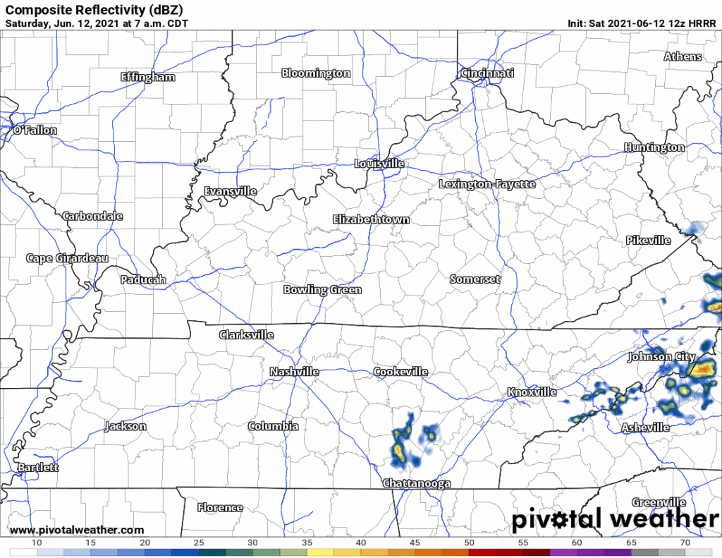
We need to dodge a few storms this weekend. Storms can form two ways on us, 1 — pop up on us or 2 — develop to our north and come streaking south. Below the HRRR has storms over the mountains in East Tennessee this morning then a few thunderstorms develop early evening, mostly west of I-65. There aren’t many of them but that won’t matter if, you know, you get one.
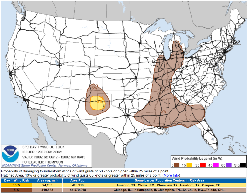
We’re excluded from the SPC damaging wind outlook (below). Rain and lightning the only legit hazards for us.
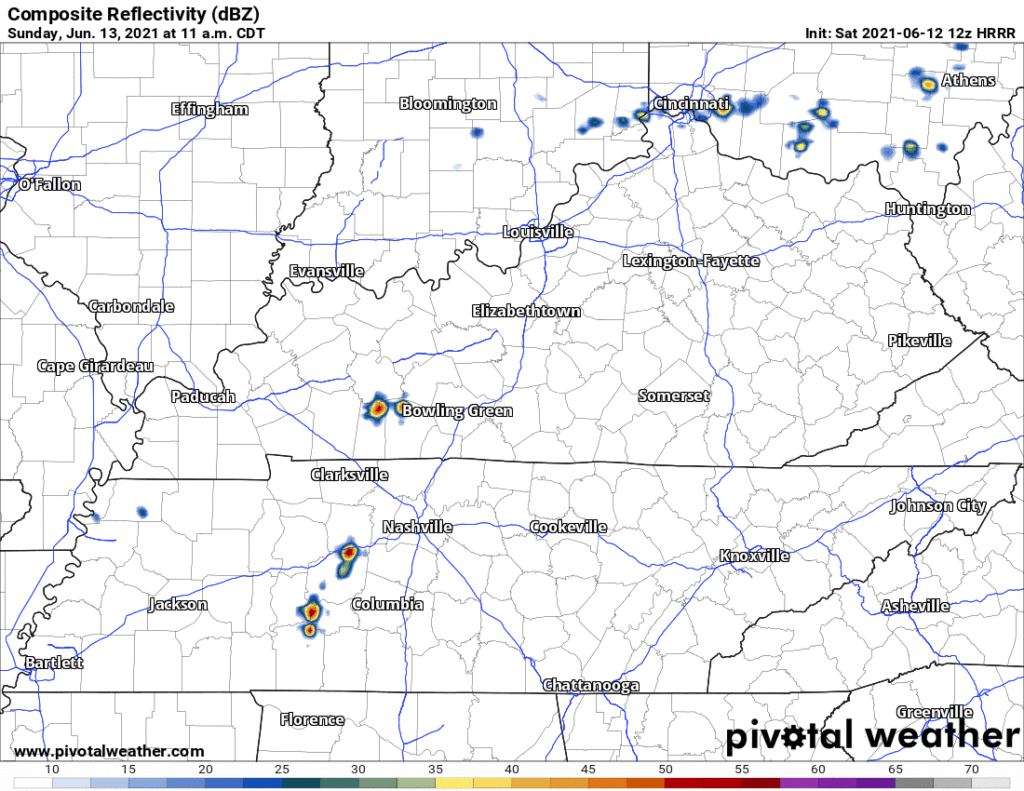
Bit different Sunday. HRRR thinks storms mid/late afternoon:
No widespread severe risk Sunday. SPC excludes us from tornado, damaging straight line wind, and hail outlooks. Expect heavy rain and lightning instead. Check back tonight for updates on storm timing and severity. These storms may end up with a straight line wind threat.
Rainfall is another story. NWS-Nashville has 0.15″ total for the weekend, but that’s an average amount. Total rainfall in this HRRR run (below) shows deep purples scattered around Davidson and Williamson Counties where 1.5″ would be possible.

This should not be a superbad rain event, but some of you reading may get an Areal Flood Advisory for minor localized flooding if you end up in a rare area that gets supersoakered. A flash flood is in the range of imaginable outcomes, but is the least likely thing that could happen. Most should see a little rain, others, maybe nothing.
Humidity drops slowly, but noticeably, through the day Monday. Lower dewpoints, lower temps, little/no chance for rain beginning Monday.

Categories: Forecast Blogs (Legacy)
You must be logged in to post a comment.