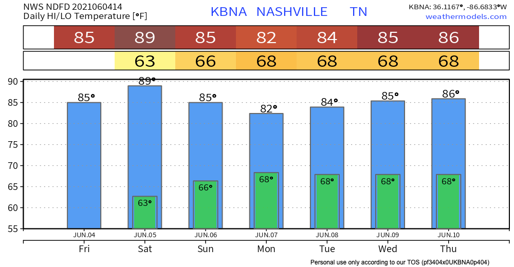
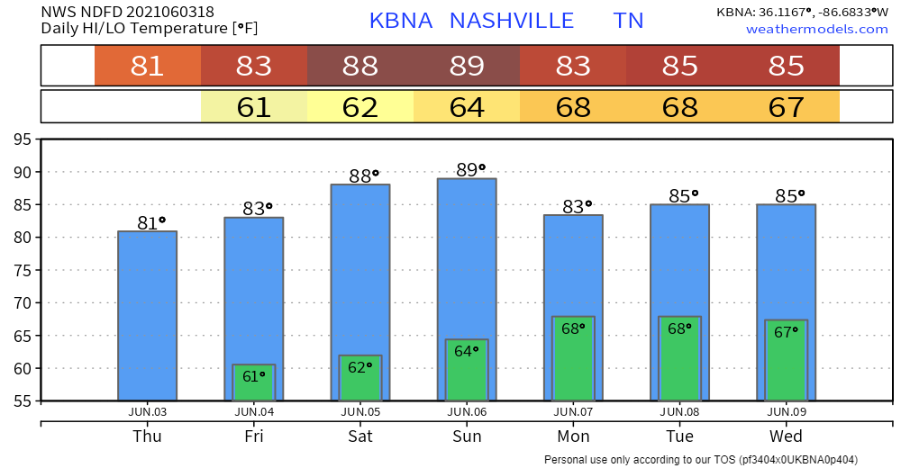
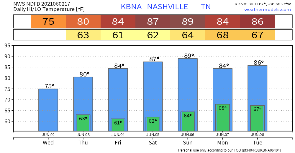
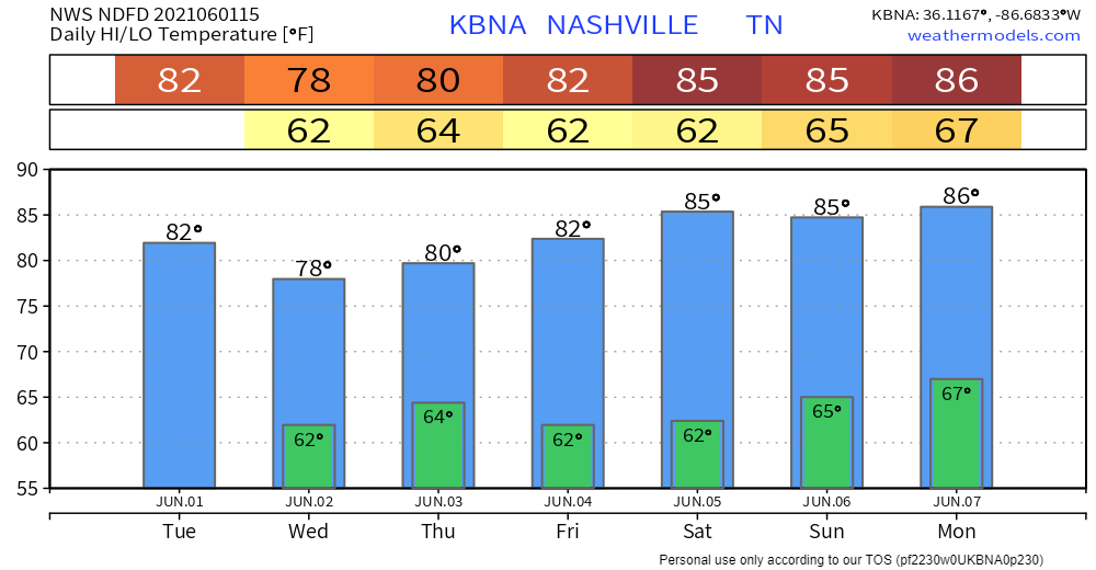
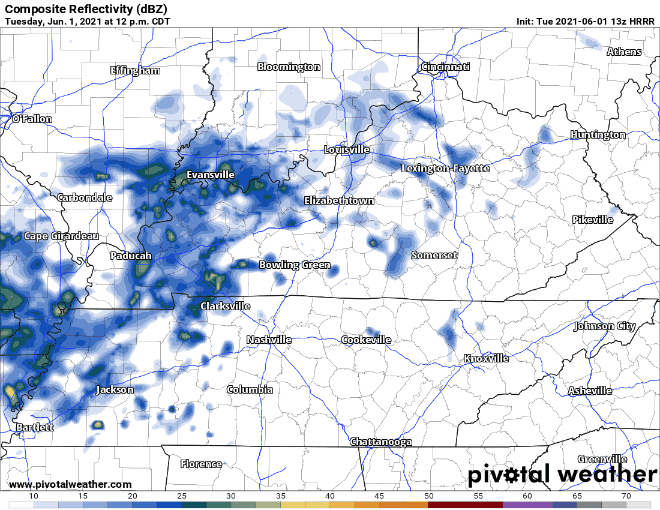
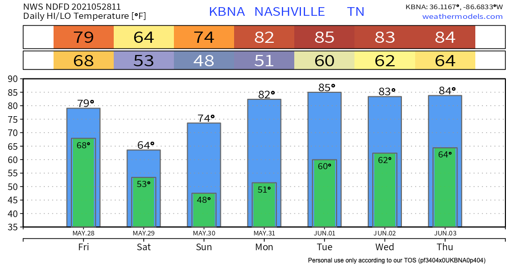
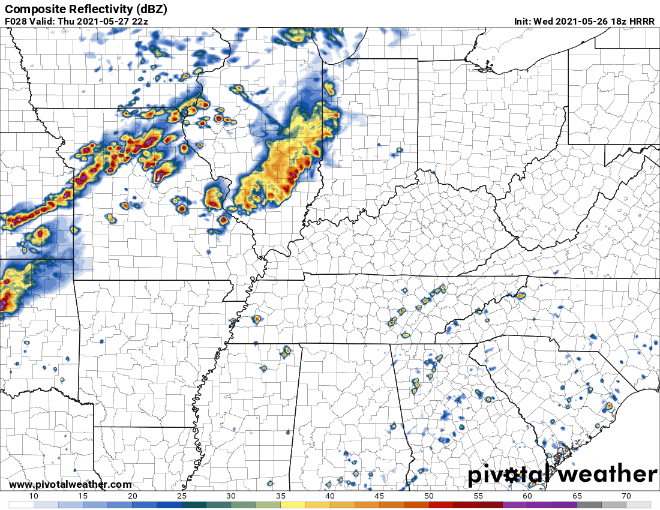
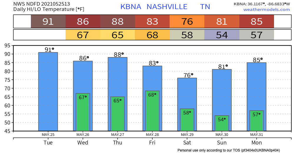
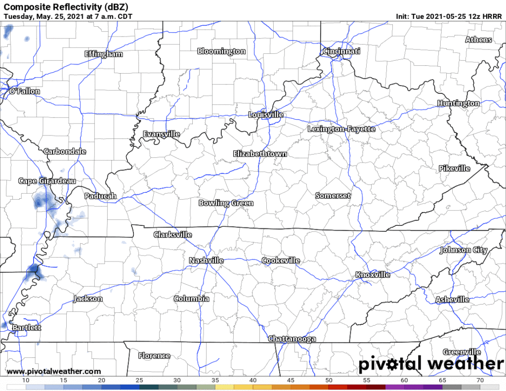
Embracing uncertainty is hard, y’all. The HRRR model was hot garbage last night. It timed the morning line well but completely missed on overnight rain. It thought there would be a lot of it, and there was none of it.
Most of Will Co is under a Flash Flood Warning this morning.
Another 1″ to 2″ is expected as rain “trains” over the area. Training rain is like a train, it runs over the same tracks. Those in the Flash Flood Warning box above are the tracks.
11 years ago today the 2010 Flood was showing itself. 1 year ago tomorrow, the derecho.
For the next two nights you’ll need to have your NOAA weather radio and Wake Me Up app (StormWatchPlus) ready. You’ll need them tonight and Monday night.
No rain today.
Rain Sunday. Not enough to cancel plans but if you’re outside all day you’ll get wet.
Light rain arrives around lunchtime/Nashville SC kickoff. Then more light rain later Sunday afternoon. See below HRRR model. Some models have it earlier, others later than that.

A nice and dry Friday in store to end the work week as high pressure builds in.
The cold front that passed through yesterday will make our temperatures a bit cooler today.

Same story in the forecast for Saturday. Sunny and dry conditions throughout the day, but temps will warm back up closer to the 80’s.
Steady, light rain has overspread the area
But, really, the HRRR thinks this rain is going to hang around for the evening with several rounds of showers and maybe a storm. HRRR through midnight…

More isolated showers/storms should develop around rush hour. These could be a bit stronger than what we have seen this morning.
Scattered showers are already popping up this morning. Expect this to continue throughout the day today.
The HRRR model shows most of the showers impacting Williamson/Davidson this morning and early this afternoon. The larger wave of rain this evening should miss us to the north.
I hope your air conditioning works.
Rain is possible Wednesday afternoon. The HRRR shows a few showers popping up, but most of them develop east of us. So chances are real, but low.

More rain may develop closer to midnight Wednesday night.

Check those temperatures out!

Editor’s Note: gross.
The Euro model shows a few showers around Wednesday afternoon, but that looks light and inconsequential.
A steadier, heavier rain is expected Thursday afternoon and/or evening. Exact timing remains unresolved, but this looks most likely to be a Thursday night thing.
Yes that’s 85° Tuesday. Smooth feet.
Not exactly sure when the next rain event will be but general idea is Thursday afternoon/evening.
GFS thinks showers hang out off to our northwest Wednesday and wait, wait, wait, before finally arriving Thursday afternoon.
You must be logged in to post a comment.