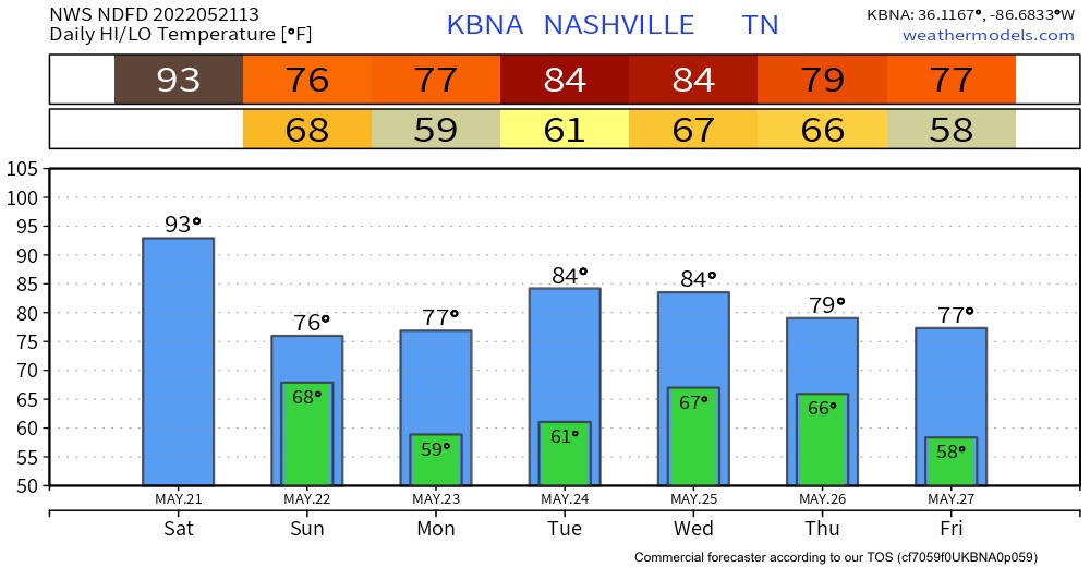
Today is going to be a muggy one. The high today is going to be 93. The record high was set back in 1941 with a high of 94 degrees. I don’t believe that we are going reach 94 today but there is still a chance.

Today is going to be a muggy one. The high today is going to be 93. The record high was set back in 1941 with a high of 94 degrees. I don’t believe that we are going reach 94 today but there is still a chance.
It’s going to be cooler today due to some clouds and a front that moved in last night. Today’s high will be around 65 and for the low, we will reach down to the upper 40s.
The HRRR shows no measurable rainfall, but expect drizzle to continue today.
No rain in the forecast at all this weekend. Just pure sunshine!!
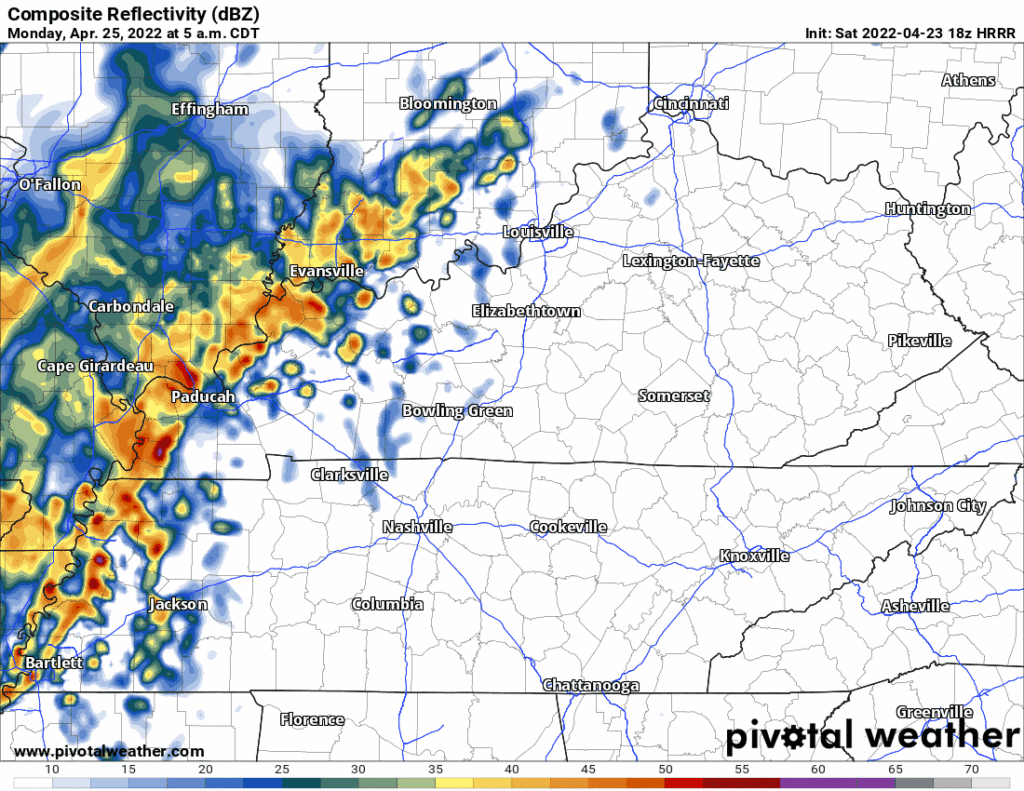
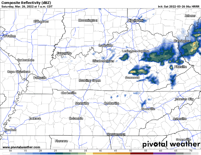
Rain should approach our area around lunchtime. The HRRR doesn’t think it’ll be much:
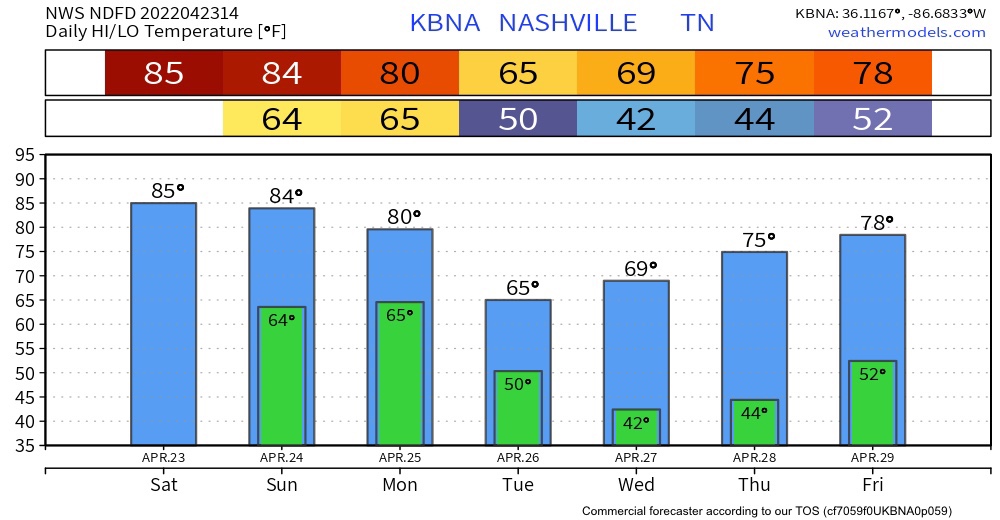
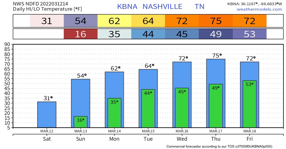
Rain is most likely during the afternoon and evening Monday. It’ll be off and on, ending some time late Monday night or early Tuesday morning. About 0.25″ to 0.35″ expected on average. A few storms may mix in Monday afternoon but that appears unlikely. Nothing severe, and no flooding concerns.
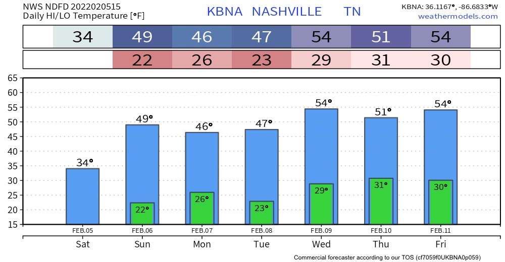
We are on the last day of the cool trend of last week. Todays temps will be in the mid 50s. Lows will be in the mid to low 40s. There was a frost advisory and it expired earlier this morning.
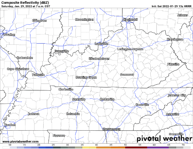
No rain expected today. It’s east of us. HRRR below:
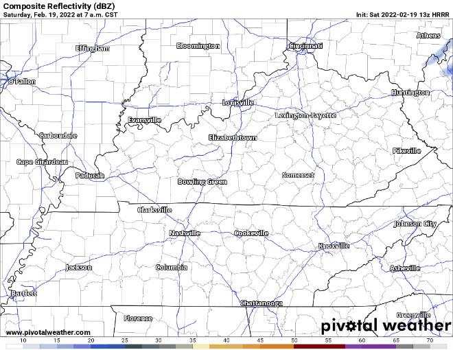
Beautiful weather today with a high near 60 and a low in the 30s. The HRRR shows no rain. That’s all off east.
It is going to be a bit windy out today with sustained winds 15-20 MPH and some gusts around 20-30 mph. The wind will relax tonight.
The temperatures reached the mid 60s yesterday, and here we are, literally the next day, with snow on the ground. Tennessee weather is weird.
Some of us woke up to 2-4 inches of snow on the ground, a few of us even 5-6 inches. (Accumulations are below). The low this morning was in the low 20s, burr. The high today will be in the lower 30’s, likely not getting above freezing. [Editor’s Note: The higher sun angle this time of year will really help melting, even with temps below freezing. But, watch out for black ice tonight as temps plummet and we lose the sun’s energy.]
Nothing crazy happening today . Temperatures will reach the mid to upper 40’s. The HRRR is rain free.
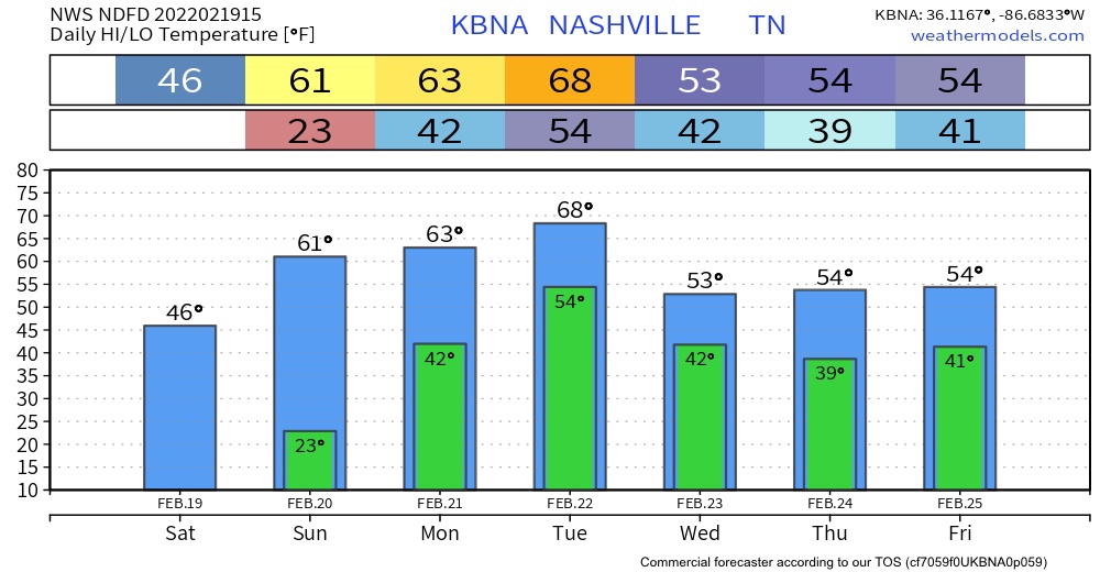
Uh oh! Sixties Sunday, Monday, and Tuesday in February. Something’s up.
It will be rain central next week. Not fun at all. There is the threat of flooding.
Nothing really exciting happening today weather wise but it is National Weather Person’s Day!
The high today is a whopping 35° (sarcasm).
Tommorow will be sunny and warmer than today.
We warm up this week.
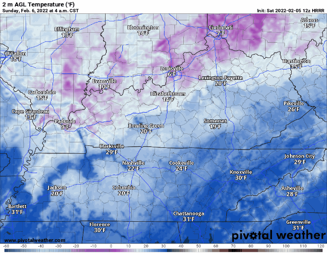
No rain today! Enjoy the sun but don’t let it deceive you because it is cold. The HRRR is not showing any showers today. The high will be around the mid 30’s, lows in the mid 20’s. The wind chill may effect the temperature feeling.
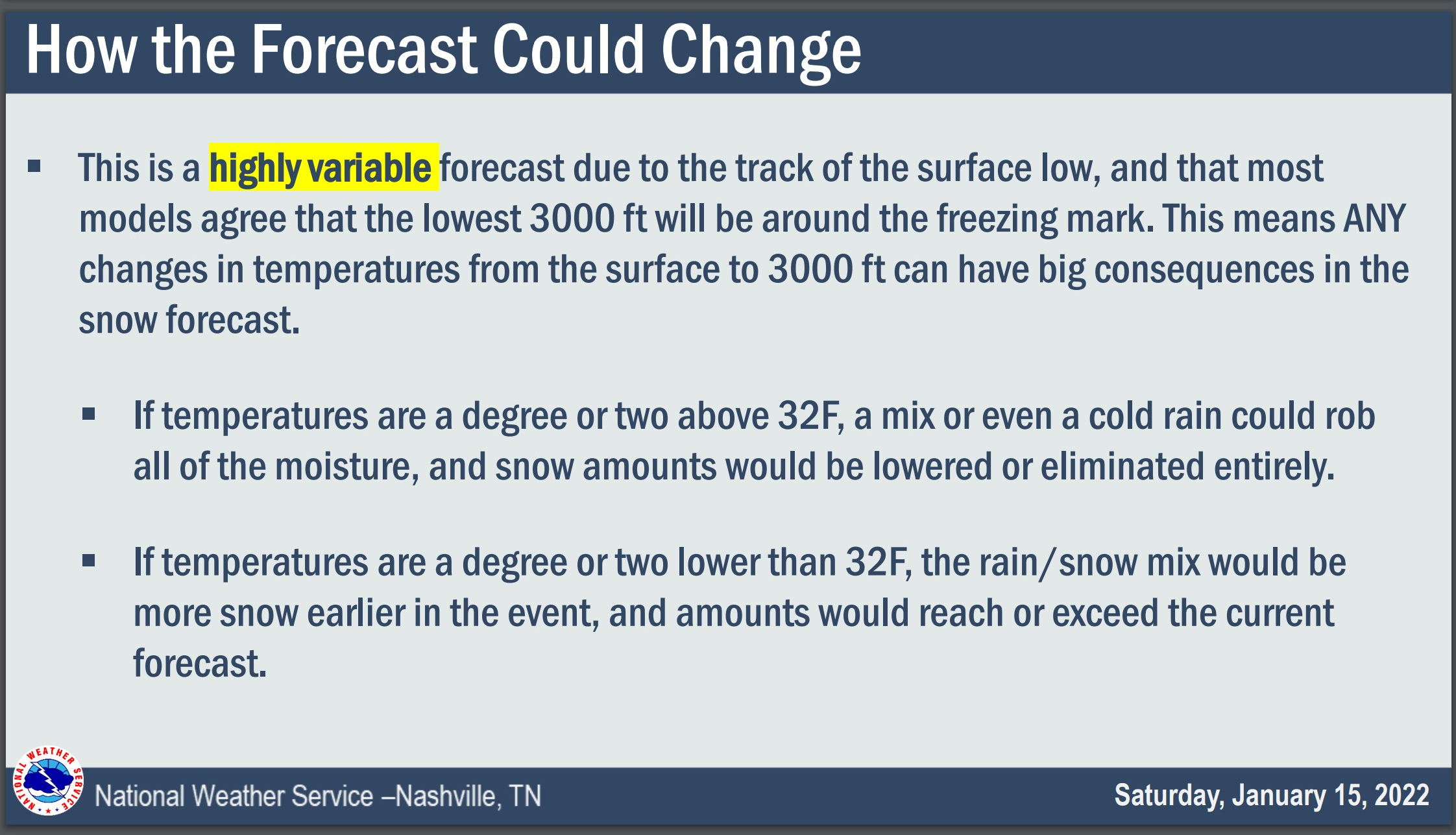
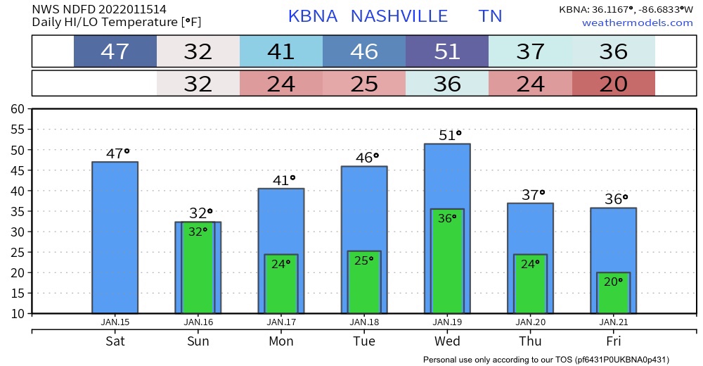
The Winter Storm Watch begins for all of Middle Tennessee tonight at 6 PM and ends Sunday at 6 PM.
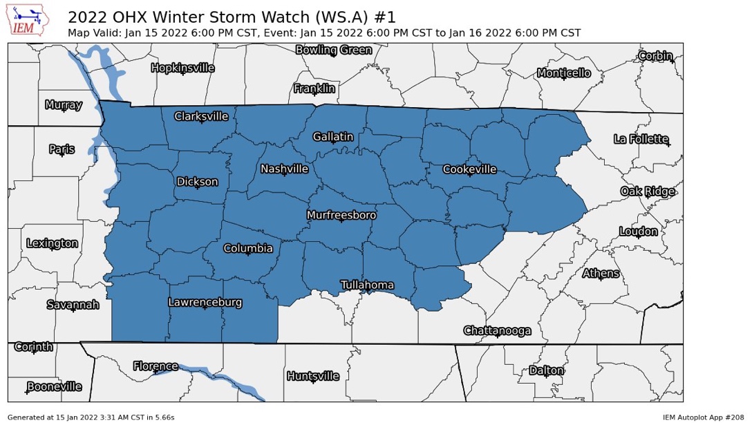
Looks like rain today will pause for a few hours then resume tonight. Overnight into early Sunday morning it should changeover to a wintry mix, then snow. The snow will be a wet, heavy snow. Somewhere in Middle Tennessee it could lay down snowfall rates around 1″ to 2” an hour.
You must be logged in to post a comment.