
Low pressure over Arkansas is bringing us rain for the next couple days.
Today
HRRR shows a line of showers moving in this afternoon after lunch. As instability builds, the rain blob will break apart into scattered showers and off and on thunderstorms. Lightning possible. Timing is difficult for any one location. These models run hourly, each run has a different idea.
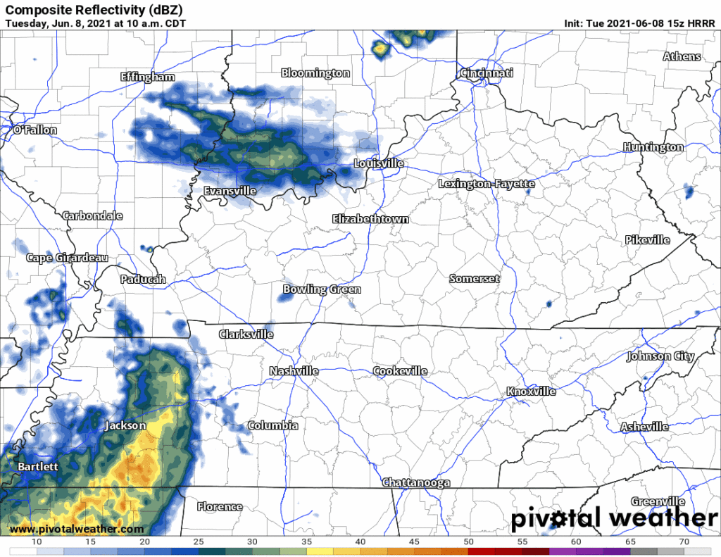
There is a possibility of damaging wind gusts. A sliver of Davidson Co. is included in a severe weather outlook for today. Not worried about tornadoes or hail.

Is This Rain Ever Going to End?!
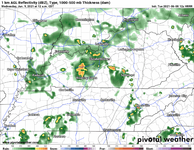
Not for Wednesday and Thursday at least 😔. HRRR has Wednesday starting off the morning with scattered showers. These become a tiny bit more uniform in the early afternoon but become more scattered in the evening. This is a lot of off and on rain.
Thursday has widespread rain as well. Euro has heavier rain in the morning to early afternoon.
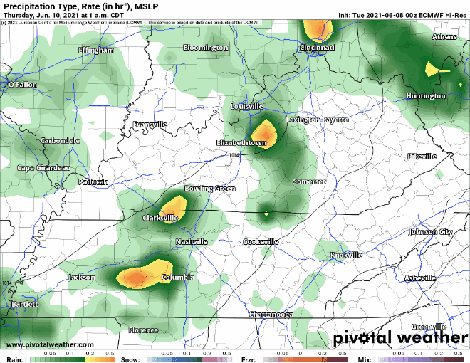
Our atmosphere will be water loaded Wednesday and Thursday. Rain totals generally from today to Thursday will average around 2″. Any one location may see more, or less. Flash flooding may be an issue where storms “scatter” most. WPC says the probability of a flash flood event within 25 miles of us Wednesday, and again Thursday, is between 10% and 20%.
Oh the Humidity
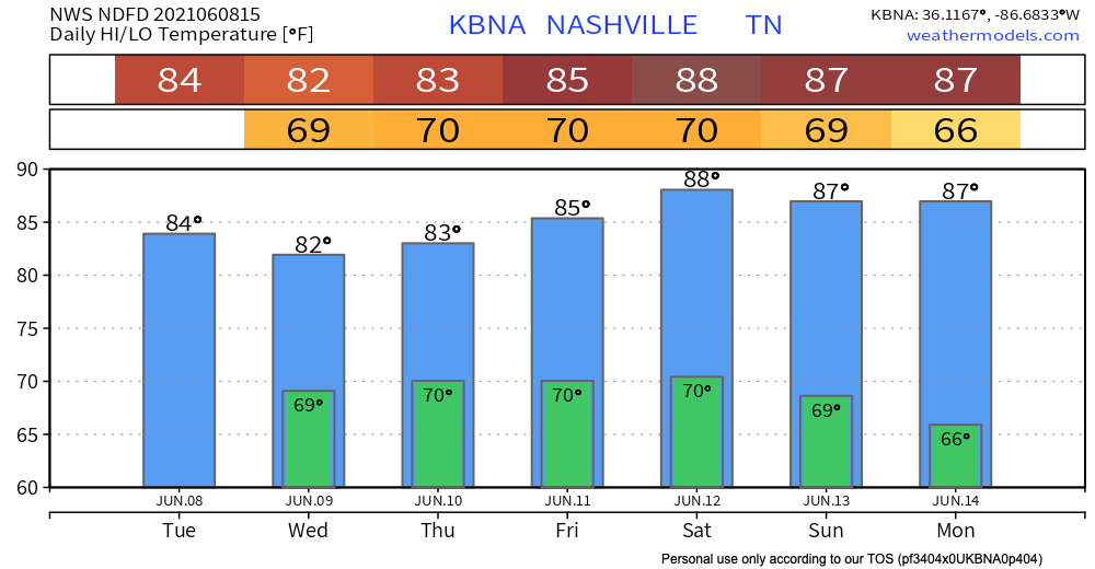
Dew points hit the lower 70’s this week. Time for sticky rain jacket season!

Rain probabilities decrease this weekend, but we’ll still be hot and humid enough for a pop up shower or storm during the afternoon/early evening.
Categories: Forecast Blogs (Legacy)
You must be logged in to post a comment.