I hope all of the runners in the marathon this morning enjoyed the awesome weather we had!
Today is going to remain nice with clear skies for the most part; expecting a high of 72º. It’ll be a bit breezy, but winds will relax tonight.

I hope all of the runners in the marathon this morning enjoyed the awesome weather we had!
Today is going to remain nice with clear skies for the most part; expecting a high of 72º. It’ll be a bit breezy, but winds will relax tonight.
Editor’s Note: Seven years ago today, the southeast suffered a generational tornado outbreak. Today we remember those lost. For a gripping, well researched, and a heavy, sad book, peeling back the layers of this tragedy, and telling true stories of grief, horror, survival, and loss, read What Stands in a Storm, by Kim Cross.
A small low pressure system has settled itself seemingly just south of Davidson and Williamson Counties. We are getting the rain from the north side of it.
Rain should continue falling lightly until early tonight.
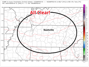
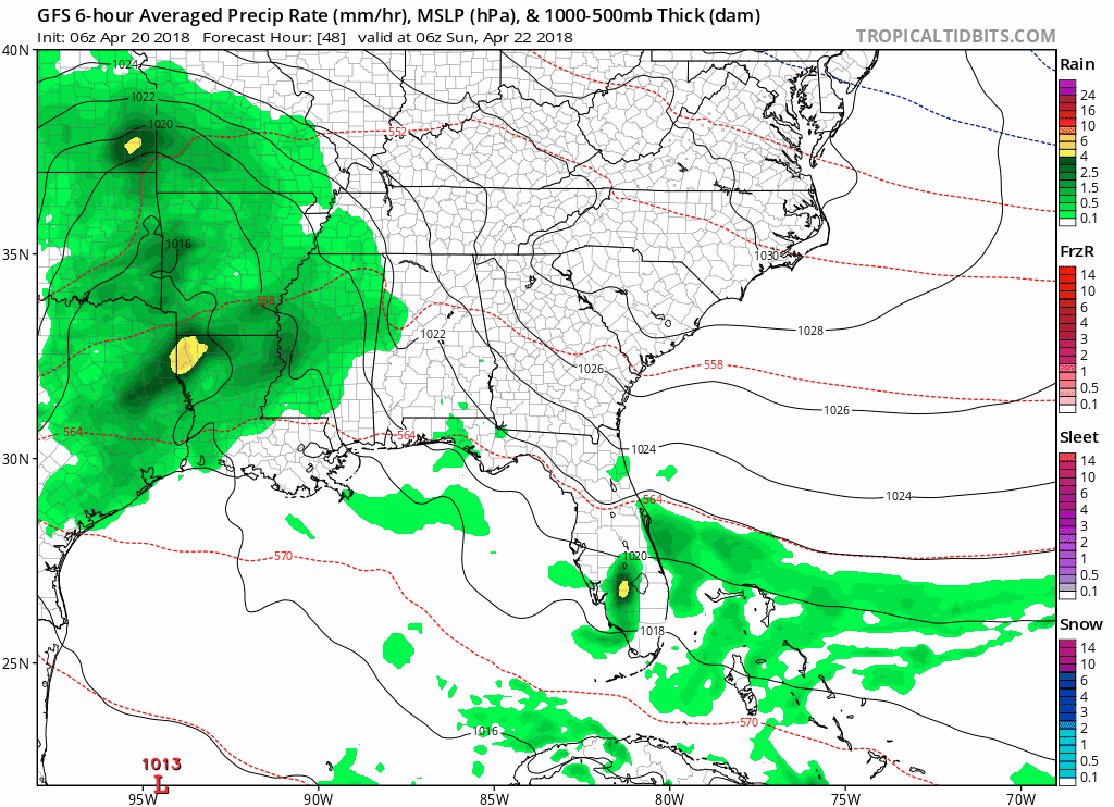
Good morning Nashville! An unsettled weather pattern looks to continue thru at least the afternoon hours on Friday. For today though, not expecting any rain until the late evening hours, after a high of 68º for the day.
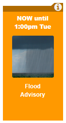
This flood advisory has been issued for the Stones River in Davidson County. Water levels are expected to fall out of the Action Stage by this afternoon.
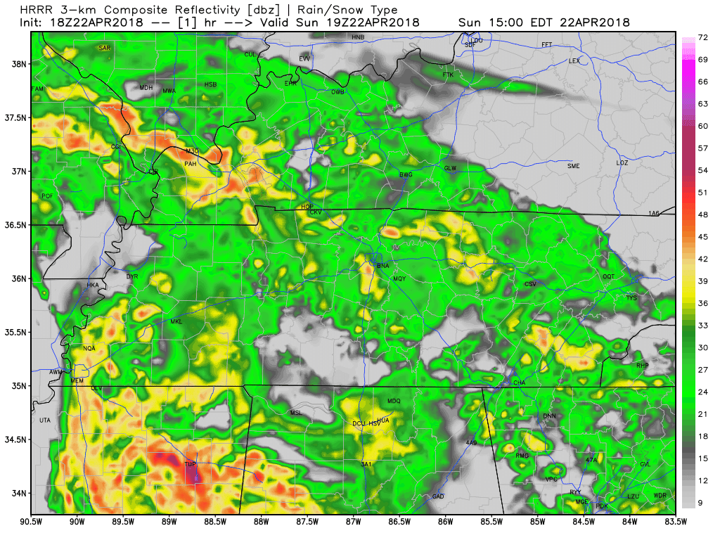
This week does not look like it will be drying out anytime soon. We still have a few chances of rain today as this low pressure system continues to spin (COUNTERCLOCKWISE!) over the southeast. The heaviest showers are finally moving eastward and out of Tennessee, so we’ll be left with spotty showers throughout the day.
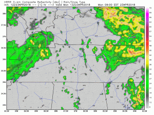
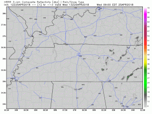
Good morning Nashville! Low pressure is going to move across the state of Tennessee today. This morning, it was centered in the Memphis area and will move east as the day progresses. You can see it in the HRRR 3km simulated radar this morning; it is able to be depicted by the center of rotation of the showers today. All in all, looking at on and off rain for Williamson and Davidson Counties this morning. High of 68º expected today. A thunderstorm or two is not ruled out.
Through 3 PM, 1″ of rain has fallen at BNA.
Brief break from the rain as a dry slot in this system rotates through / Radar 3:13 PM pic.twitter.com/bs2SMj6sg9
— NashSevereWx (@NashSevereWx) April 22, 2018
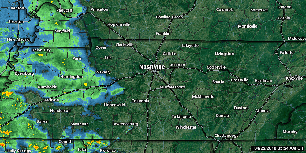
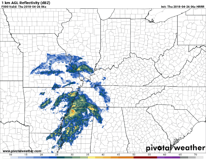
Radar thru 6:32 AM shows rain inching closer to us.
You can update this radar on our radar/camera/tweets page here.
All models predict rain to work east and wash us out today.
The HRRR model thinks it’ll rain from mid-morning until 10 PM (and likely longer; this model only runs thru 10 PM):

Sunshine on a Saturday has us all excited!
This break in the clouds has been brought to you by a bubble of high pressure hanging over central Tennessee. It’ll hang on for one more day before being pushed east as rain moves in later on tonight.
Enjoy these warmer than average temperatures today, because they will be gone tomorrow! (But not by much)
We interview interns by Google Hangouts. Two years ago, we did one last one interview, thinking we were going to choose only Brendan. When it was over, me, Will, and Andrew immediately said: “Well, there is nothing to talk about, this is a no-brainer, Caroline is going to be very good at this.” We were right. Caroline will graduate from Mississippi State this spring, then transition to grad school. She’s been a leader at State. She has volunteered at NWS-Nashville during the summer (they love her), and has driven up here to help everyone out during Severe Weather Awareness Day. Most of all, she has excellent weather skills, she’s reliable, trustworthy, and smart. Our rule is that interns graduate from @NashSevereWx when they finish undergrad, if not before. With our full support, she’s going to help out @memphisweather1 while she continues her post-grad education. Caroline has served me, Will, and Andrew well. She’s been no stress for us, she needs no editing; it takes a lot for us to trust someone with @NashSevereWx and she earned that trust right away. She’s served our community well, behind the scenes, during challenging forecasts. We will miss working with you, Caroline. We look forward to what your future will bring. It’s not goodbye. It’s see ya later.
You must be logged in to post a comment.