

Future prediction is hard.
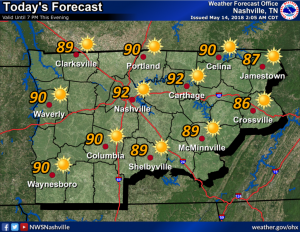
This week we’re at our outdoorsiest…during what’s statistically the wettest week of the year, mid-May.
Will it rain [insert location, date, time] because I have [plants to water, graduation ceremony, a game, going out with friends and thinking about a white top, it’s field day, etc] and I have to decide what to do?


You must be logged in to post a comment.