
This morning, NWS wrote:
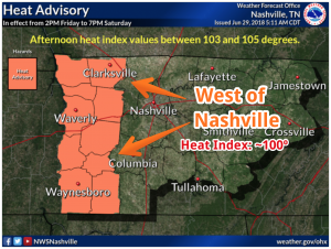
A slight veering of the surface winds to more southerly today may allow slightly higher dewpoints to advect into the region which could push heat index values into the 100° to 105° range particularly across the Nashville to Clarksville corridor.

You must be logged in to post a comment.