
Waves of rain coming.
FRIDAY
The first isn’t much of a wave. A cold front will cross Friday morning. It’ll bring a few light showers. No appreciable rainfall expected. So let’s not count that one.

Waves of rain coming.
The first isn’t much of a wave. A cold front will cross Friday morning. It’ll bring a few light showers. No appreciable rainfall expected. So let’s not count that one.
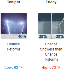
Mild and humid with isolated showers and a possible thunderstorm. Areas of fog overnight. Severe weather is not anticipated.
The latest HRRR thinks there won’t be much from this evening through tomorrow afternoon:
8 AM UPDATE
Looks like a rain + wind event. A few storms possible, main concerns lightning and strong winds.
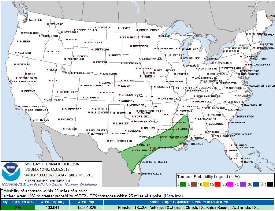
Tornado: we are removed from risk area. Insufficient instability the reason. Previous outlook said 2%.
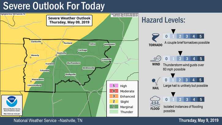
Some strong to severe thunderstorms are possible today, with the main threat being damaging winds. Hail and a few brief tornadoes are possible as well, but chances are low. Localized flash flooding will also be possible for areas that receive multiple rounds of heavy rain today.
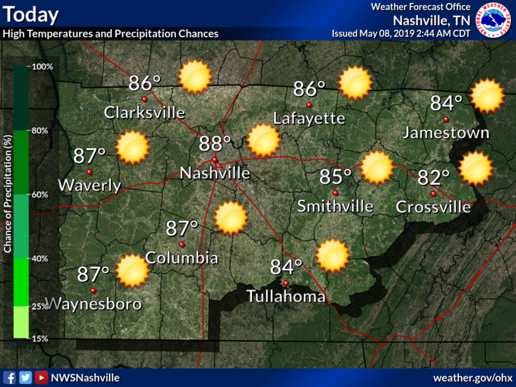
Today will be a beautiful day.
Winds will be around 5-15 MPH, but we could also see gusts as high as 25 MPH.
[Editor’s Note/Fun Fact: If we reach our forecast high of 88°, this would be the warmest day so far this calendar year.]
Mid to upper 80s today (Tuesday) and Wednesday.
Wednesday will be the last good time to get any yard work done before higher humidity and rain arrives Thursday.
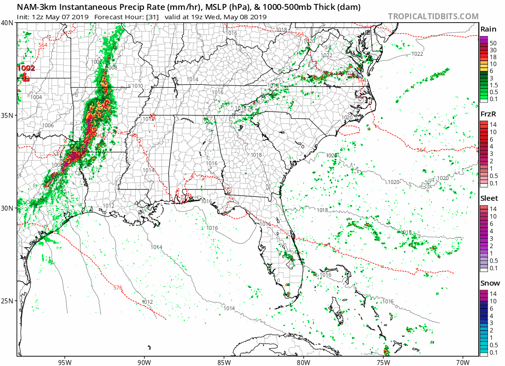
The NAM3 model thinks rain will fizzle before arriving Wednesday night:
Rain ETA as early as Wednesday night, but bet on a Thursday rain ETA. Right now outdoor events Wednesday night look safe.
Very little good high res data available between hours 60 and 90, which is how many hours we are from this event. Thankful for Euro model 90 hour data which suggests rain arriving sometime middle of the day Thursday and lasting Thursday night into the overnight hours. But one run of one model is no way to plan life, so expect updates/changes/refinements to this prophesy.
Yesterday’s rain is gone. It went east.
Patchy fog/light mist is possible this morning and maybe early this afternoon.
Otherwise, high of 72°. Mostly cloudy. Sunshine may break through late this afternoon.
Rain will be moving into the area throughout the day. It looks like there will be two rounds. The first round this morning with another round tonight.
The NAM3 has the first round moving through between 10 AM to 1 PM, second round from 7 PM to 10 PM:

The main line of storms will move out of the area this morning and leave us with a mostly cloudy and wet end of our work week. Rain chances diminish in the afternoon, but still hanging around enough to potentially see a small shower or two, but definitely not a washout. We will reach near 81º for the high. Dewpoint values will be in the mid 60s so it is going to be a pretty muggy and sticky one out there this afternoon. This evening will remain mostly dry, still with a chance of seeing a small shower into the overnight hours. Temperatures will drop down to around 64º.
You must be logged in to post a comment.