Sunny today. We warm up into the low 80°s with light south winds.
Clear skies means a temp drop into the 60ºs tonight, mid 50°s Tuesday morning.
Tuesday
More clouds as a mid/late week rainmaker creeps closer. No real temperature change.

Sunny today. We warm up into the low 80°s with light south winds.
Clear skies means a temp drop into the 60ºs tonight, mid 50°s Tuesday morning.
More clouds as a mid/late week rainmaker creeps closer. No real temperature change.
Great weather continues!
Monday: sunshine with a high of 81°. A nice south/southeast breeze of 5 to 10 MPH winds.
Tuesday looks similar with a high of 81°. We could see a few more clouds, but it should still be mostly sunny. Winds will still hang around 5-10 MPH.
Right now it is 43° and mostly cloudy around our area. You can thank the recent cold front for the unseasonably cool weather. There is a chance of rain and showers this morning and into this evening, though this rain will be light and precipitation amounts will be meager (less than a tenth of an inch).
Scattered showers dominate the area throughout the day, some being heavy at times. Believe it or not our high temp was 61º and midnight. By sunrise we had already fallen to a temp of 51º and we’re going to keep getting cooler all day.
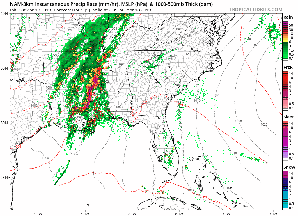
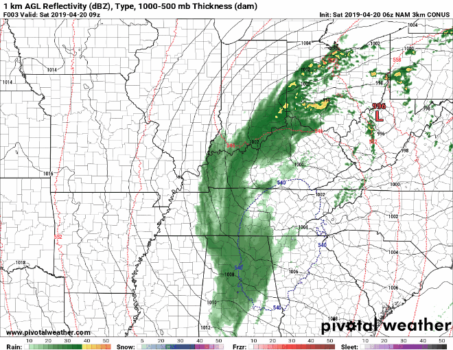
Showers and thunderstorms will move into our region over the next several hours. The main threat is locally heavy rainfall, which the National Weather Service highlights in their afternoon discussion:
Some strong to maybe a couple of severe thunderstorms possible, but in analysis of model sounding profiles, this looks more and more like mainly a rain making event with some heavy downpours this evening causing local ponding of water on area roadways and possible minor flooding of flood prone areas.
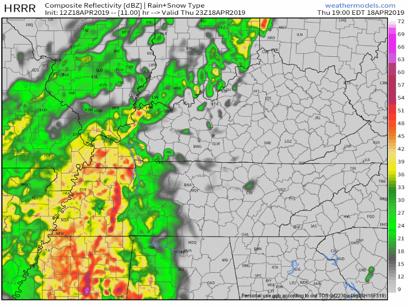
Big storm system churning through Louisiana, Arkansas, and Mississippi today will be here tonight.
Local worry level: low.
Before storms, gusts to 40 MPH possible. Blowing in from the south, crossing perpendicular to east-west highways (I-40, I-840, and I-440*), so be especially careful driving big trucks. Don’t get blown out your lane.

Today is the last dry and (mostly) sunny day we will have until Sunday, so make sure to get outside and make the most of it! The high temperature will reach 81°. It may also be a little breezy with warm southerly winds at 10-15mph, though gusts could reach up to 20mph.
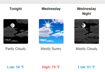
Pleasant conditions will persist into Wednesday as an area of high pressure continues to bring sunny and dry weather. Temperatures will remain above normal with lows tonight in the mid 50°s and highs tomorrow right around 80°.

We were off to a cool and dry start this morning due to a cold front that moved through this weekend. Winter decided to show itself very briefly, reminding us that it is still April. However, this did not last long as temperatures should rebound quite nicely as we move into the afternoon hours.
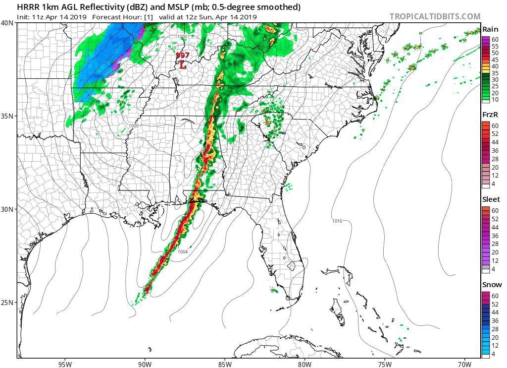
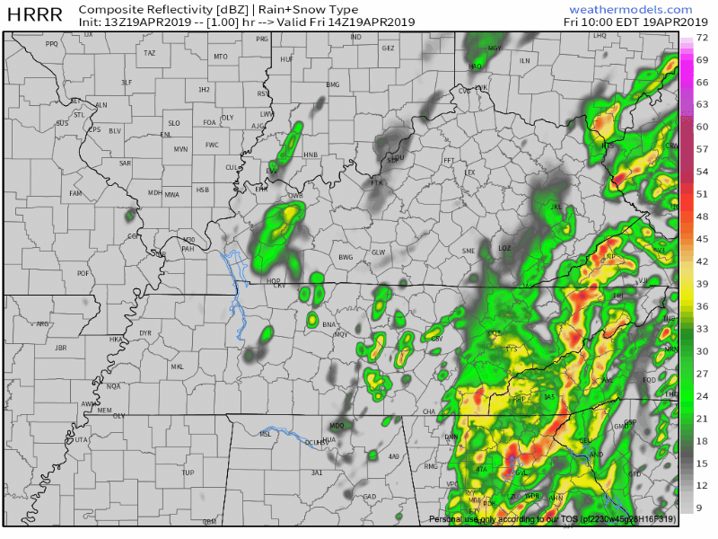
The line of rain and thunderstorms has officially pushed off to our east. The chance for showers and thunderstorms still linger; however, we are not concerned with any of them being severe. They are also not expected to bring a lot of rain either.