
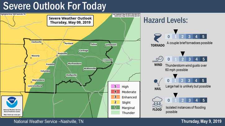
NWS-NASHVILLE OVERVIEW
Some strong to severe thunderstorms are possible today, with the main threat being damaging winds. Hail and a few brief tornadoes are possible as well, but chances are low. Localized flash flooding will also be possible for areas that receive multiple rounds of heavy rain today.
HAZARD LEVELS
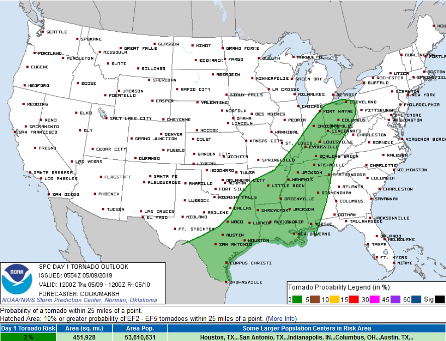
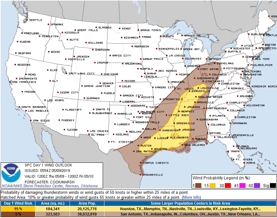
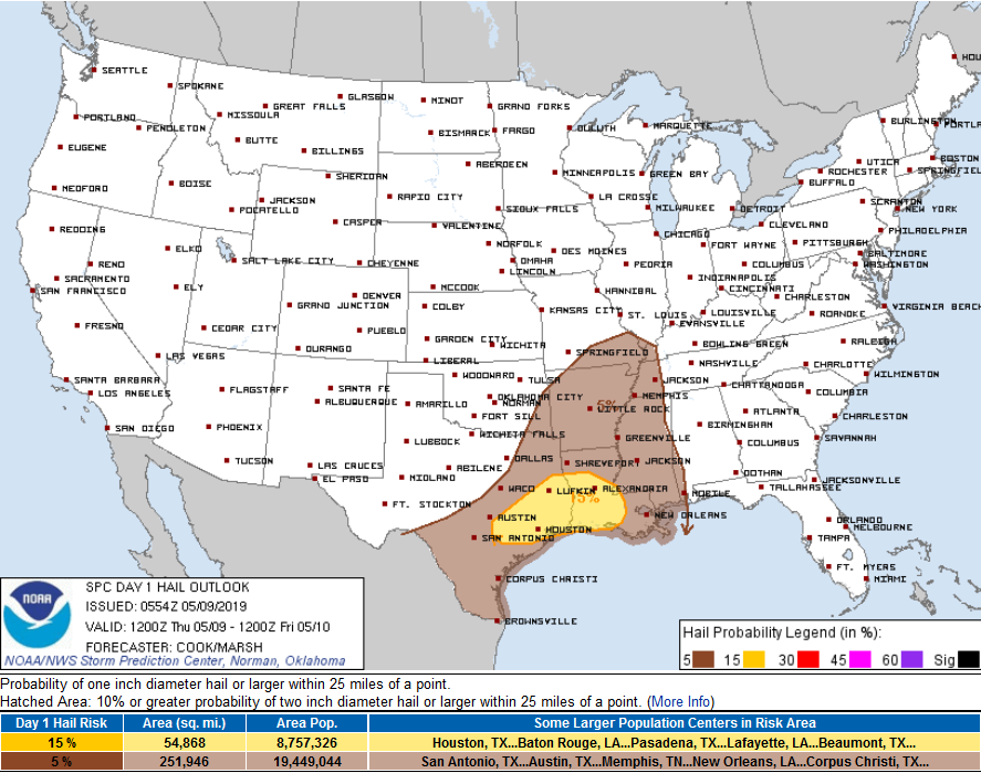
STORM PREDICTION CENTER PROBABILITIES OF X WITHIN 25 MILES
Tornado 2%
Damaging Thunderstorm Winds, between 5% and 15%
Hail, nothing for us, threat for far western Middle Tennessee.
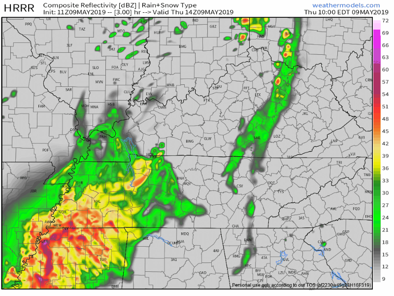
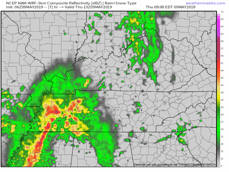
TIMING
HRRR model, 9 AM to 4 PM.
NAM3 model, 9 AM to 3 PM.
CURRENT WATCHES
SPC also has not announced plans to issue a Severe Thunderstorm Watch or Tornado Watch. This may change, will update on Twitter @NashSevereWx.
VERY WINDY
Already winds have gusted to 43 MPH. This should continue today.
RAIN TOTALS
About a half inch before the evening rush hour. Enough to rain out most sports. Your field may vary.
THURSDAY NIGHT – WEEKEND
Intern Jon will be along this afternoon with an update. But for now expect only a few off/on showers tonight. Can’t rule out rain Friday but that looks like the “driest” day between Thursday and Sunday. After Thursday the NAM3 thinks the next big rain event will arrive around lunch Saturday afternoon:
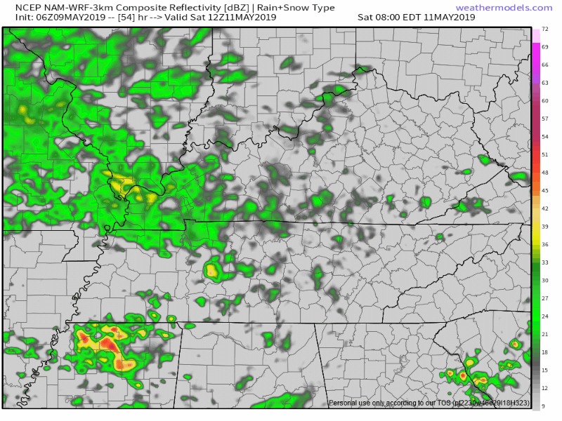
Have low confidence this model is right.
Best rain chances this weekend return Saturday night and last through Mother’s Day. Call your mom Sunday.
See you on Twitter. Expect an update on this dot com later this afternoon.

Categories: Forecast Blogs (Legacy)
You must be logged in to post a comment.