
8 AM UPDATE
Looks like a rain + wind event. A few storms possible, main concerns lightning and strong winds.
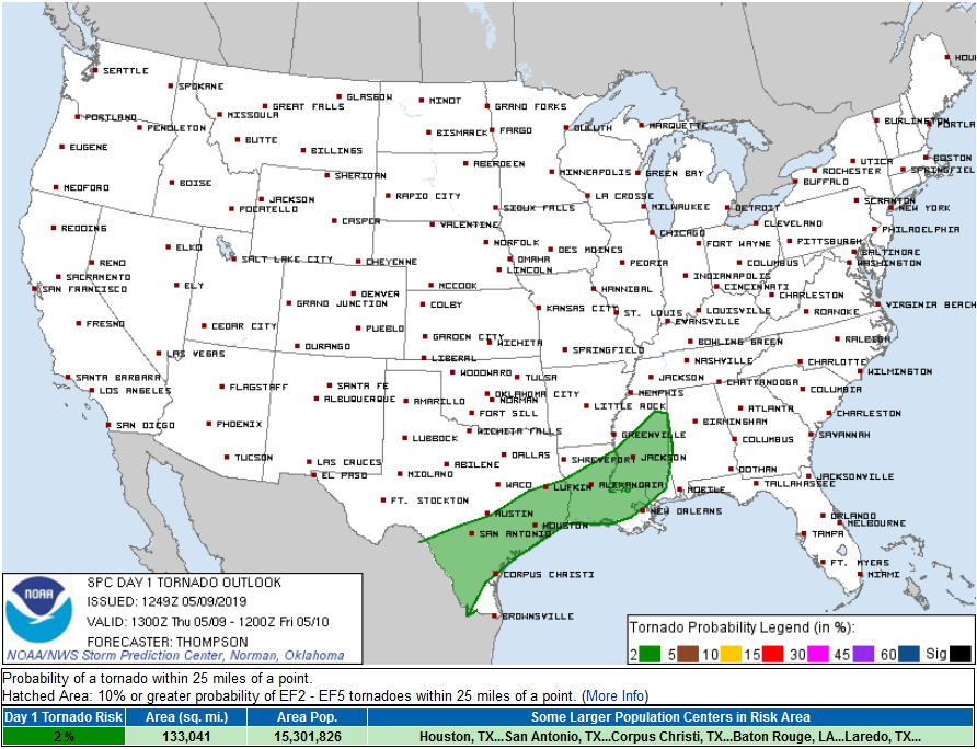
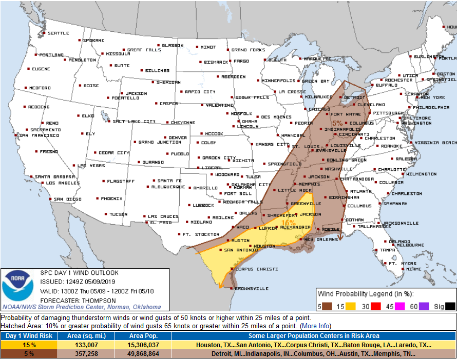
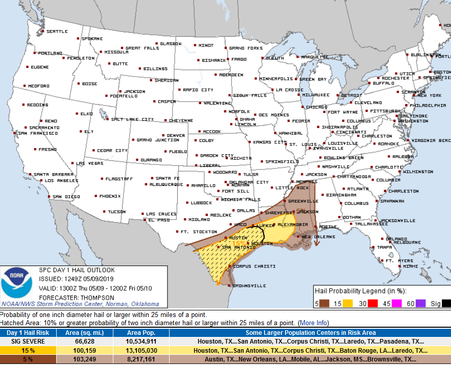
STORM PREDICTION CENTER PROBABILITIES OF X WITHIN 25 MILES, 8 AM Update
Tornado: we are removed from risk area. Insufficient instability the reason. Previous outlook said 2%.
Damaging Thunderstorm Winds, just 5%. Previous outlook said between 5% and 15%
Hail. Still excluded from the outlook.
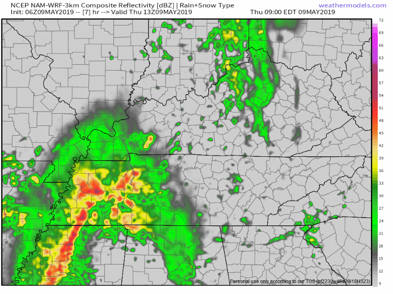
TIMING
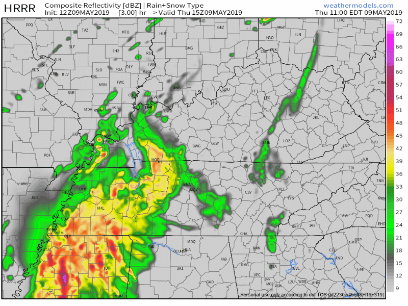
HRRR model, main rain 10 AM to 4 PM. Heaviest rain after lunch.
NAM3 model, 9 AM to 3 PM.
CURRENT WATCHES
SPC also has not announced plans to issue a Severe Thunderstorm Watch or Tornado Watch. This is unlikely to change. Severe weather unlikely. Will update on Twitter @NashSevereWx should this change.
VERY WINDY
Already winds have gusted to 43 MPH. This should continue today.
Winds toppled two trees this morning. One struck a car. The other laid across a road blocking traffic.
Do not ride out heavy rain/wind storms in a car parked beneath a tree. Also don’t be in the tree.
RAIN TOTALS
About a half inch before the evening rush hour. Enough to rain out most sports. Your field may vary.
THURSDAY NIGHT – WEEKEND
Intern Jon will be along this afternoon with an update. But for now expect only a few off/on showers tonight. Can’t rule out rain Friday but that looks like the “driest” day between Thursday and Sunday. After Thursday the NAM3 thinks the next big rain event will arrive around lunch Saturday afternoon:
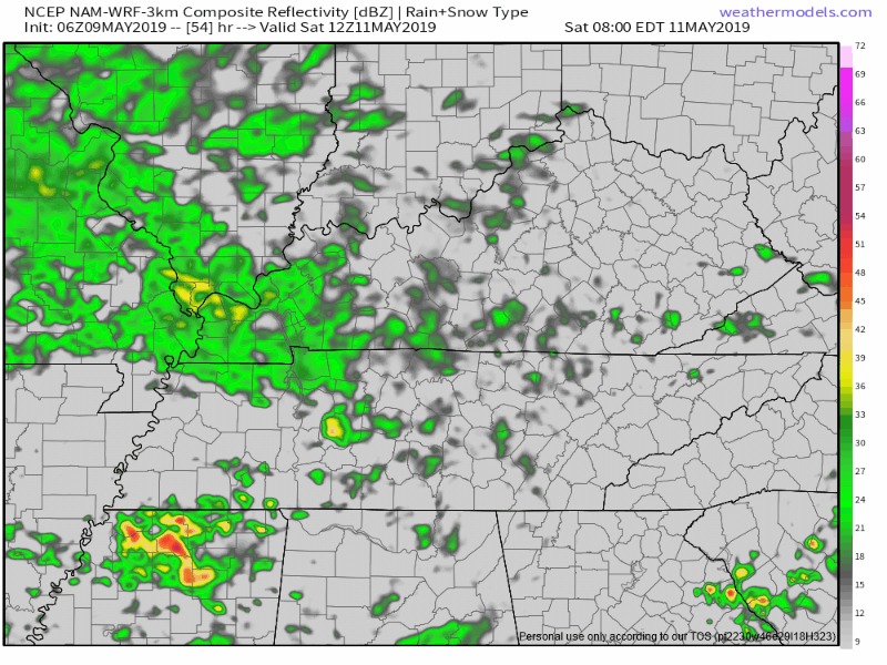
Have low confidence this model is right.
Best rain chances this weekend return Saturday night and last through Mother’s Day. Call your mom Sunday.
See you on Twitter. Expect an update on this dot com later this afternoon.

Categories: Forecast Blogs (Legacy)
You must be logged in to post a comment.