
Cool And Dry For Friday
An abundance of some clouds will keep our temperatures around 48° for the high this afternoon. No rain in the forecast for the rest of today, so Friday evening plans are all clear, but you’ll probably need a jacket as temperatures drop once the sun sets.

Showers Move In Saturday, Plus Winds Ramp Up
The early morning hours of Saturday will introduce some stronger winds before showers move into Middle Tennessee. Winds could gust up to 20 to 25mph after midnight, then stronger when the afternoon rolls around, gusting up to 35mph.
Showers will begin to move in between 6AM-9AM. Here’s the latest NAM3 model:
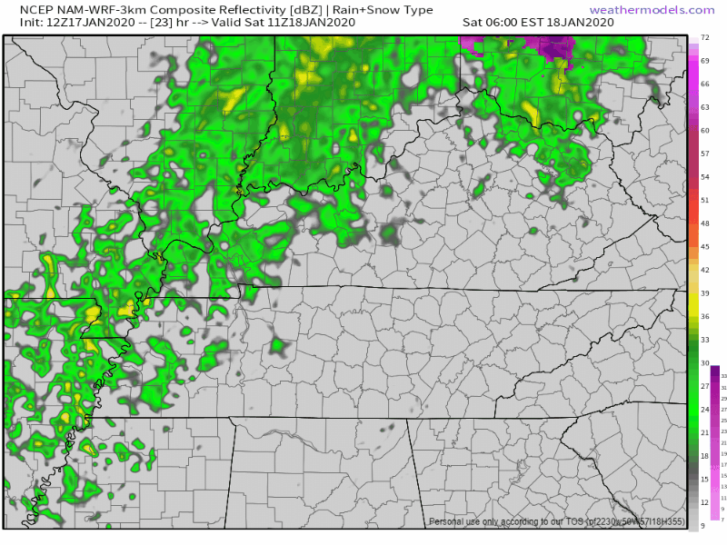
Currently, there is no severe weather in the forecast. No flooding impacts are expected either, but you might want to keep an eye on the things you have on your porch with these strong winds.
It’ll be pretty warm as the rain moves through, 61° for the high, but then much colder air comes in behind the front Sunday.
Much Colder Through Tuesday
Once the cold front moves through late on Saturday, our temperatures are going to plummet.
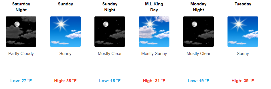
You’ll want to grab that heavy coat from the closet for the end of the holiday weekend. We’ll drop below freezing for the lows every night through Tuesday, with highs only in the 30s to end off the holiday weekend on Martin Luther King Jr. Day. No precipitation expected through the beginning of the workweek as the temps drop, sorry again snow lovers.
Checkout the hoodies we sell. Stay warm!

As usual check back for more updates and follow us on twitter @NashSevereWx!

Categories: Forecast Blogs (Legacy)
You must be logged in to post a comment.