
It’ll probably rain a little before midnight tonight, no big deal.
Models indicate snow Friday night lasting off and on overnight into Saturday morning.
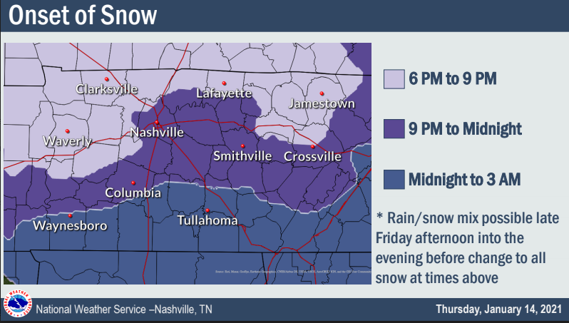
What Time?
Rain is expected to change to snow Friday night between 9 PM and midnight:
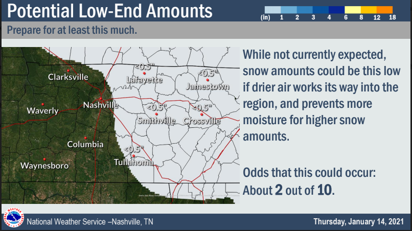
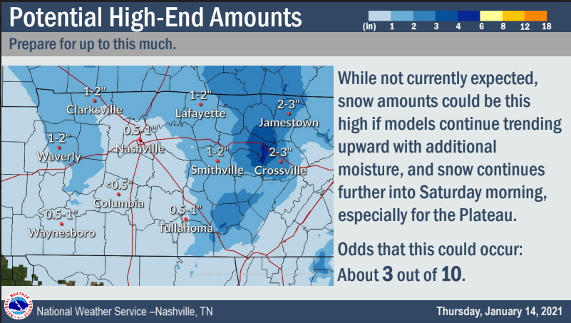
How Much?
Scenario 1: Nothing. Dry air infiltrates and there’s just not enough to accumulate. Warm surface temps splat and melt flakes.
Scenario 2. This slightly more likely, the higher end, a half inch to 1″ by Saturday morning.
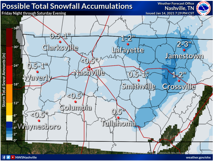
Scenario 3: The most likely outcome is under a half inch:
Yeah, we also see that whistle shaped snowdome from downtown east to Wilson County. Probably reflects low elevation and albedo/heat island influences models are struggling to resolve. Try to pay little attention to it. Don’t worry, you’ll see it again, keep reading.
Where’s It Coming From?
A system passing north of us. Spinning us some moisture on its south side.
Flakes should be light; initial flakes may be zapped by the Dry Air Monster or suffer splat melt as flakes nestle onto an earth slightly warmer than the air above it. But after that we may see accumulation.
HRRR model:
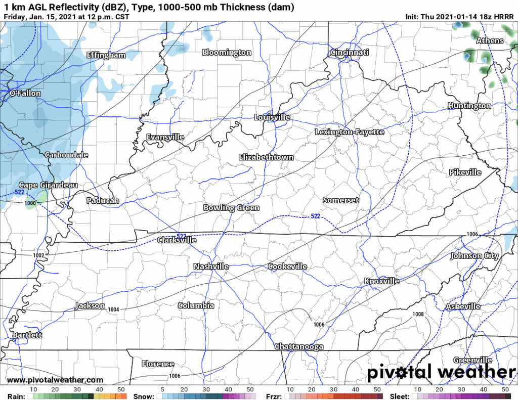
What The Models Say About Accumulation
The HRRR model deposits 1″ on us by noon Saturday:

All other models running at 18z show way less than that.
We have the NAM, the worst of all the models, but like a broke clock is “right” twice a day. 0.4″:

Then there’s the Euro at 0.3″:

Check out the Hi-Res GFS with the Ultimate Troll Job #Snowdome:

The NWS Blend of Models is likely the best guidance, it puts down 0.4″:

You Sure About This?
Nope.
Forecast confidence is “low to medium” mostly due to forecasters questioning whether enough moisture will get in here. Some data this afternoon was favorable for an accumulating snowfall (plenty of lift aloft, large depth of dendritic growth zone, and other super nerdy things you probably don’t care about). This is not the worst snow setup (cold front chasing moisture), and it’s not the best setup (deep 700 mb low passing SE of us with a powerful high pressure in the Great Plains). This somewhere in between.
Expect forecast changes as new data becomes available.
More info tonight, Friday, and through the event here but mostly on Twitter @NashSevereWx.
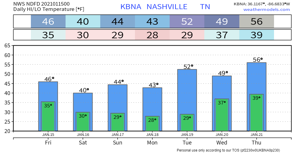
BTW, check out the below temps, but wind chills willi be below freezing all weekend.
Categories: Forecast Blogs (Legacy)
You must be logged in to post a comment.