As of this writing, there is a Flash Flood Warning for western Williamson County and a multitude of Areal Flood Advisories across both counties. Have a way to get additional warnings and advisories should they be issued today. More rain is expected.

As of this writing, there is a Flash Flood Warning for western Williamson County and a multitude of Areal Flood Advisories across both counties. Have a way to get additional warnings and advisories should they be issued today. More rain is expected.
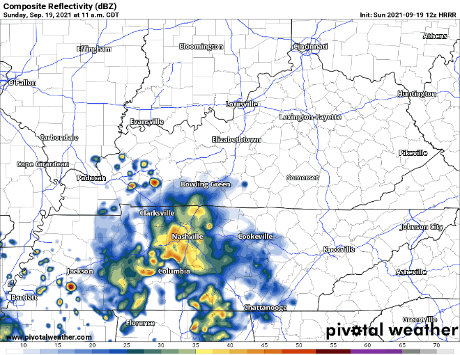
Rain will continue today. HRRR shows our area getting rain from lunchtime to the evening.
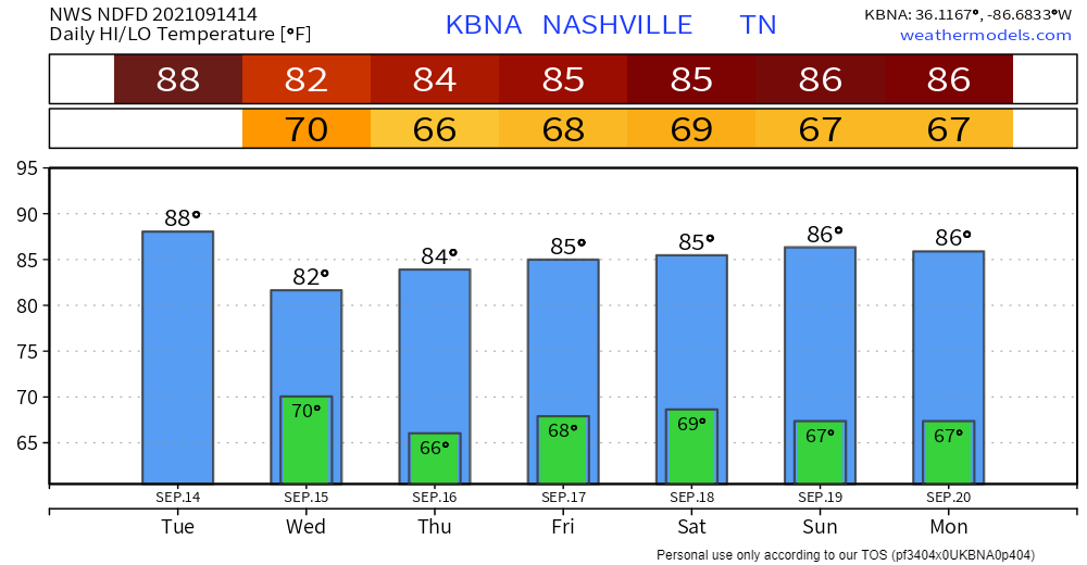
These showers and storms can drop a lot of water fast which is why were under a Flash Flood Watch through Monday night. WPC has us in the 10-20% chance of a flash flood occurring. Be alert, don’t drive through flooded roads.

Those who live near fast-rising creeks and streams should pay close attention to the weather this weekend. If a Warning is issued, be sure you are paying attention and can move to higher ground. No one should attempt to drive across a flooded road.
Scattered showers and storms continue today, and coverage looks much more widespread. Storms start firing up around lunchtime and hang around into the overnight hours. Nothing severe expected, but lots of lightning, thunder, and downpours can happen with these. The potential for rain/lightning delays to anything outdoors exists. Radar will definitely be handy today.
Expect scattered showers/storms today. These will miss a lot of us, and will not be like the rain event we had yesterday. These will affect our counties from late afternoon until bedtime, around 10pm. Nothing severe is expected with these scattered storms but be prepared for lightning and heavy downpours if on of these storms gets close to where you are.
Let’s get right into it. A Flash Flood Watch was issued earlier this morning including our counties. It’s in effect until 7pm tonight as of now. Keep a close eye on your weather alert apps in case Flash Flood Warnings are issued.
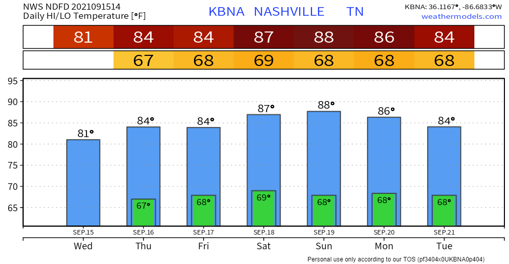
It’s been pretty dry for the last week or so. Some incoming rainmakers look to change that for us. There’s Tropical Storm Nicholas that will bring some tropical moisture to the area. Add a front moving in from our northwest and you get widespread rain chances.

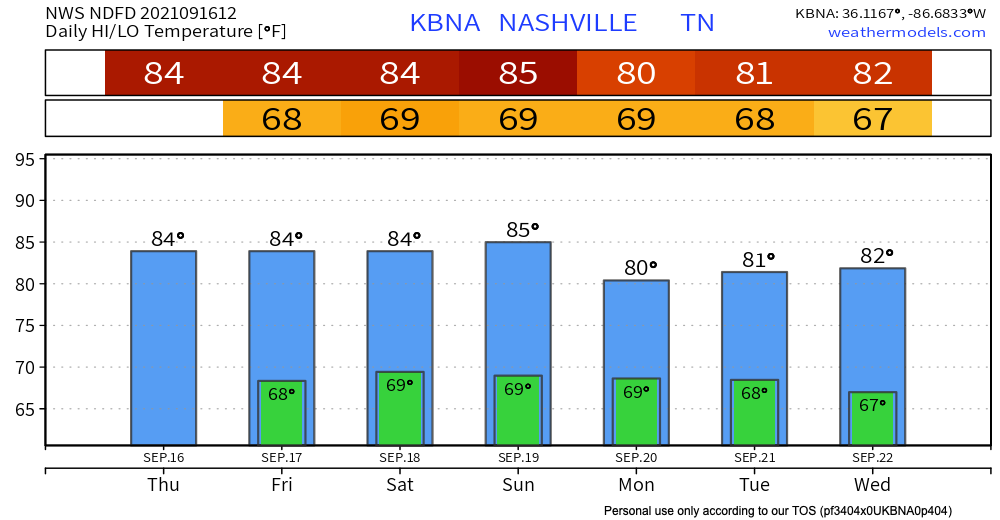
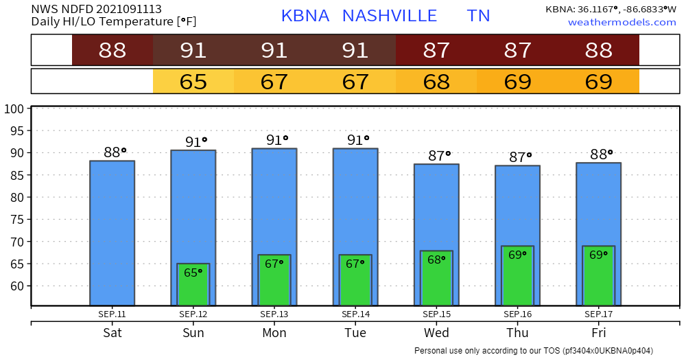
You might’ve noticed some fog in the area this morning if you were up early, this is because of the humidity. Although the fog dissipated already, the humidity is here to stay. Temps will be in the upper 80s today, and dewpoints in the upper 60s, so it’ll be uncomfortable.
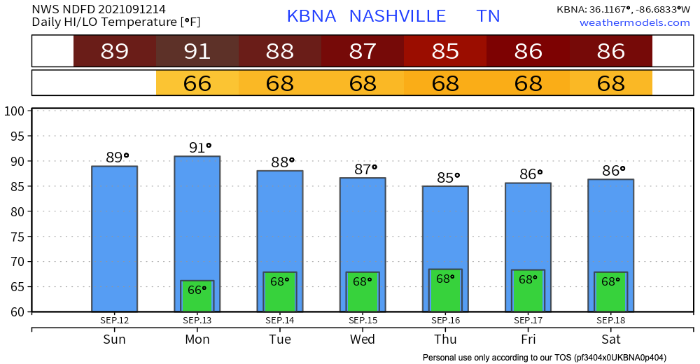

Today, as a high pressure ridge moves into our area, we can expect a completely clear day. Temperatures will rise a little higher than the last few days, slightly higher than the yearly average.
Here’s the perfectly clear HRRR model in case you want proof.

Other than temps being slightly above average, (our normal for this time of year is mid 80’s) there isn’t much better weekend weather you could ask for. Clear and sunny skies will dominate, along with dewpoints being in the low 60’s, almost too good to be true.
You must be logged in to post a comment.