
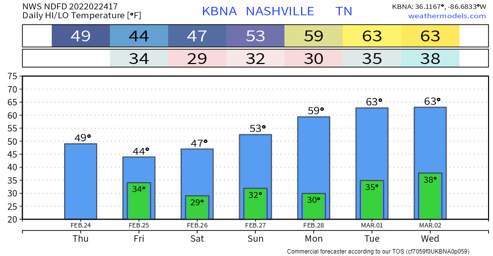
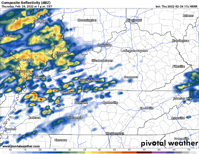
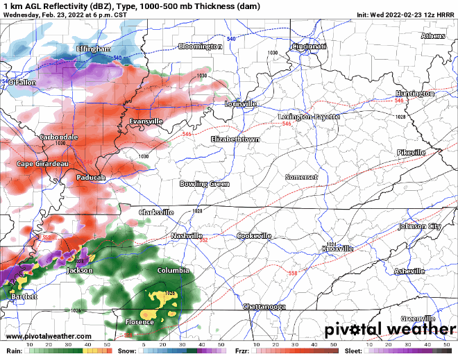
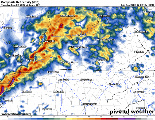
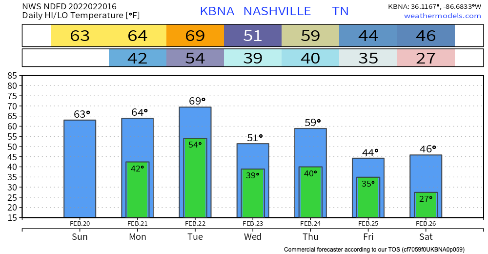
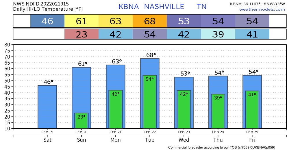
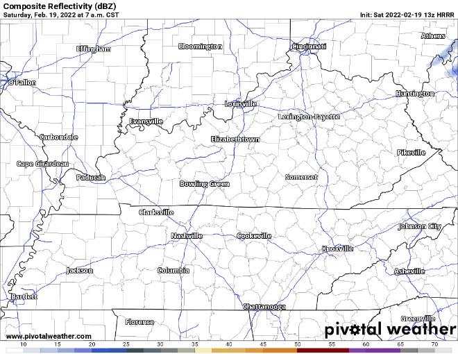
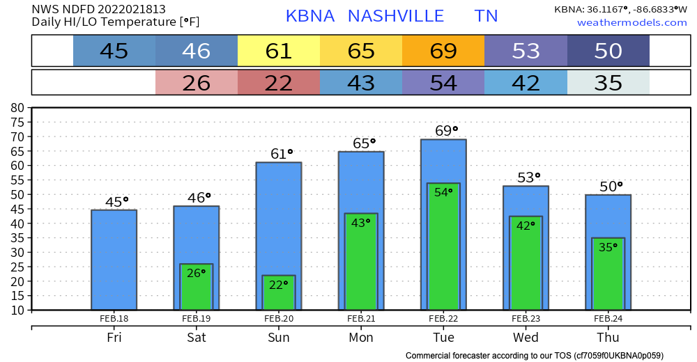
The heaviest of the rainfall is past us. Hit or miss showers rest of today. Under a half inch of rain between now and the wee hours tomorrow morning. Everything should be mostly out by then.
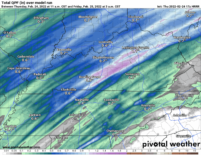
Good news is the ground has more time to accommodate this new rain. But flooding is still possible. Anything that falls is going to easily runoff to already flooded areas. Especially north of I-40 where more rain is expected. We remain under a flood watch until 6AM tomorrow morning.


You must be logged in to post a comment.