
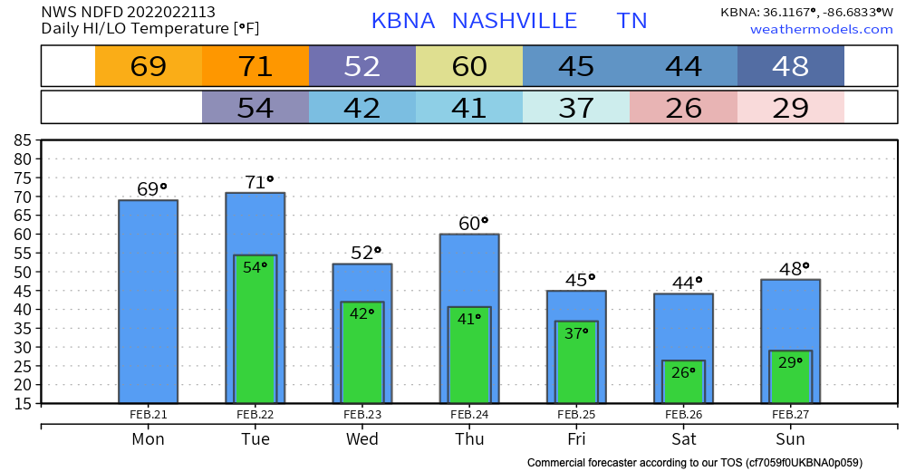
Temps are above average today with highs almost reaching the 70 deg mark. Might feel a tad sticky with the moisture that will roll in today.
A wet week is ahead with rain all throughout the work week. There will be two main rounds that we see this week.
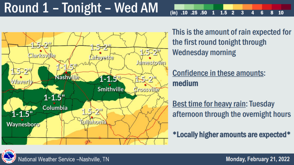
Round #1 – Tonight through Wed AM
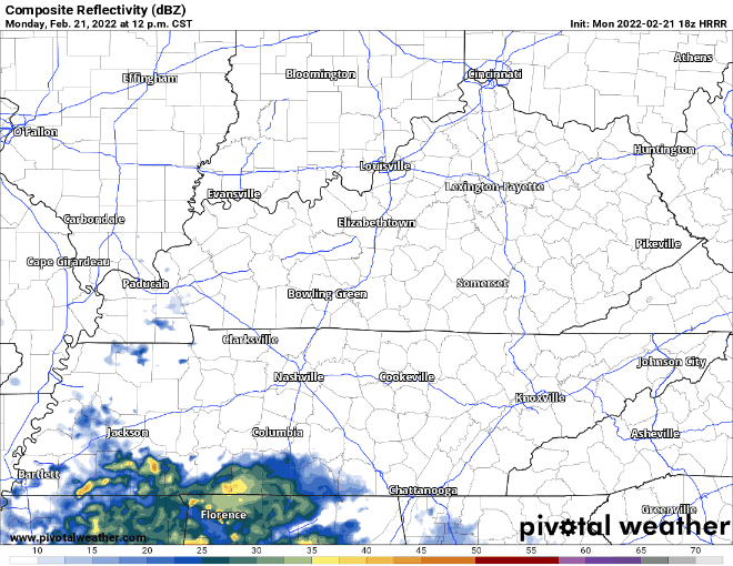
HRRR model below shows isolated showers coming in this afternoon and picking up this afternoon-evening. (Model loop through the wee hours of Wednesday morning.)
SPC has placed our counties in a 1/5 level risk for severe thunderstorms today. This means this afternoon-evening we could see isolated strong to severe thunderstorms. Gusty winds are the main concern with these storms with gusts reaching 58+ mph.
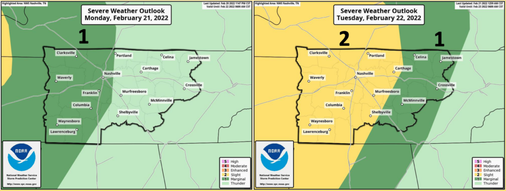
SPC has placed our counties in a 2/5 level risk for severe thunderstorms Tuesday. Flooding and severe thunderstorms are most likely Tuesday afternoon-evening. The Storm Prediction Center has us outlooked with a 15% chance of damaging wind, 5% risk of 1″ in diameter or larger hail, and a 2% risk of a tornado within 25 miles of any given point in our counties.
A flood watch will be active for both Williamson and Davidson counties Tuesday at 12pm-Wednesday at 12pm. With this first round, 1-2″ of rain is possible meaning that flooding is possible in urban and low lying areas, which is why the WPC has us in a 15% risk of a flash flood event within 25 miles.
Round #2
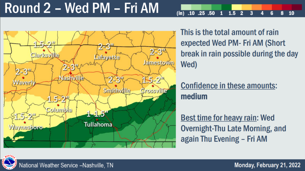
During the day Wednesday some of us could see a sprinkle or two but round #2 comes in Wednesday night. Models below show heaviest showers and storms overnight Wednesday-Thursday morning and Thursday evening-Friday morning. Strong thunderstorms are possible during this time. This round we could see 1.5-3″ of rain. Since the ground is already saturated, flooding risks are elevated.
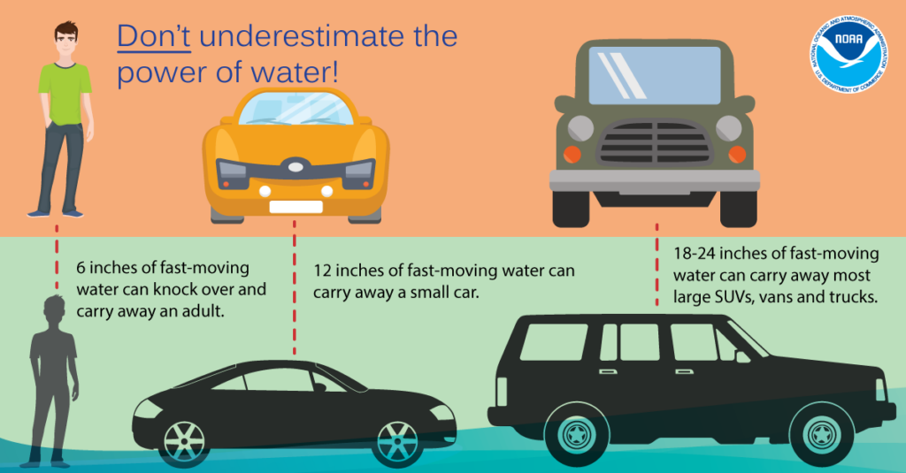
Over the course of these two rounds, our counties could see up to 4″ of rain. Higher amounts are possible if a band of heavy rain sets up and starts “training” over the same area. If you are in a low lying, flood-prone or urban area stay especially weather aware, turn around don’t drown.
Quick References:
Weather changes constantly.
Follow @NashSevereWx on Twitter for any changes to this forecast.
Live coverage during tornado and severe thunderstorm warnings:
Look good.
Support the mission.
We are 100% community supported. No ads. No subscription fees. Keep it free for everyone.
Categories: Forecast Blogs (Legacy)
You must be logged in to post a comment.