
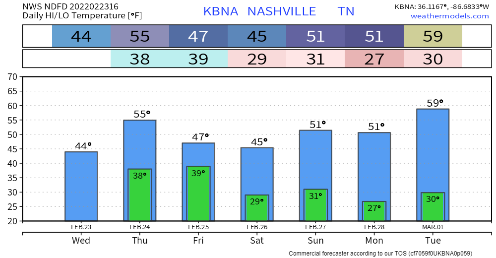
Shortlived break from the rain today. Chilly temps today and tonight. Most of the frozen precip expected to fall NW of us. HRRR thinks a little sleet could mix in early on… nothing impactful.
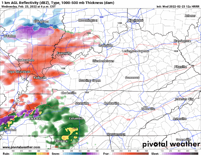
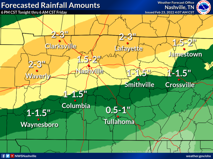
On and off rain showers start tonight and continue throughout the day tomorrow. Heaviest rainfall overnight tonight:
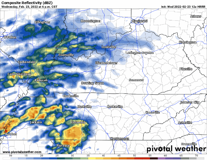
Good news is no severe weather is expected with round two. No more than the occasional rumble of thunder. Heavy rains could cause more flooding. Already saturated ground and swollen rivers/creeks mean water has nowhere to go but up. Rain gauges around our counties measured 2-2.5 inches of accumulation from yesterday’s rain… More to come:
See statement issued in this morning’s forecast discussion:
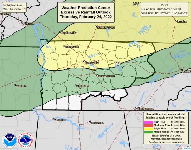
WPC has issued risks of flash flooding within 25 miles of any given point in our counties: 15% probability (yellow) and 5% probability (green).
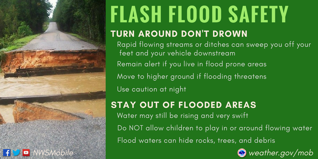
Prepare for new flooding, especially in low-lying areas. Could see some creeks/rivers reach above flood stage. Keep in mind if you live near one that’s prone to flooding. Turn on your weather alerts so you don’t miss any flood advisories, watches, etc. that are issued. We’ll keep you updated!
Quick References:
Weather changes constantly.
Follow @NashSevereWx on Twitter for any changes to this forecast.
Live coverage during tornado and severe thunderstorm warnings:
Look good.
Support the mission.
We are 100% community supported. No ads. No subscription fees. Keep it free for everyone.
Categories: Forecast Blogs (Legacy)
You must be logged in to post a comment.