
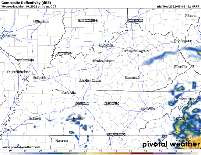
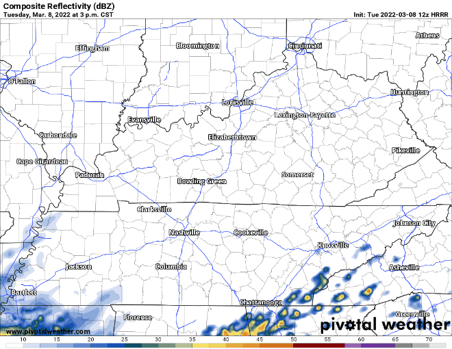
We’re on the tail end of the low pressure responsible for the latest rain. Nothing left but a few light showers (mostly south of I-40). Everything should be out by this evening:
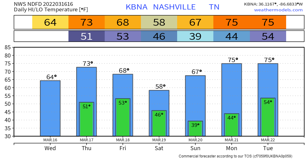
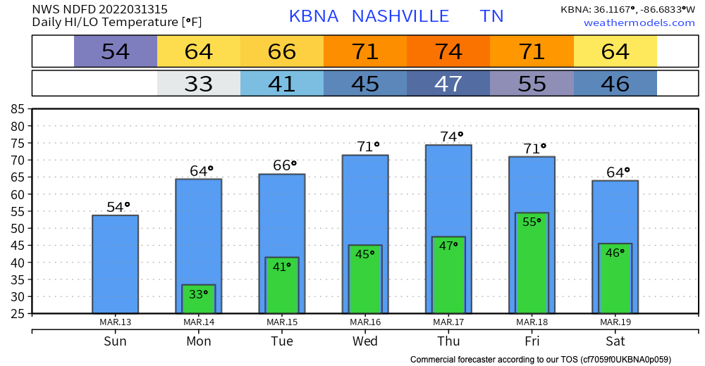
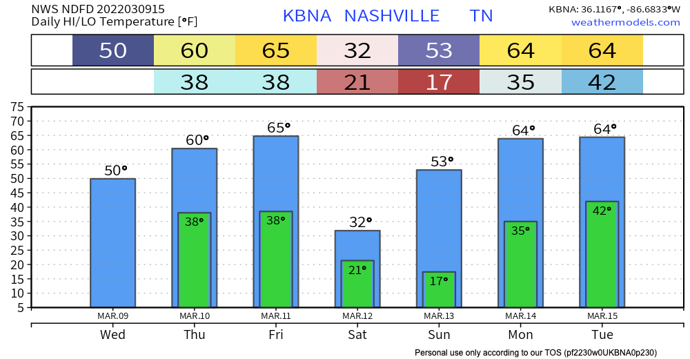
NWS has backed off of forecasted highs for today… courtesy of cloudy skies. Will get more sun tomorrow as we dry out. Thursday will be more agreeable with your spring break plans. Warm temps and no rain.
You must be logged in to post a comment.