Looking for 98° today. Heat index up to 104°. The record temp is 100° from 1952. Doubt we’ll make it there today.
Rain is unlikely but the HRRR consistently shows a few non-severe thunderstorms popping up around 6-8 PM.

Looking for 98° today. Heat index up to 104°. The record temp is 100° from 1952. Doubt we’ll make it there today.
Rain is unlikely but the HRRR consistently shows a few non-severe thunderstorms popping up around 6-8 PM.
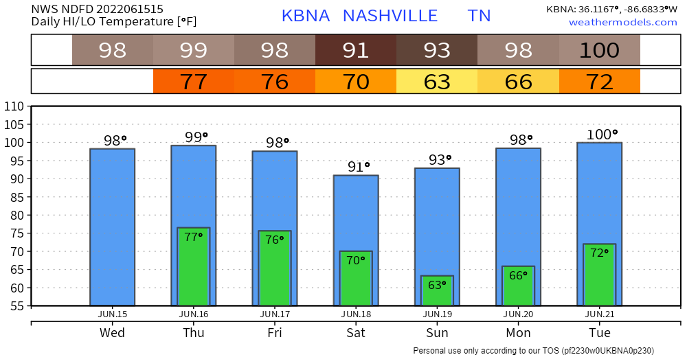
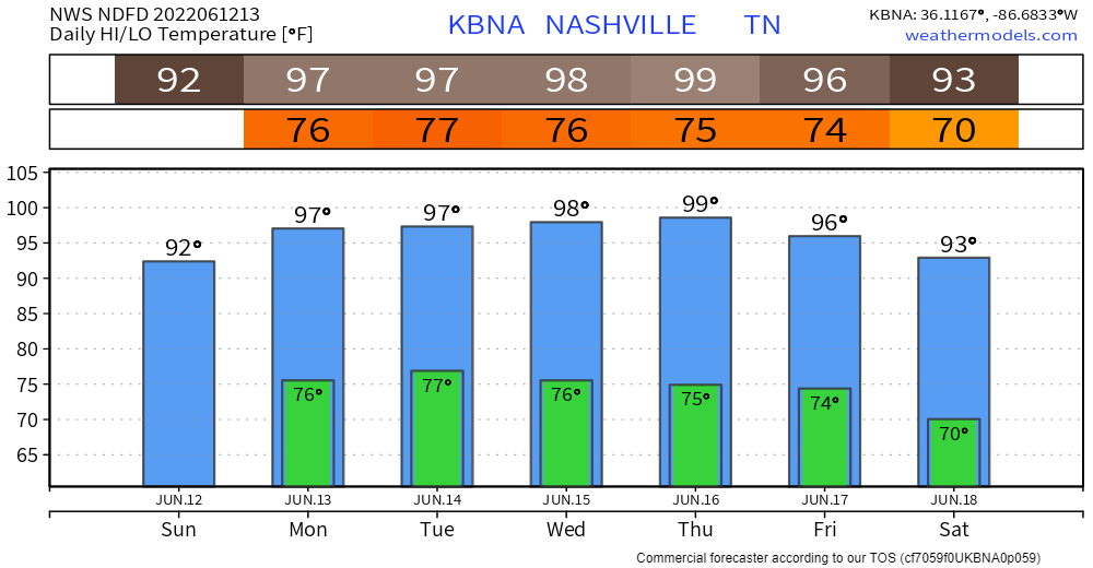
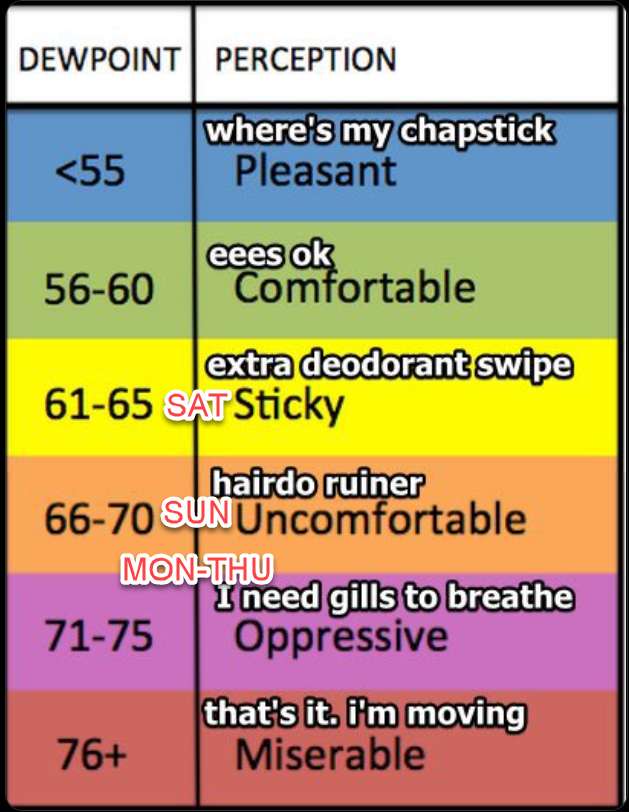
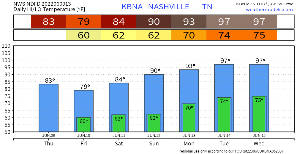
Oppressive humidity will combine with 98° today and 99° Thursday to send our “feels like” heat index well over 100°, maybe as high as 105°+.
Humidity drops a category (low 70°s to upper 60°s) by Friday.
This brutal heat is continuing to be a total vibe killer.
High of 98° (which would break the daily high record by 2°) combined with a dewpoint of 72-73° will be lead a heat index of 106-108 (in the shade). For that reason, NWS Nashville has issued another Heat Advisory for us today from 11AM – 7PM. Wednesday will have nearly the same temp/dewps combo, so they went ahead and issued another Heat Advisory for us tomorrow.
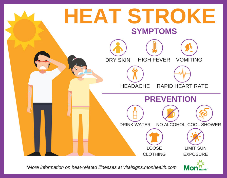
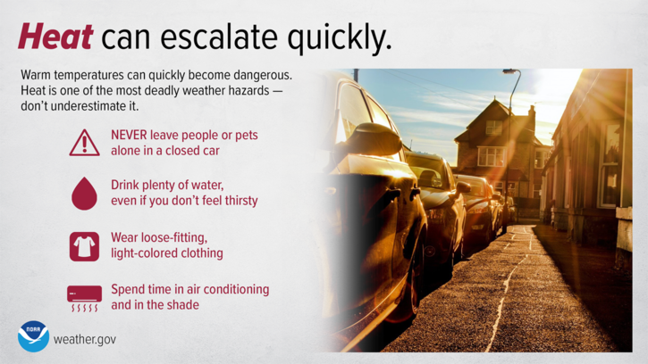
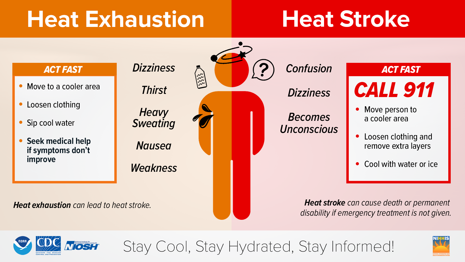
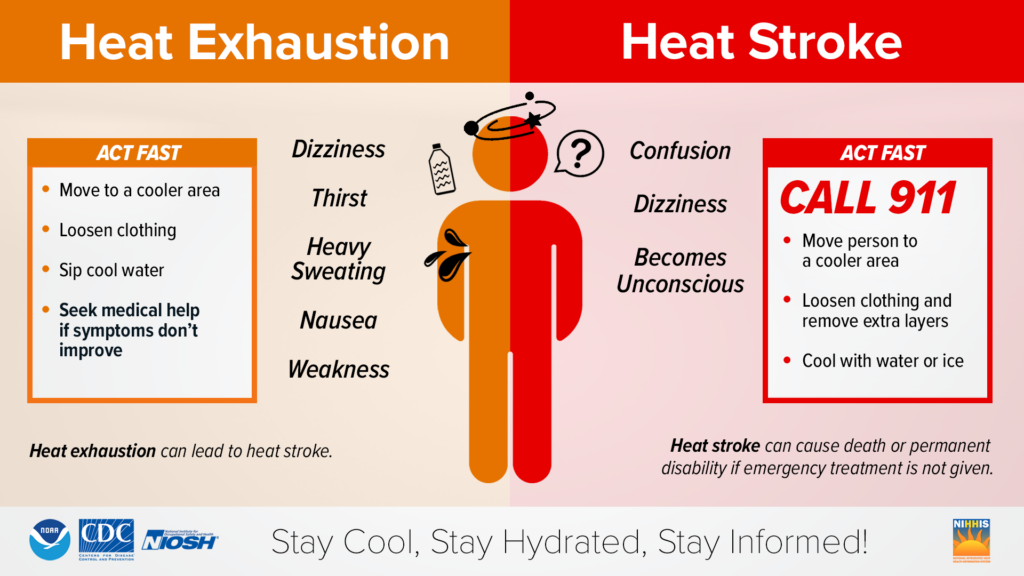
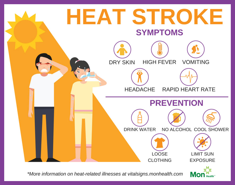
→ Our bodies are not acclimated to the heat/humidity combo here today. It’ll stay through most of this week. Cramping, feeling dizzy, headaches are among the warning signs of heat exhaustion and heat stroke. Listen to your bod. No force of will or “toughness” can overcome the natural process of an overheating body starting to shut down. At minimum, heat exhaustion is embarrassing because you’re vomiting on a sidewalk. At worst, it can land you in the hospital with organ failure. I’m not a biologist but I recall from A&P classes that your organs are important. Take care of those most vulnerable — those working outside — and if you employ such workers require that they get inside. These conditions will exceed every and any reasonable OSHA workplace safety guideline.
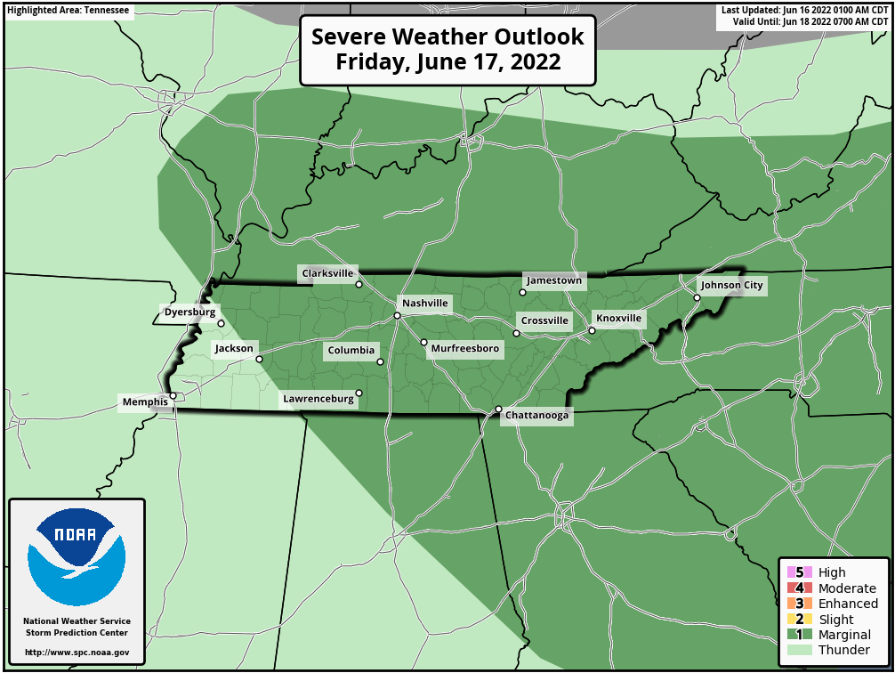
SPC (Storm Prediction Center) has outlooked us for a 5% chance for damaging wind and hail threat for today. Reason being, there is currently a cluster of storms in Nebraska. SPC thinks this cluster may end up being an “I-24 Special” due to our atmosphere having a whole lot of CAPE (storm fuel). None of the models really have a good handle on this. The HRRR and NAM3k model think nothing, the Euro and a couple others think something. If I had to bet, I’d bet more on nothing, but I don’t bet. We’ll be watching it all day and tweeting if it does materialize.
→ Humidity will get worse each day. It’ll be nice today. But big dewpoint jump Sunday. Then we straight up heatswamp Monday through at least Thursday.
→ Temps will follow the humidity rise.
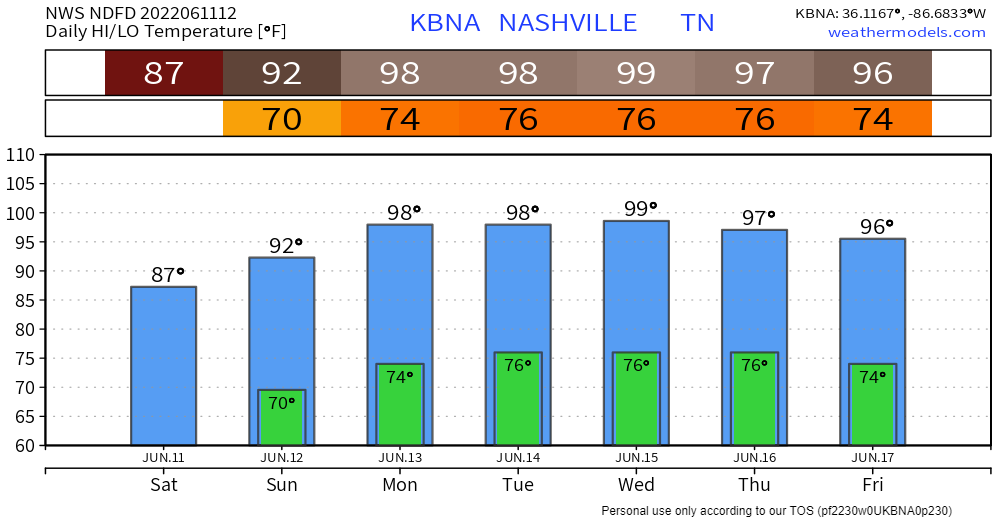
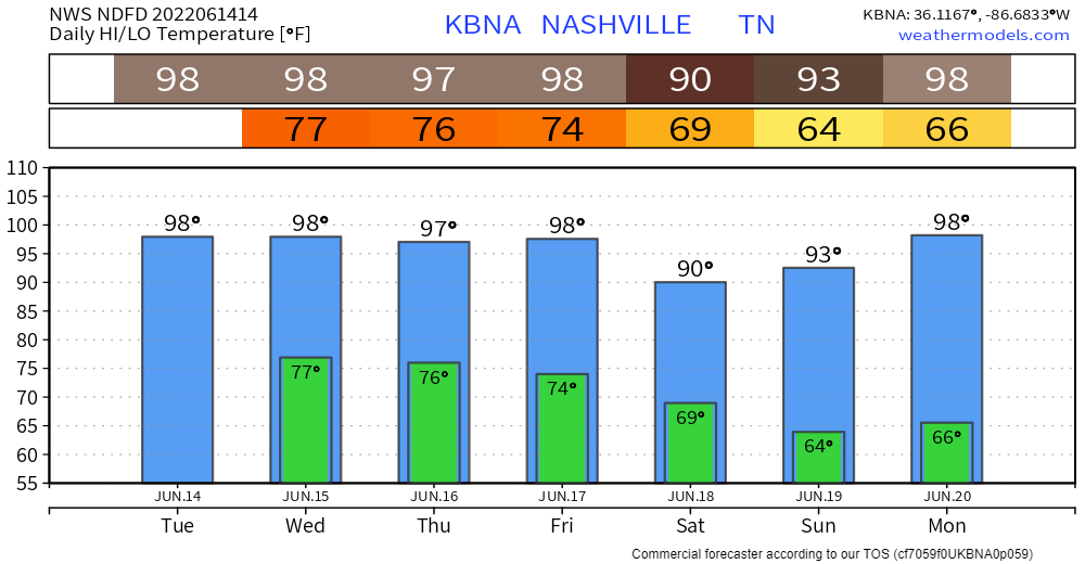
→ CMA Fest Sunday will scorch. Shaded temps up to 92° plus dewpoints rising up thru the 60°s. This’ll drive the heat index close to 98°. That’s the forecast for the shade and does not account for the heat radiating off crowds. Music goers should mix in more water today to prep for tomorrow. Locals are not acclimated for this.
Today and maybe Sunday are the only possible blips for this weekend.
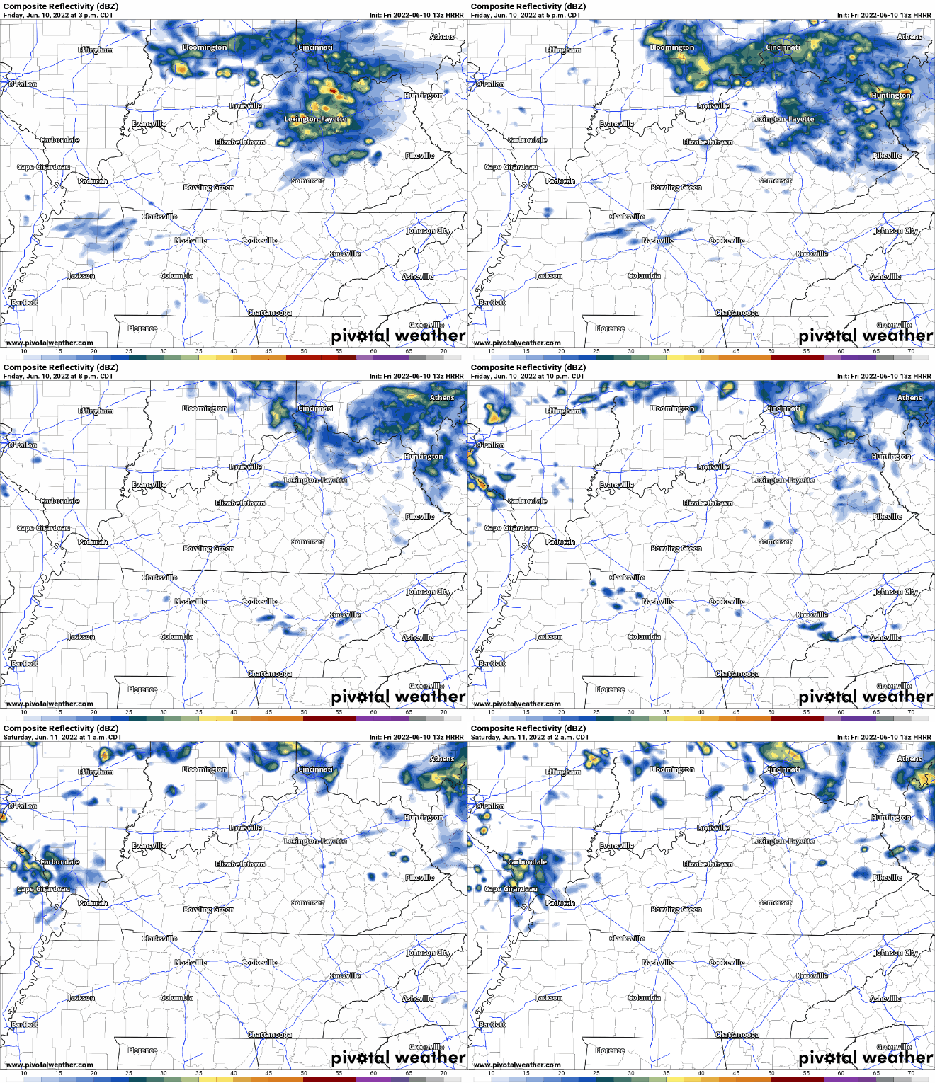
HRRR model thinks some showers might swing in here this afternoon/evening. Even if they do, they will just be light showers. No severe weather, not even lightning = party on.
THE GOOD NEWS
→ Humidity way down for CMA Fest.
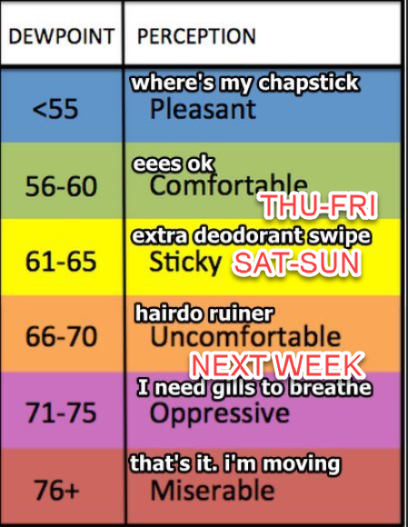
→ Temps cooler than most CMA Fest weekends, the only gripe is Sunday:
→ Only rain in the forecast is maybe Friday with a few light showers in the morning and afternoon possible, HRRR model below:
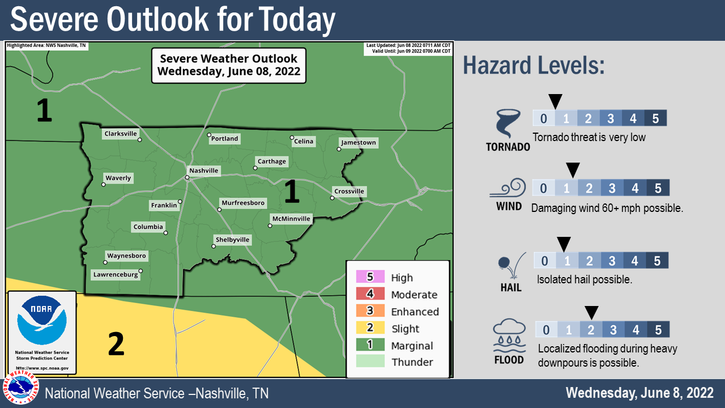
Today looks to be the last day of our three day streak of being outlooked for severe weather. Today is another 5% chance of damaging straight-line winds, hail, and flash flooding within 25 miles. On the bright side, we are yet again not outlooked for any tornado threat.
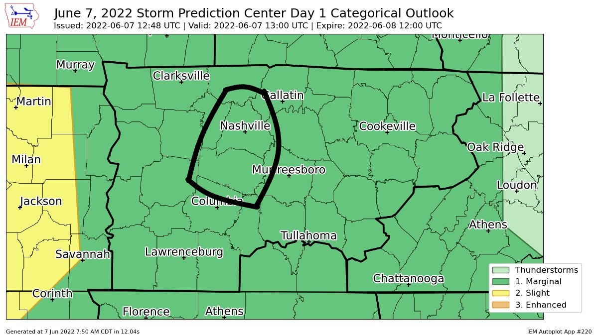
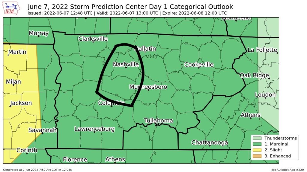
Rain has moved out from last night. SPC has outlooked us again today, 5% chance for damaging winds, hail, and flash flooding. We are not outlooked for a tornado threat, thanks to very little shear.
HRRR model (below) still shows a rough ETA of 5 – 6PM, still may not be exactly right.
You must be logged in to post a comment.