
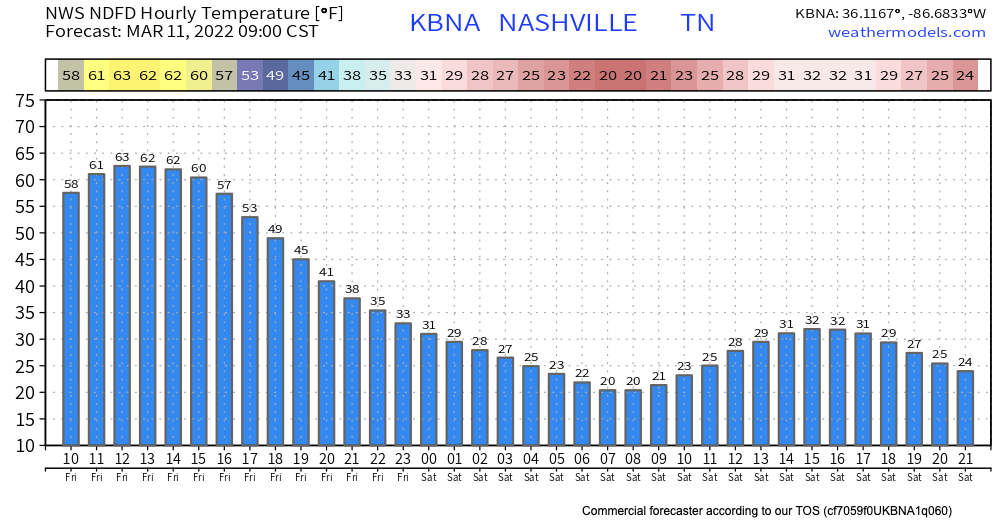
Today, we’re going to start off with a pretty nice, warm day. This is going to quickly change. A cold front is going to quickly drop temps. See the roller coaster that is the hourly temperature chart:
With this rapidly dropping temperature and precip being brought in with this cold front, we are expecting some snow.
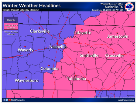
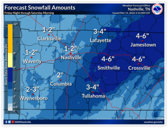
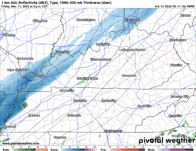
We’ll be under a winter weather advisory starting tonight at 6 p.m., lasting until 6 a.m. Saturday. During this time frame, we’re expecting 1-3 inches of snow. The HRRR shows the timing of the arrival of this snow between 8 and 9 p.m, clearing out around 2 a.m.
Here’s a look at the 14z HRRR reflectivity map. It’s still showing a strong snowmaker moving through the area tonight and into the wee hours Saturday. Take the timing with a grain of salt.
Even with the warmer temps we’re experiencing before this storm, we are expecting some accumulation, especially on bridges and overpasses. Use extreme caution if you will be driving during this because that road will be SLIPPERY. The road will also be slippery after the snow stops falling.
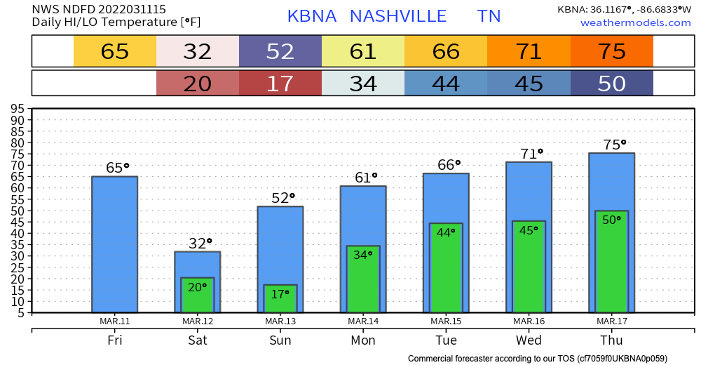
Most of the snow should melt Saturday when the sun comes back out, however any remaining moisture could freeze again overnight Saturday when temps drop again. Starting Sunday, temps will jump back into the comfy and snow-free 50s/60s.
Quick References:
Weather changes constantly.
Follow @NashSevereWx on Twitter for any changes to this forecast.
Live coverage during tornado and severe thunderstorm warnings:
Look good.
Support the mission.
We are 100% community supported. No ads. No subscription fees. Keep it free for everyone.
Categories: Forecast Blogs (Legacy)
You must be logged in to post a comment.