
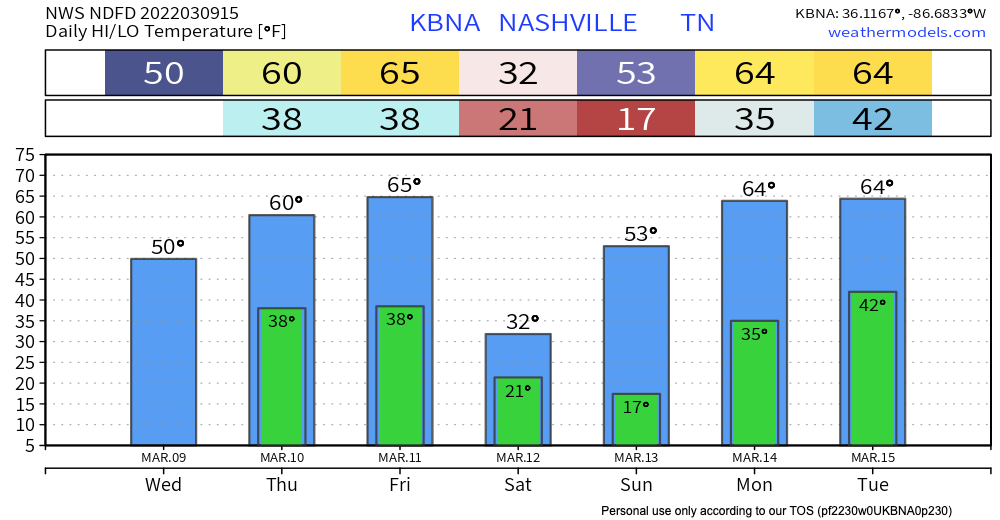
Rain has moved out… so what’s next? Highs warm up to the 60’s tomorrow and Friday. More sunshine the next couple days.
Late Friday night is when things start to get interesting. A strong cold front is expected to roll through… frigid temps along with it. Talking about a turnaround of almost 45 degrees from Friday afternoon to Saturday morning! Possible that we don’t get above freezing Saturday:
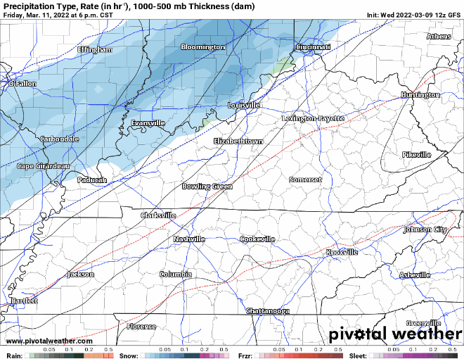
It’s likely we see precip with the front. Believe it or not, snow is possible as temps plunge below freezing. Low res models generally agree on a rain to snow transition late Friday night into early Saturday:
NWS thinking about an inch or so of accumulation right now (susceptible to change). Takeaway is that travel could be impacted by slick roads into Saturday. Be mindful if you plan to travel.
Lots of questions to be asked here. Will there be enough moisture? How will Friday’s warm temps affect accumulation? High res models will be in range tonight to give us a clearer picture. These events are very sensitive to intensity, track, and moisture. A slight change in any one of those things could mean more/less accumulation than forecasted. We’ll keep you in the loop!
Quick References:
Weather changes constantly.
Follow @NashSevereWx on Twitter for any changes to this forecast.
Live coverage during tornado and severe thunderstorm warnings:
Look good.
Support the mission.
We are 100% community supported. No ads. No subscription fees. Keep it free for everyone.
Categories: Forecast Blogs (Legacy)
You must be logged in to post a comment.