
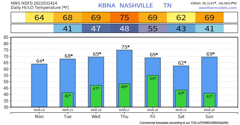
Forecast this week looks a lot different than the cold temps and snow we experienced over the weekend. Temperatures warm up to the mid 70s by Thursday. We stay warm for the rest of the week staying in the 60s.
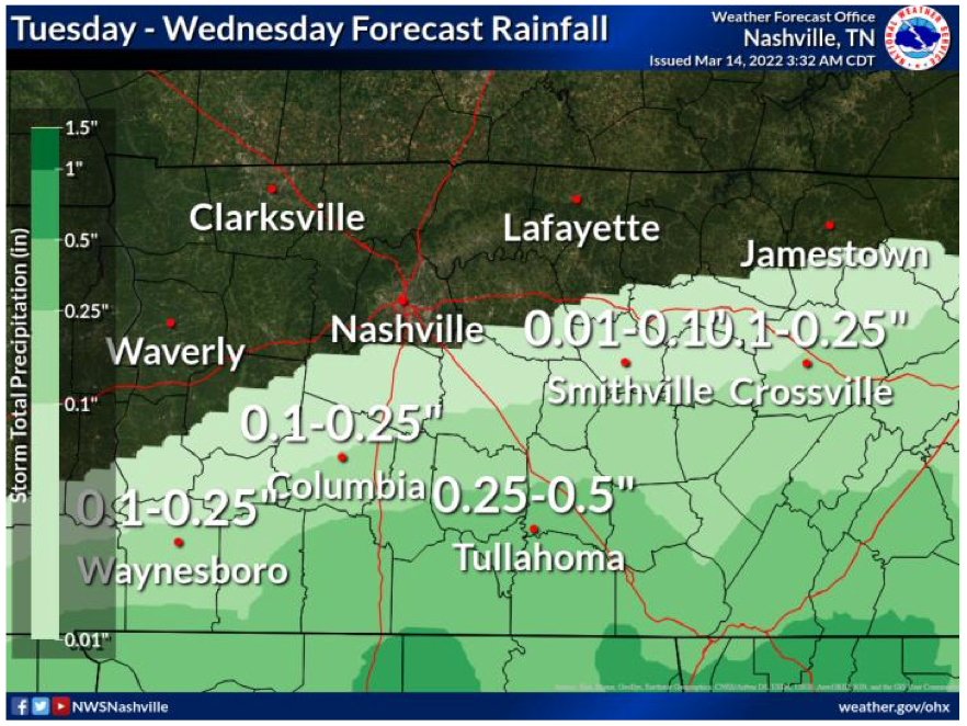
Tuesday evening rain chances come back into he picture. Euro and GFS models below shows rain coming in after dinnertime Tuesday night into Wednesday morning. Some of us may see a sprinkle early Wednesday afternoon. Most of the precipitation should be gone by mid Wednesday morning.
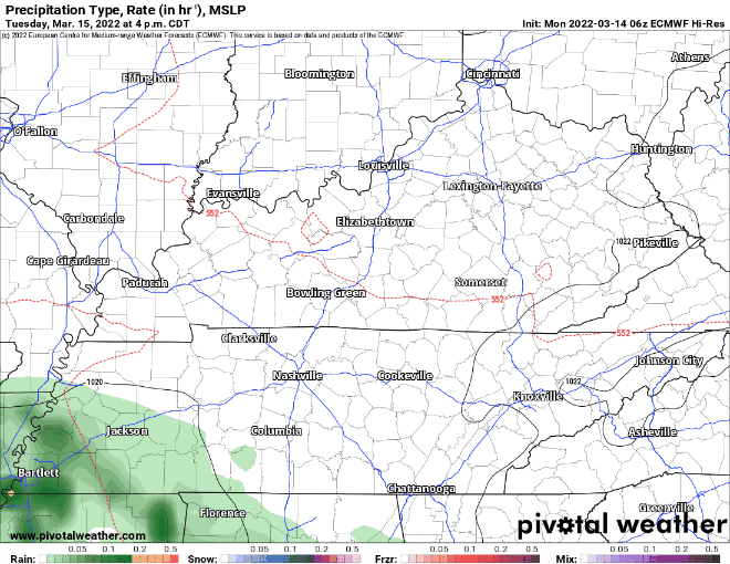
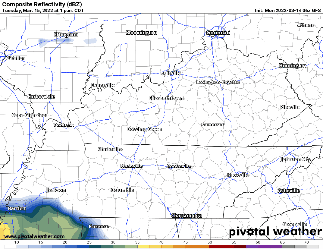
This system mainly tries to stay south of I-40. No threats are included in Tuesday evening rain. It won’t be super heavy with our counties getting up to 0.1″.
After Wednesday morning we stay dry and warm until the end of the work week. Chance for rain comes back Friday.
Quick References:
Weather changes constantly.
Follow @NashSevereWx on Twitter for any changes to this forecast.
Live coverage during tornado and severe thunderstorm warnings:
Look good.
Support the mission.
We are 100% community supported. No ads. No subscription fees. Keep it free for everyone.
Categories: Forecast Blogs (Legacy)
You must be logged in to post a comment.