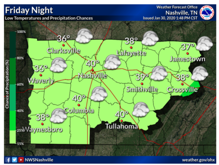
Friday Night
As we head into the weekend, rain will dissipate into early Friday afternoon and leave us with overcast skies and a slight chance of precipitation. Temperatures in the low 40’s Friday night.

Friday Night
As we head into the weekend, rain will dissipate into early Friday afternoon and leave us with overcast skies and a slight chance of precipitation. Temperatures in the low 40’s Friday night.
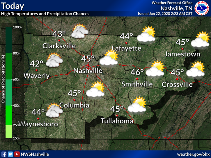
Clouds will linger for the day today, keeping the high at around 49. Light rain creeps closer late tonight and early Friday morning. Low temperatures will be close to 38.

High temperatures will stay around 49. It’s not going to be a washout; models expect a tenth of and inch precipitation falling off and on during the day. Wouldn’t hurt having that rain jacket or umbrella ready! Rain tapers off Friday overnight.
Light rain will end before midnight. Expect drizzle here and there until then.
It will get a bit chilly later tonight, with temperatures falling to a low of around 38° for the early morning. Wind chills closer to freezing.
[Editor’s Note: Intern Applican #2 is Patrick. He wrote this:]

After a morning with dense fog with a risk of patchy black ice (though we got no reports of that), the rest of the day should yield mostly cloudy skies with temperatures around 46.
[Editor’s Note: Intern Applicant #1, Haley, brings us the blog today. Thanks Haley!]
Overnight rain moves eastward by afternoon, with temperatures in the mid-lower 50s. Mostly cloudy skies linger into the overnight hours with a low of 31°.
Light rain overnight. Gone before rush hour. Monday morning low 42°. 51° Monday afternoon.
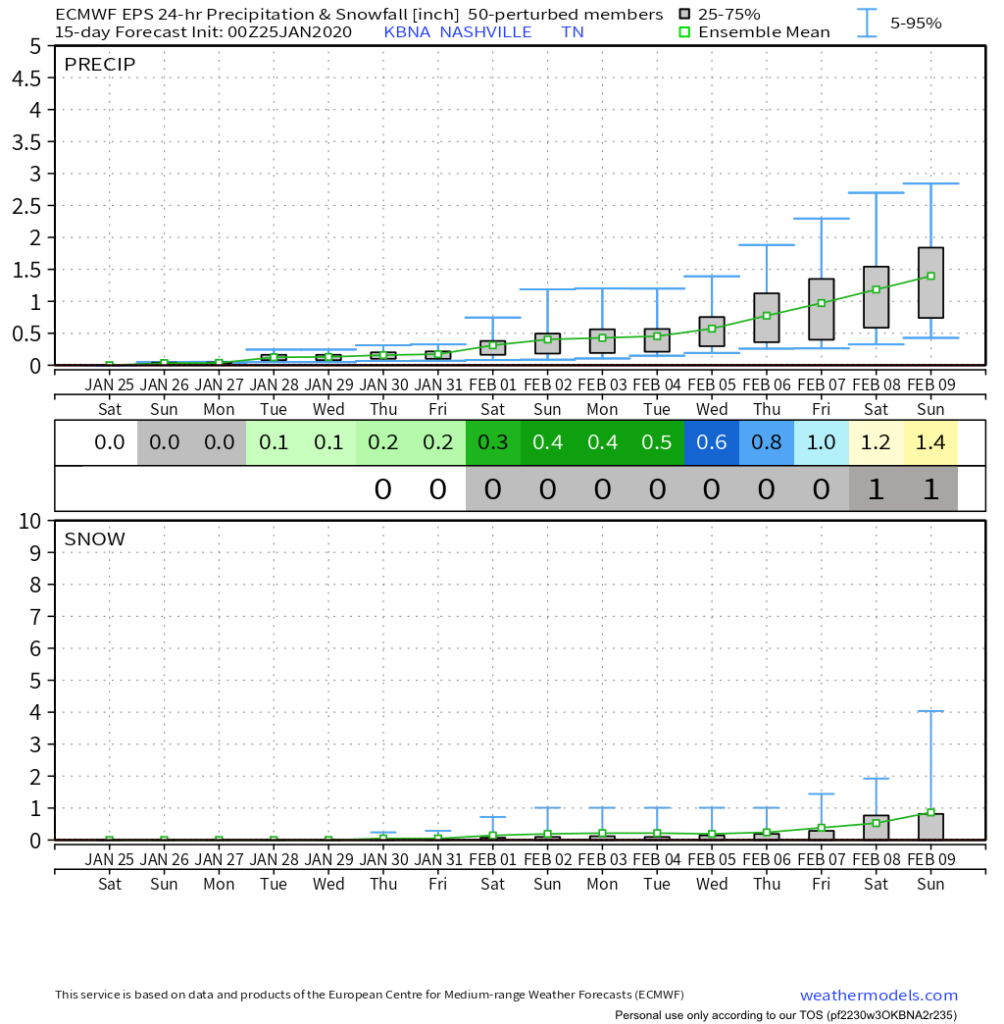
Cold rain Wednesday morning could fall as a rain/sleet/snow mix, then splat/melt. The Euro model (below) is the warmest of the models, predicting mostly – if not exclusively – rain.

Still gross Sunday morning (34°), bit warmer Sunday afternoon (51°) but still cloudy. Then light rain Sunday night.
We do the mornings 30°s, afternoons mid/upper 40° thing next week. Precip possible but iffy Tuesday night into Wednesday (low water content) and again Friday (as usual models vary substantially).
Snow isn’t found in Euro Ensemble model data thru 2/9/20. The slope rises toward the end of that time frame but that’s been happening all winter in this product and no one has used a sled.
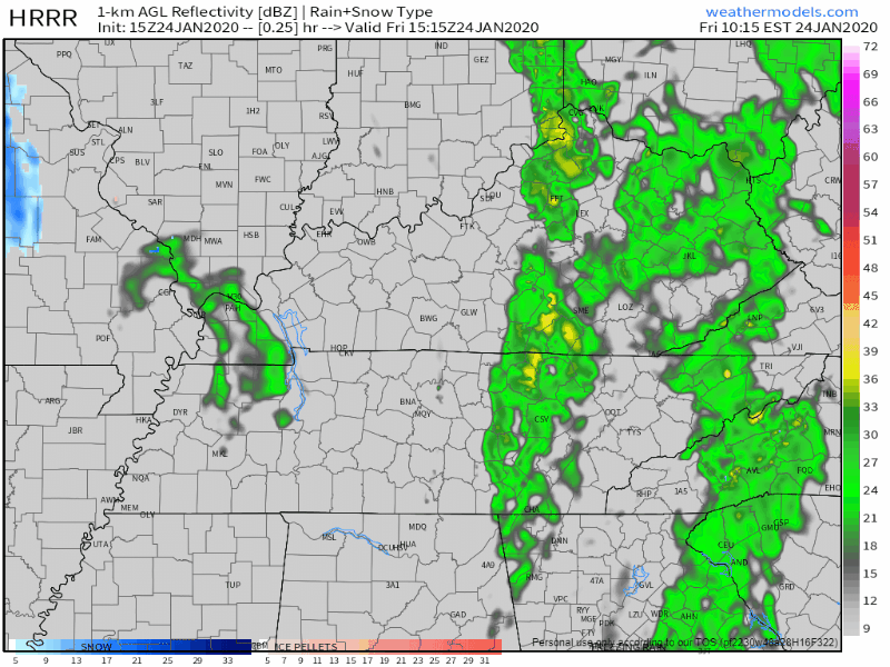
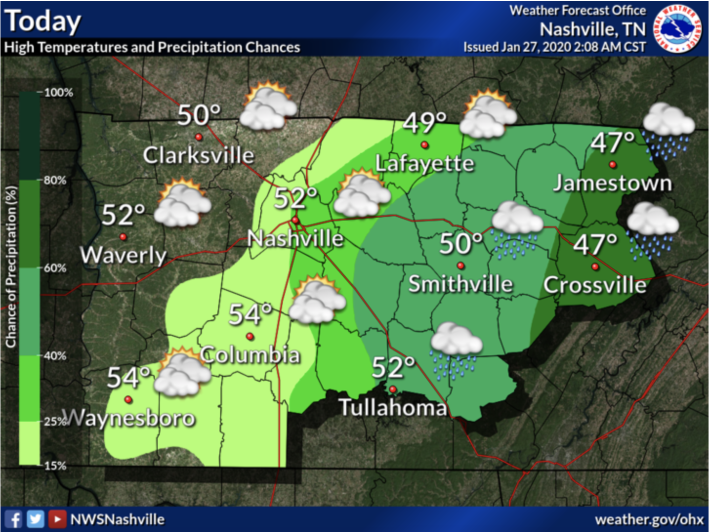
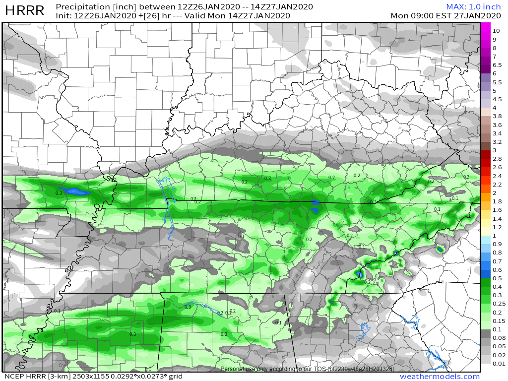
We’ve got a few lingering showers passing through Middle Tennessee this afternoon. Nothing close to a washout, but have the umbrella handy just in case. Here’s the HRRR
The low pressure system that’s been giving us rain the past couple of days finally moves out of the region today. The cloud cover sticks with us through tonight however, holding our temperature to 48° for the high. We could see a flurry or two overnight, but no accumulation.
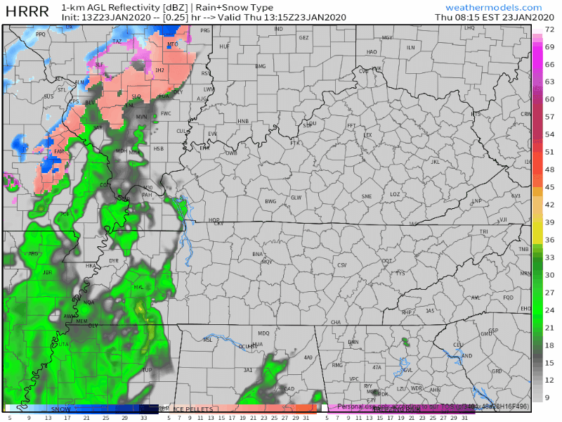
The HRRR model shows rain moving in this afternoon (around 2pm):
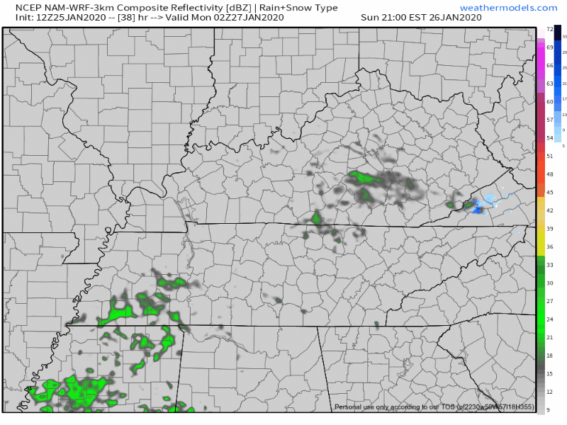
The NAM3 model says rain closer to noon:
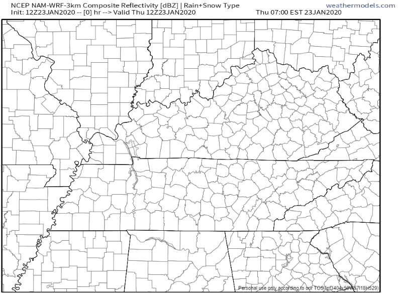
Regardless, plan for rain around lunchtime and after.
Showers will be off and on tonight through Friday, and sorry snow lovers, no snow. Those in the Plateau may see some light flurries Friday night/Saturday morning, but there will be no impacts.
The past few days have been… well cold, to say the least. Our average high for January is right around 48°F and our highs have been falling short of that recently. This will be changing as we move through the end of the work week.
You must be logged in to post a comment.