

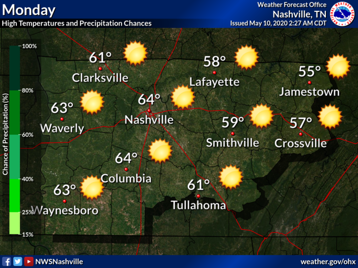
Monday
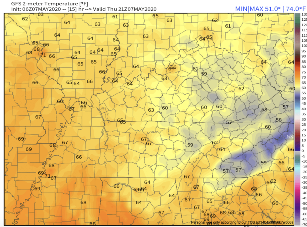
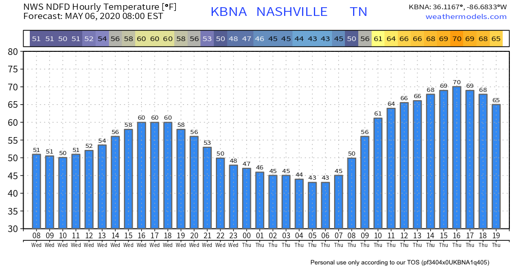
Although cool, it’s looking to be a nice day today. The high temp will reach around 63° with sunny skies.
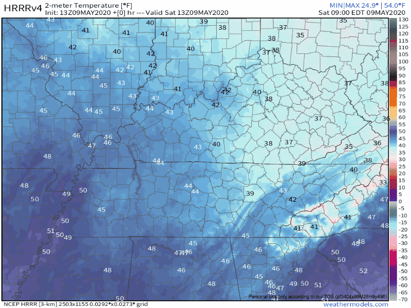
Clouds will return overnight, with temps dropping to 44°.
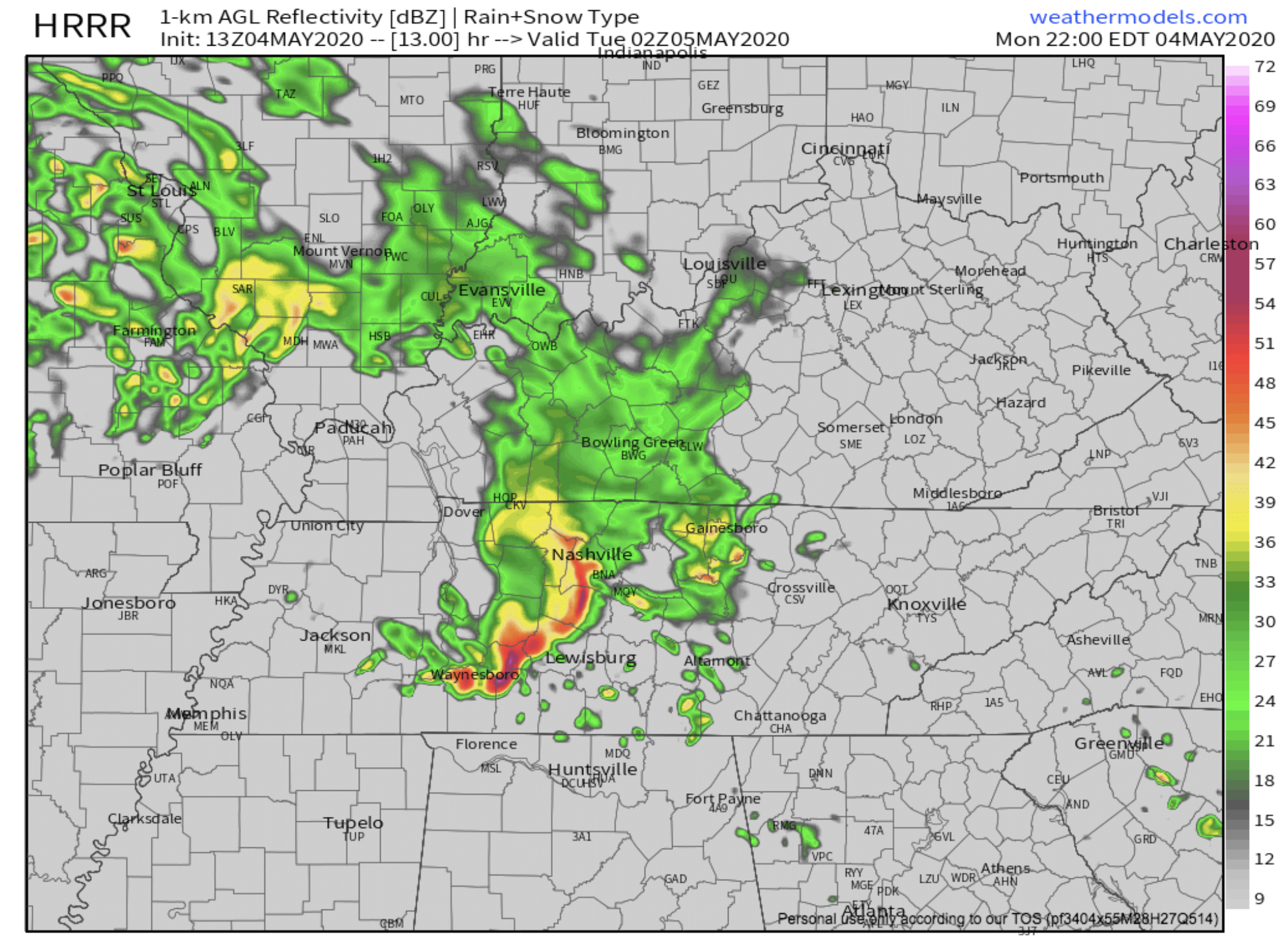
Rain Returns Tuesday and Wednesday
Rain chances increase after 9 am Tuesday. Highs will be in the lower 60s.


You must be logged in to post a comment.