Today – High of 71

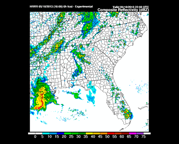
Very light, scattered showers or a thunderstorm possible today. Odds of one getting you are pretty low, but if it’s going to happen, the HRRR thinks 6pm is the most likely time:

Wednesday – High of 78

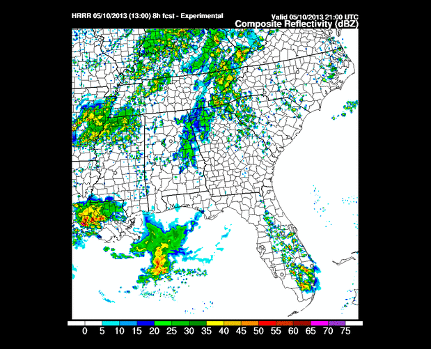
Like today, the odds of rain are small. If it’s going to rain, early evening is the most likely time. Here’s the Hi-Res NAM showing Wednesday night at 7pm:
 Thursday, Friday & Steeplechaseday
Thursday – High 82
Much like today and Wednesday — chance of rain or a thunderstorm, most likely in the late afternoon/evening hours.
Friday – High 77
Thunderstorms are likely Friday into Friday night. Our NWS was talking about it this morning:
MODELS CONTINUE TO PROMOTE THE
ARRIVAL OF A PRETTY DECENT
COLD FRONT . . . SLICING
ACROSS THE MID-STATE FRIDAY
NIGHT INTO SATURDAY AND
USHERING IN A PERIOD OF RATHER
COOL TEMPERATURES FOR SUNDAY
AND MONDAY. read more